- Green Bridges forum
- Kangaroo Point Connections
- The Fifth Green Bridge
- Go Between Bridge Update
- Disruption on the Bicentennial Bikeway
- Footpaths and garden beds
- Morningside Roundabout
- Connecting Rochedale
- Draft Brisbane Off-Road Cycling Strategy
Green Bridges Forum
Thanks to Jonathan Sri, Councillor for The Gabba, Michael Berkman MP, Member for Maiwar and Amy MacMahon MP, Member for South Brisbane for organising a public forum on Saturday to discuss Council’s proposal for green bridges from St Lucia to West End and West End to Toowong.
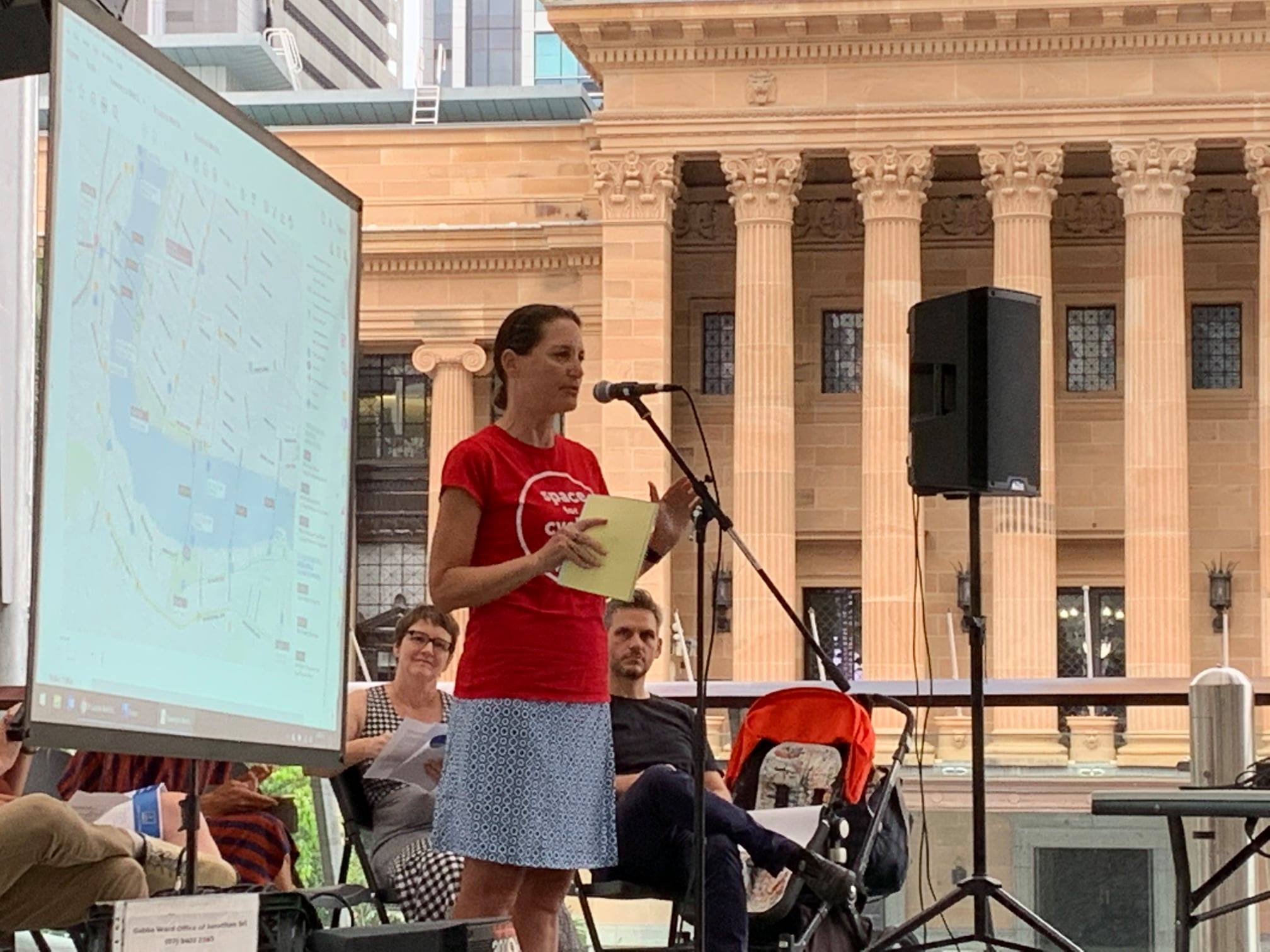
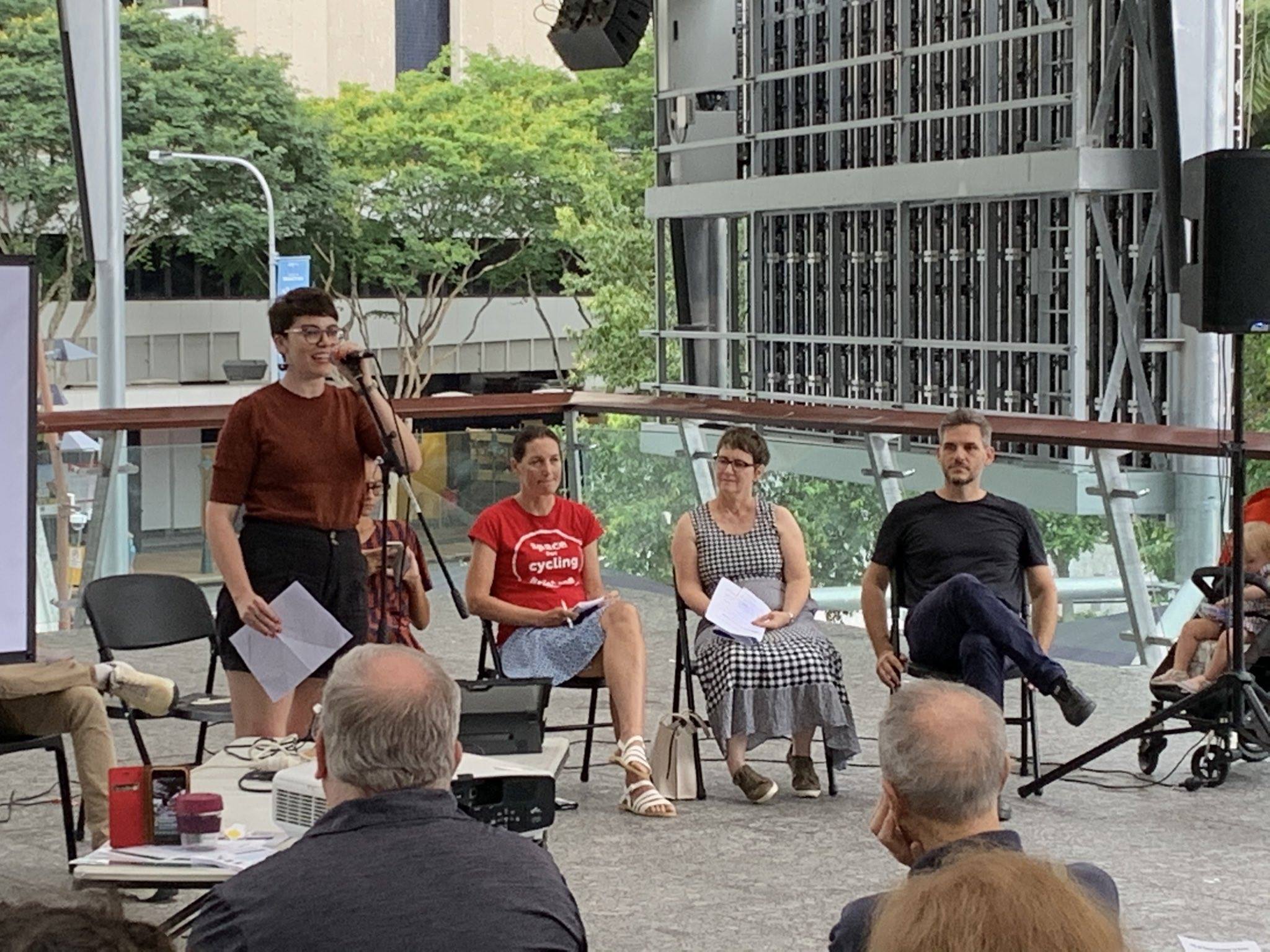

Belinda spoke about the benefits of active transport connections for disrupting business as usual—which includes growing congestion, vehicular traffic sucking the life out of our local precincts, an epidemic of diseases of inactivity, and a “car-first” transport system which is not responding to the climate crisis and is incredibly fragile in storms or man-made disasters.
We also heard from representatives of West End Community Association and St Lucia Community Association.
A number of people highlighted the absence of community engagement by the University of Queensland who are a major stakeholder. We’re also concerned that there hasn’t been much input from those people in St Lucia who are keen for better connections to jobs, services, night-life, dining, and cultural activities in West End, South Brisbane and Toowong.


We encourage people to get involved in the discussion about new green bridges for Brisbane by having their say via Council’s community survey:
We think there are benefits to the whole city of enabling more people to take trips by bike (and scooter, and walking, and connecting to good public transport) instead of defaulting to motorised transport. New green bridges will enable and encourage new active travel patterns. However we recognise that there are genuine challenges to be addressed with the design of a bridge and landing areas at any of the proposed locations.
It can be difficult not to be distracted by shouty cycle-haters. Unfortunately that attitude has been stoked by more than a decade of negative stereo-typing in the media. We think it’s great that people cycle for fitness and exercise and to catch up with mates, but that’s not our motivation for promoting better active transport connections in Brisbane. Having said that; many car trips are made for the purposes of leisure and travelling to social or sporting engagements, and a trip by bike that serves one or more of those purposes is no less legitimate than a trip which is strictly a commute to work.
A city with better connections and more people who get out and about in their neighbourhoods on foot and by bike is a safer, happier, healthier, more sustainable city.
Kangaroo Point Connections
Earlier this week, Council’s Public and Active Transport Committee was given an update on the green bridges program. The most advanced of these is the bridge between Alice St in the CBD and Scott St, Kangaroo Point. A contract to design and construct this bridge is expected to be awarded in mid 2021 to one of two short-listed tenderers.
The reference design is for a central mast cable-stay bridge. The deck will be approximately 470m long, and 6.8m wide with separated space delineated for cycling and walking, and a canopy cover on the pedestrian side similar to the Goodwill and Kurilpa Bridges.

This is all good news – including the predicted completion date of late 2023.
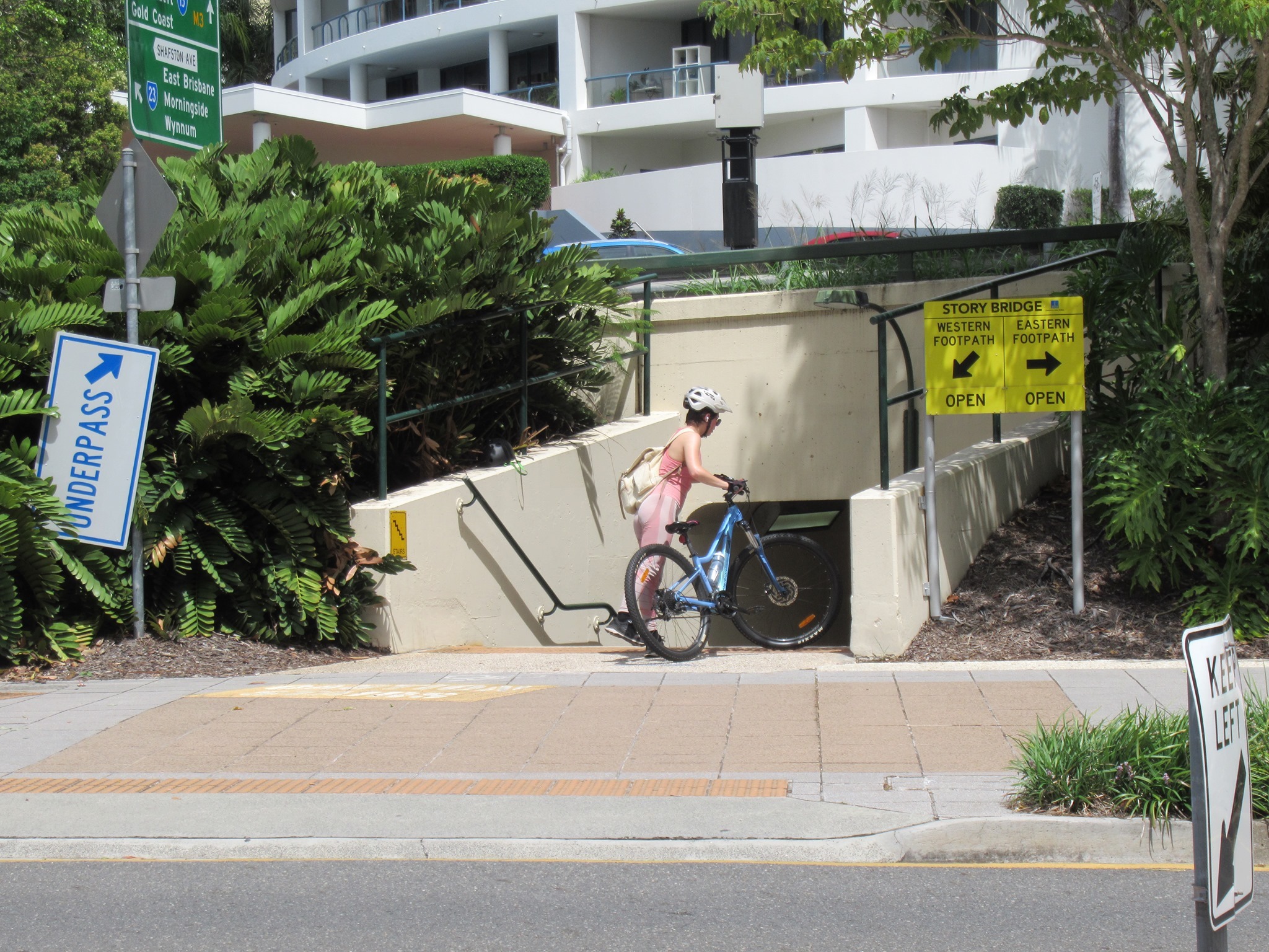
However nothing was said about the connections at Kangaroo Point which will be vitally important to achieve the goal of replacing thousands of car trips with active transport (walking, scooting and cycling).
There has previously been mention of a crossing at Main St and accessible underpass beneath Bradfield Highway – which is decades overdue. But that still leaves the issue of Deakin St, where the current shared path is certainly not wide enough to support the 6,000-plus trips predicted on the bridge by 2036. A new supermarket has recently been approved at the corner of Deakin and Ferry St, but it doesn’t appear that Council have required land necessary to build a separated bikeway of adequate standard.

We are watching this with interest.
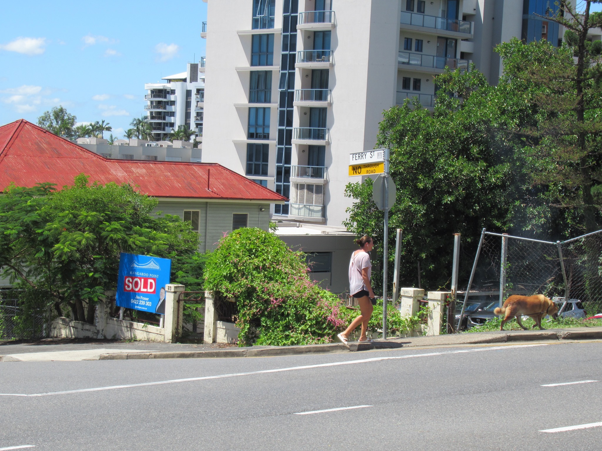
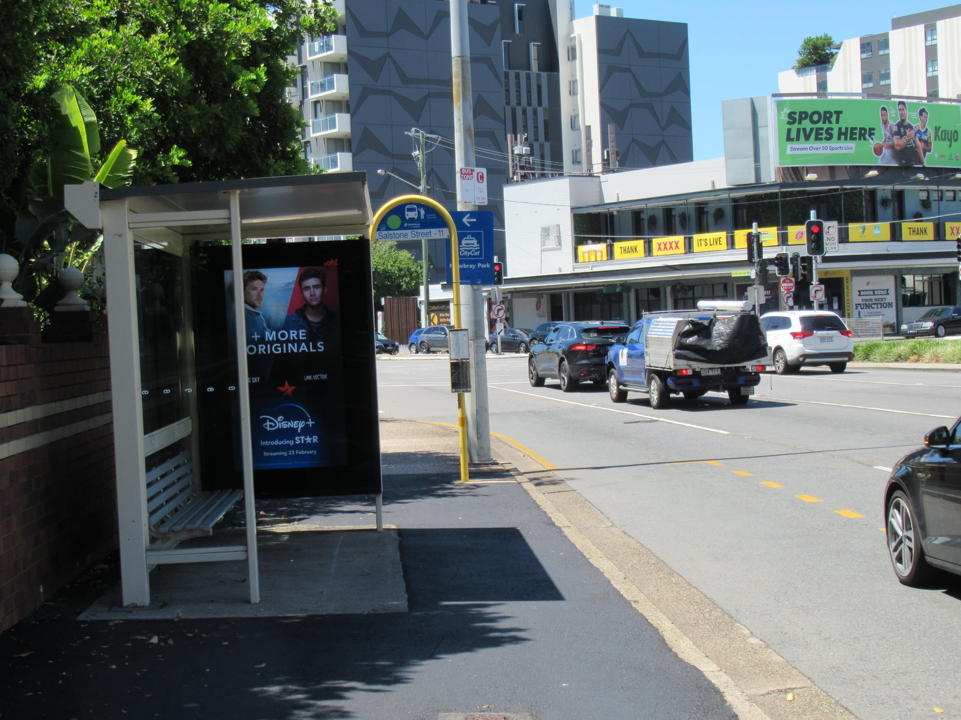
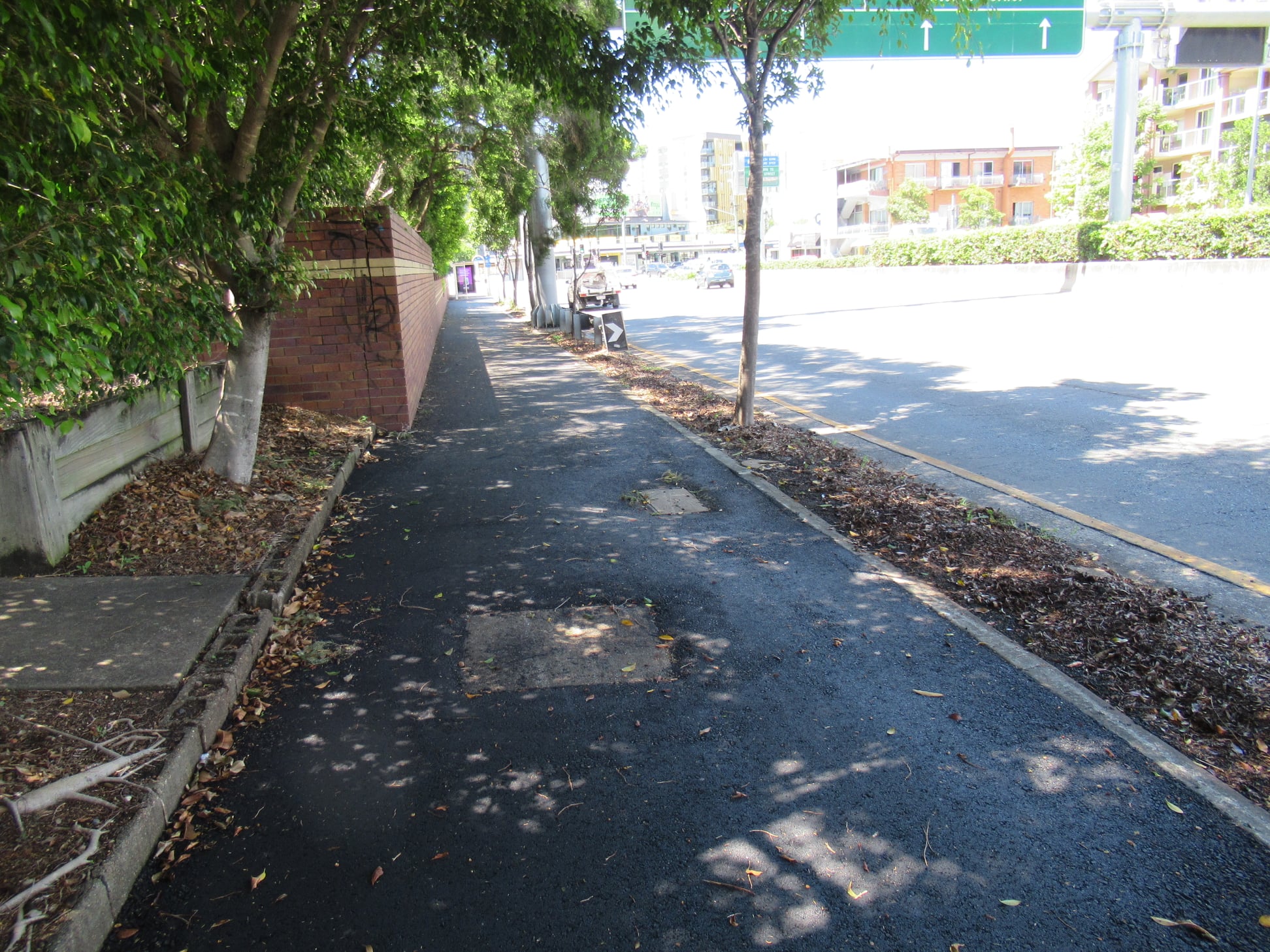
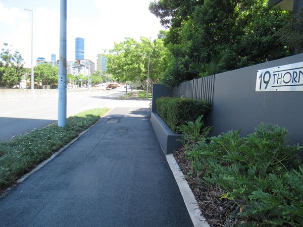
Just to the east, cyclists recently found a pleasant little surprise: the footpath along Shafston Ave, Kangaroo Point between Thorn St and Wellington Rd has been resurfaced. This is actually supposed to be a principal cycle route. It’s still too narrow to cater for much bike traffic as well as pedestrian traffic, but at least it’s no longer horribly lumpy.
Now if only we could get the advertising signage at the bus stop removed – it completely blocks the site line and creates a dangerous pinch point that pushes people very close to the edge of the road.


The Fifth Green Bridge

Also in Council’s Public and Active Transport Committee meeting on Tuesday, Councillor Jared Cassidy asked about Council’s process for selecting the site for a 5th green bridge, since one at Bellbowrie was rejected by the local community. He highlighted that almost a thousand people signed a petition by Councillor Kara Cook (Morningside Ward) asking for a new river crossing downstream from the Story Bridge.
Cr Ryan Murphy’s response was a bit vague; mentioning multi-criteria analysis, traffic modelling, and also that including public transport on the 5th bridge was still under consideration.
In their comprehensive analysis of Brisbane in 1925, the Cross River Commission identified the need for no fewer than FOUR bridges downstream from the location of the present-day Story Bridge. in 1925. They nominated:
- Sydney St, New Farm to Wellington Rd, East Brisbane
- Barton Rd, Bulimba to Chermside St, Teneriffe
- New Farm to what’s now Norman Park, at Galloway’s Hill
- a tunnel from Bulimba to Hamilton
The merits of those locations remain as valid now as they did in 1925. But the need has grown in the intervening 96 years!! Perhaps as a first step in their investigation, Council’s team should go looking in their own library!
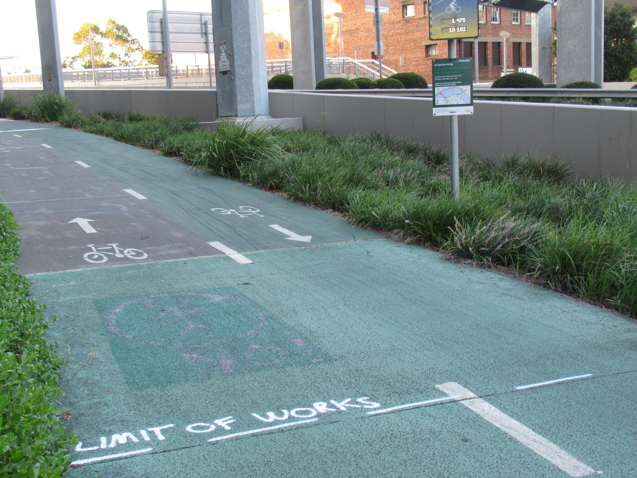
Go Between Bridge Update
Speaking of bridges, Transurban have finally provided an update on the Go Between Bridge resurfacing, which we know is causing considerable disruption to the hundreds of people who used to use this bridge daily:
“In mid-January 2021, we commenced resurfacing the Go Between Bridge cycle and pedestrian pathways. Due to wet weather and unexpected construction delays, works are currently scheduled to finish in April 2021. Works will shortly move to the pedestrian path and pedestrian traffic wanting to utilise the bridge will move to the cycle path – cyclists will still be required to follow the signed detour route or dismount and walk across the bridge.
We appreciate Brisbane’s cycling community’s patience as we complete these necessary works.”
Transurban
Disruption on the Bicentennial Bikeway
For west-side riders there’s more disruption ahead, too. The Bicentennial Bikeway at Toowong will have stop-go control in place for approximately 6 weeks from 3 March for sewer replacement work.


Stage 1 (existing bike path on Coronation Drive between Archer Street and Booth Street Pedestrian lights) 3-17 March 2021
The existing pedestrian path (runs parallel to the bike path), will remain open for cyclist access only. 24-hour traffic controllers will use a stop/go system to allow cyclists to bypass the works from either direction. Please observe all site signage and barriers – they are there to keep you and our workers safe.
Stage 2 (existing bike path on Coronation Drive between Booth Street Pedestrian lights and the guardrail located outside 576 Coronation Drive): 18 March to 1 April
Stage 1 bike path will reopen. The existing pedestrian path (which runs parallel to the bike path), will remain open for cyclist access only. 24-hour traffic controllers will use a stop/go system to allow cyclists to bypass the works from either direction. Please observe all site signage and barriers – they are there to keep you and our workers safe.
Bike paths will be reinstated as per Brisbane City Council requirements.
Footpaths and garden beds
We love well-tended gardens that makes our streets greener and cooler, particularly if they include shady trees. But we don’t support narrowing footpaths to make that happen. Conflicts between people walking, cycling, and scooting happen when all those users are pushed into narrow spaces with no room to move aside or give a wide berth when overtaking. Yet somehow no-one seems to question that the majority of public land is given over to cars – both moving and parked. (And sometimes just reserving all space where someone might conceivably want to park).


The Brisbane City Council is narrowing footpaths all over the inner suburbs by installing garden beds. When footpaths are narrowed it is difficult for pedestrians to walk side by side when people are approaching from the other direction. It difficult for people on scooters or bikes to pass pedestrians and to give them a wide berth.
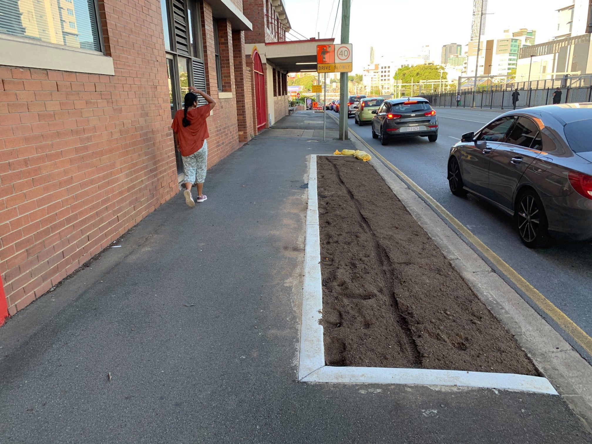
The latest footpath narrowing is on Milton Road outside the XXXX Brewery. This is a busy footpath used by rail and bus commuters as well as people walking to nearby businesses. The new garden beds already have footprints and tyre tracks in the loose soil showing people need this space to get around.
We understand and support Brisbane City Council wanting to make the city greener. But rather than reduce space for people getting about by walking, scooting, and cycling (if they’re not prepared to mix-it with heavy traffic on the road) we ask that BCC look at excess road-space that might be converted to gardens instead.
Morningside Roundabout
In Morningside, EaST BUG report that the roundabout at the intersection of Pashen St, Thynne Rd, and Burrai St took another beating last week. We’ve previously nominated this intersection as a perfect candidate for Brisbane’s first “protected roundabout” making it much safer for people walking and cycling – especially given the proximity to 2 schools and a childcare centre. Brisbane City Council argue there’s no need, because it’s not a dangerous intersection. The regular piles of debris and signs of vehicles driving through the fences and over the centre island tell a different story.


With the plans for hundreds of trucks to deliver fill to build up the Bulimba Barracks site above future flood levels, we’re concerned there will be a big increase in heavy vehicles ripping along Thynne Rd and through/over this intersection which will only make matters worse.
Connecting Rochedale
The politics of this are a little strange, but there’s definitely a need for a bikeway connecting Rochedale to frequent public transport services at Eight Mile Plains and to the SE Veloway. So please add your name to this petition by Corrine McMillan MP, State Member for Mansfield requesting that Council prioritise this badly needed connection.

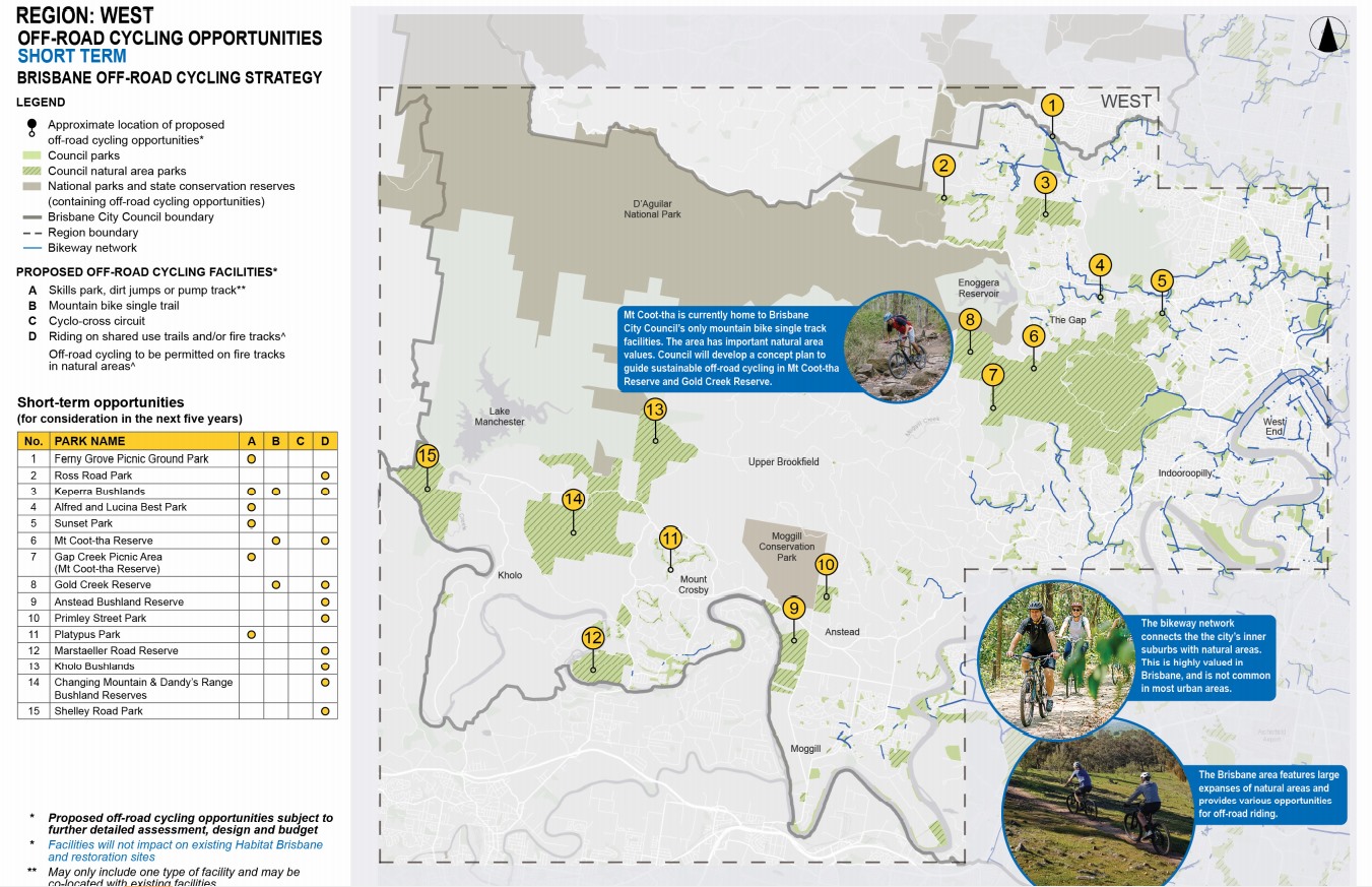
Draft Brisbane Off-Road Cycling Strategy
Public comment on Council’s Draft Off-Road Cycling Strategy closed this week, with the various BUGs providing input on proposals in their local areas.
Council’s draft strategy outlines an approach and guiding principles to enable providing more off road cycling opportunities, which is increasing in demand, while protecting important and fragile ecosystems and habitat. The two goals aren’t mutually exclusive, and we think the guiding principles are an excellent start to this conversation. Critically, the strategy protects areas for Habitat Brisbane or undergoing restoration processes through catchment and bushcare groups.

Unfortunately there seemed to be a bit of misinformation circulating about this strategy, and misunderstanding about what off-road cycling means. To some, it conjures images of extreme, thrill seeking mountain bike descents. But it’s important to understand the strategy does not propose mountain bike trails taking over our bushland.
In the Western suburbs, the strategy proposes potential mountain bike trails in Keperra Bushlands, Mt Coot-tha Reserve (which already has numerous tracks), and Gold Creek Reserve in the short term, and longer term in Mt Nebo Reserve, Kholo Bushlands, Changing Mountain and Dandy’s Range Bushland Reserve and Shelley Road Park.
What’s more prominent is making existing fire trails and shared use trails open to cycling. This isn’t about extreme sports, but about being able to travel through bushland to get off the beaten track and explore the region.
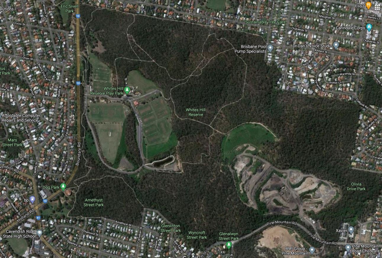
In the eastern suburbs, there are two new locations where single track mountain biking tracks might be considered in the short term (within the next 5 years): Remediated open space at Bacton Rd, Chandler (old Council dump), and Prout Road Park, Chandler. In addition, it is proposed to allow cycling on some existing fire trails and shared use paths (following community consultation) in a number of bushland reserves: Bayside Parklands, Whites Hill Reserve, Prout Road Park, Brisbane Koala Bushlands, Seven Hills Bushland Reserve, and Mount Gravatt Outlook Reserve.

A number of community groups had expressed consternation at any mention of allowing cycling in Whites Hill Reserve, as this is an area which has suffered significant damage from illegal trail building over many years. EaST BUG provided feedback on what was proposed in the draft strategy specifically in Whites Hill Reserve:


Whites Hill Reserve Proposal 1: A facility such as a skills track, pump track, or collection of dirt jumps. This would have a contained footprint, in an area of existing open land. It would most likely be integrated into the existing recreational reserve – which already hosts touch football, cricket and soccer, as well as a playground and BBQ facilities, toilets, and extensive carparking areas.

An example of the type of facility which we think could work well in this park (although perhaps at a smaller scale) is the amazing city dirt BMX facility in the Adelaide Parklands, which is built and maintained by the volunteer City Dirt Crew for people of all ages and abilities to enjoy. Creating a community of riders who care about their facility and making it safe and fun for everyone is a good way to direct energy away from people who create or follow illegal trails in secluded locations that result in damage to sensitive bushland areas.

Another alternative facility is something like the bitumen pump track in DM Henderson Park at MacGregor. Our observation is that facility is used mainly by younger children.
We think there are a number of locations within the recreational park of Whites Hill Reserve where a BMX facility would be quite appropriate, and would not impact any areas of ecological importance.

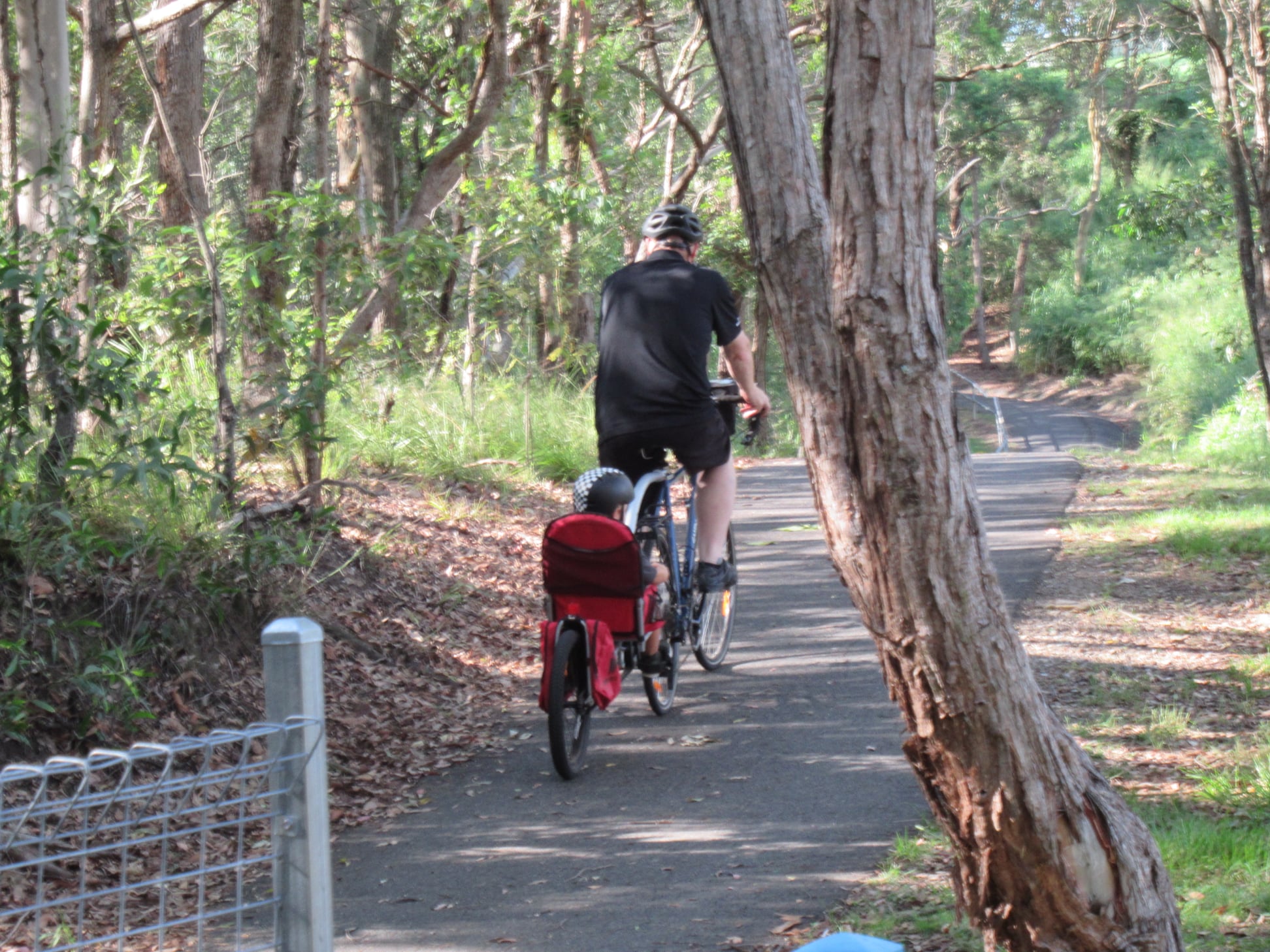
Whites Hill Reserve Proposal 2 – Permitting cycling on selected existing fire trails and suitable walking tracks (ie. making these shared use trails). This would need to be done with community consultation, and providing notice to existing path users.

Allowing cycling on selected trails potentially enables more people to access and appreciate the park and the environmental significance of the bushland area in Whites Hill Reserve. We think there should be an opportunity to designate some trails as shared-use, while others remain for walkers only.
This would potentially also enable access to recreational facilities in the reserve for people from surrounding suburbs (Carina Heights, Camp Hill, Carindale) without having to drive around the park to enter from Boundary Rd. The only cycle track currently in the reserve is the shared path inside the western edge that roughly parallels Boundary Rd. Pine Mountain Road, which runs along the southern boundary of Whites Hill Reserve, is extremely hostile for cycling.
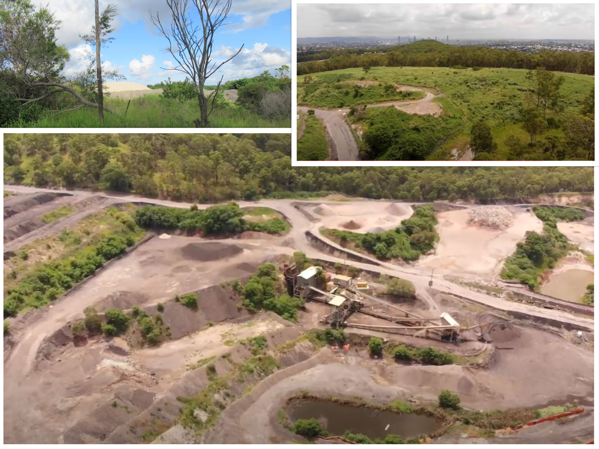
Whites Hill Reserve Proposal 3: A long term plan (5-10+ years out) to consider converting the quarry area – once active operations cease – to a mountain bike park, with ‘single track’ trails.
This is currently an operational quarry (see images), so this long-term proposal would be considered as a step in remediating areas as quarrying operations cease. The terrain offers opportunities to develop a challenging, world-class mountain biking facility separate to the bushland area of Whites Hill Reserve.
To find out more about the particular significance of Whites Hill Reserve, and why protecting the sensitive bushland there is so important, we recommend reading this detailed post on Facebook by the Rocky Waterholes Environment Group:
