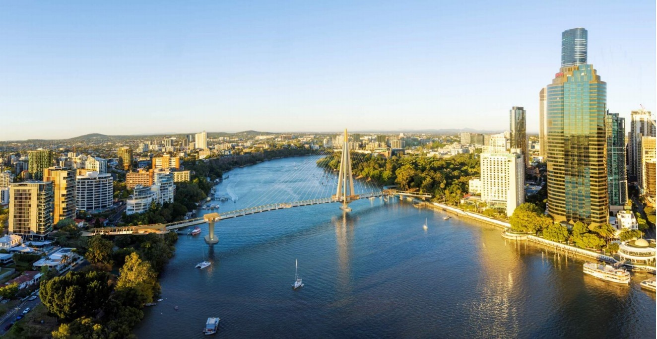
- Kangaroo Point Bridge
- Your City Your Say
- Dutton Park Dash and Boggo Road Futures
- A near miss on the Gabba Bikeway
- Hanlon Park, Stones Corner
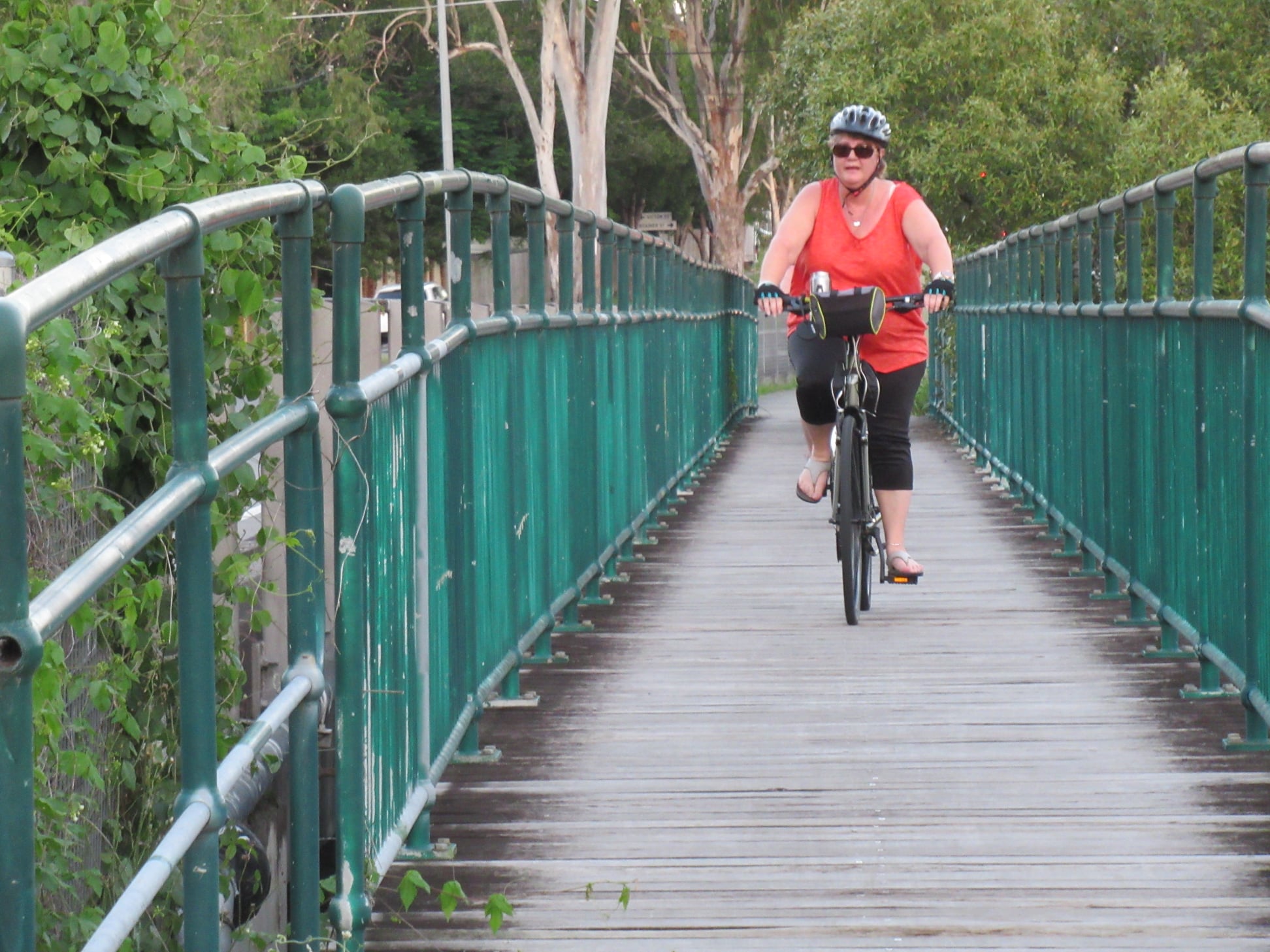
- Minnippi Bikeway
- Cycling Infrastructure Policy and Old Cleveland Road
- Sumners Road Underpass
- Hoyland St
- Brisbane Bike Bites Short Film Competition
Kangaroo Point Bridge
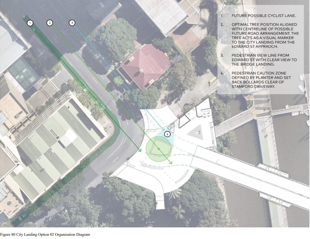
The development application for the CBD to Kangaroo Point Green Bridge was lodged this week. Those who are interested in the details of the bridge and the landing points might like to check out the Design Report (Appendix H) for application A005674527 available at this link.

Unfortunately the underpass at Kangaroo Point is not included in the scope of this development, but it does seem that Council are committed to moving ahead with it.
Also, the design at CT White Park doesn’t include a ramp down to the riverside pathway – instead showing stairs and an elevator. However, the discussion of dedicated bike lanes on Main St is promising.


This bridge has been talked about for almost a hundred years. We’re excited to watch it become a reality!
Your City Your Say
On Wednesday, Belinda went along to Council’s “Your City Your Say” public forum to hear from Lord Mayor Adrian Schrinner and members of his Civic Cabinet. Having been a regular at these events for 5 years now, it is noticeable that the conversation has shifted much more to acknowledging the vital role of active transport in the health and liveability of our city. There has been some great progress in this time, but we still have a very long path ahead.
Belinda from East BUG managed to book a timeslot to catch up with Council’s Public and Active Transport Chair, Cr Ryan Murphy to talk about the lack of any coherent trunk cycling route from the CBD to the eastern suburbs. As usual it’s impossible to cover everything in just a few minutes, but we appreciate Cr Murphy’s engagement and commitment to working through the issues—in collaboration with the state government as necessary.
We’ve pushed for an extension of the Woolloongabba Bikeway along Stanley St East to the rail corridor as a relatively straight-forward way of addressing the inner 5km of a connection to the east. This is one of the reasons we support the residents of East Brisbane in opposing plans for a new petrol station at 999 Stanley St East. (Other reasons include the site being in the medium-inundation flood zone of Norman Creek, and that there is already a petrol station just 50m away—see Save Edgar St – No 7-Eleven Servo in a Flood Zone on Facebook for more.)
Belinda was also joined in the discussion by Lori from Kangaroo Point who was there to highlight the issues caused by huge numbers of new apartments being constructed in an area that is surprisingly poorly served by public and active transport given its geographical proximity to the CBD. Lori pointed out that the main cycling and walking connection east from the new green bridge (which will be fabulous) is via Lambert St, which is already fraught. Adding the driveways to towers of hundreds of apartments right on the off-camber corner is only going to make this worse. (Check out No To Lambert Street for more on that issue).
A liveable future for Brisbane needs to put healthy mobility at the front and centre of all planning and policy, not leave it as an afterthought for inclusion “where space allows”.
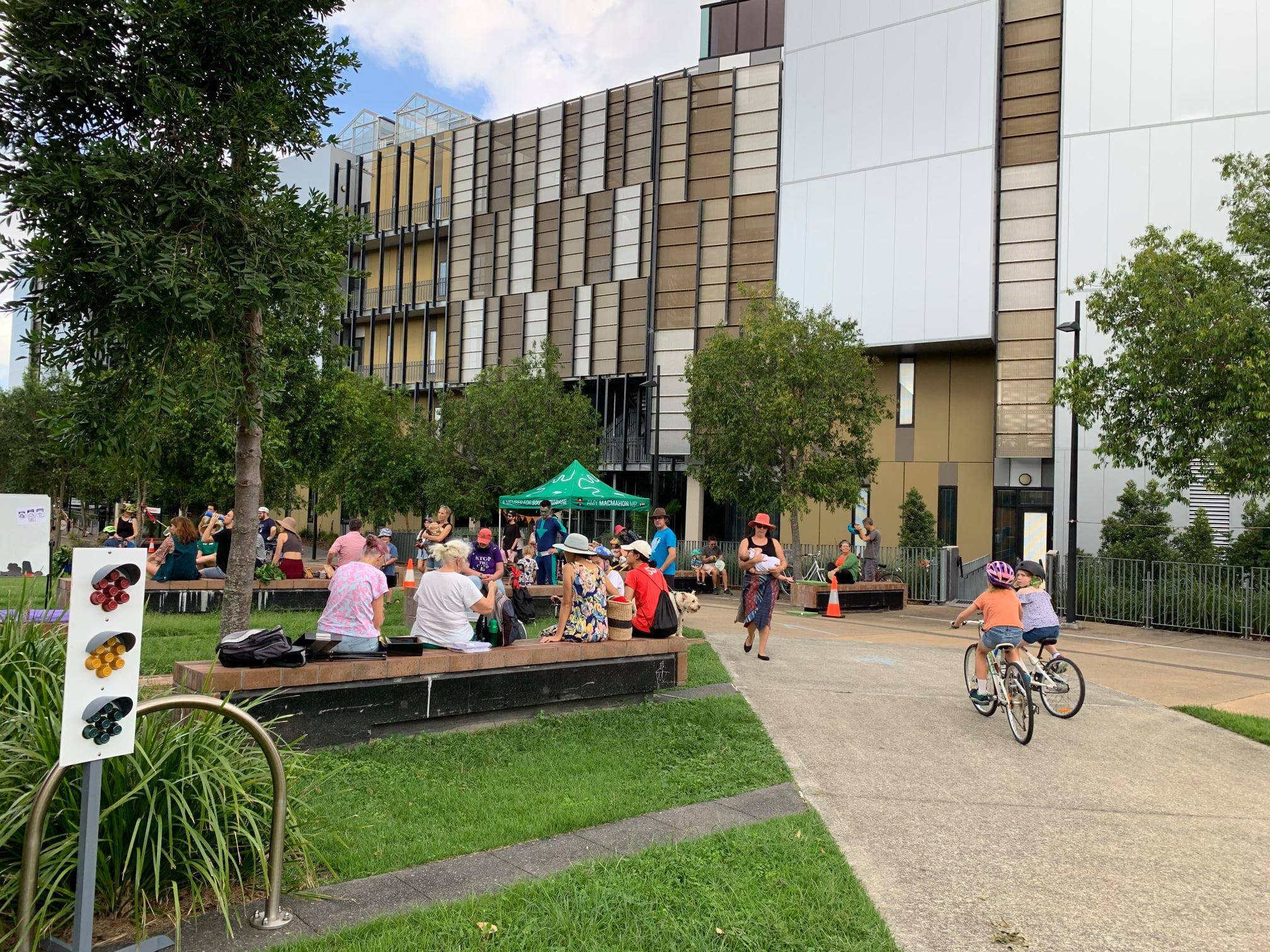
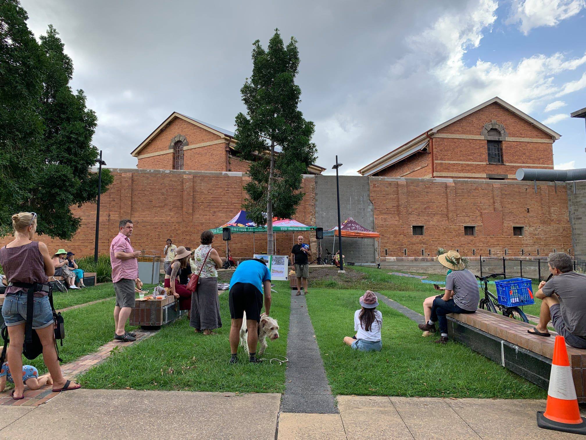
Dutton Park Dash and Boggo Road Futures
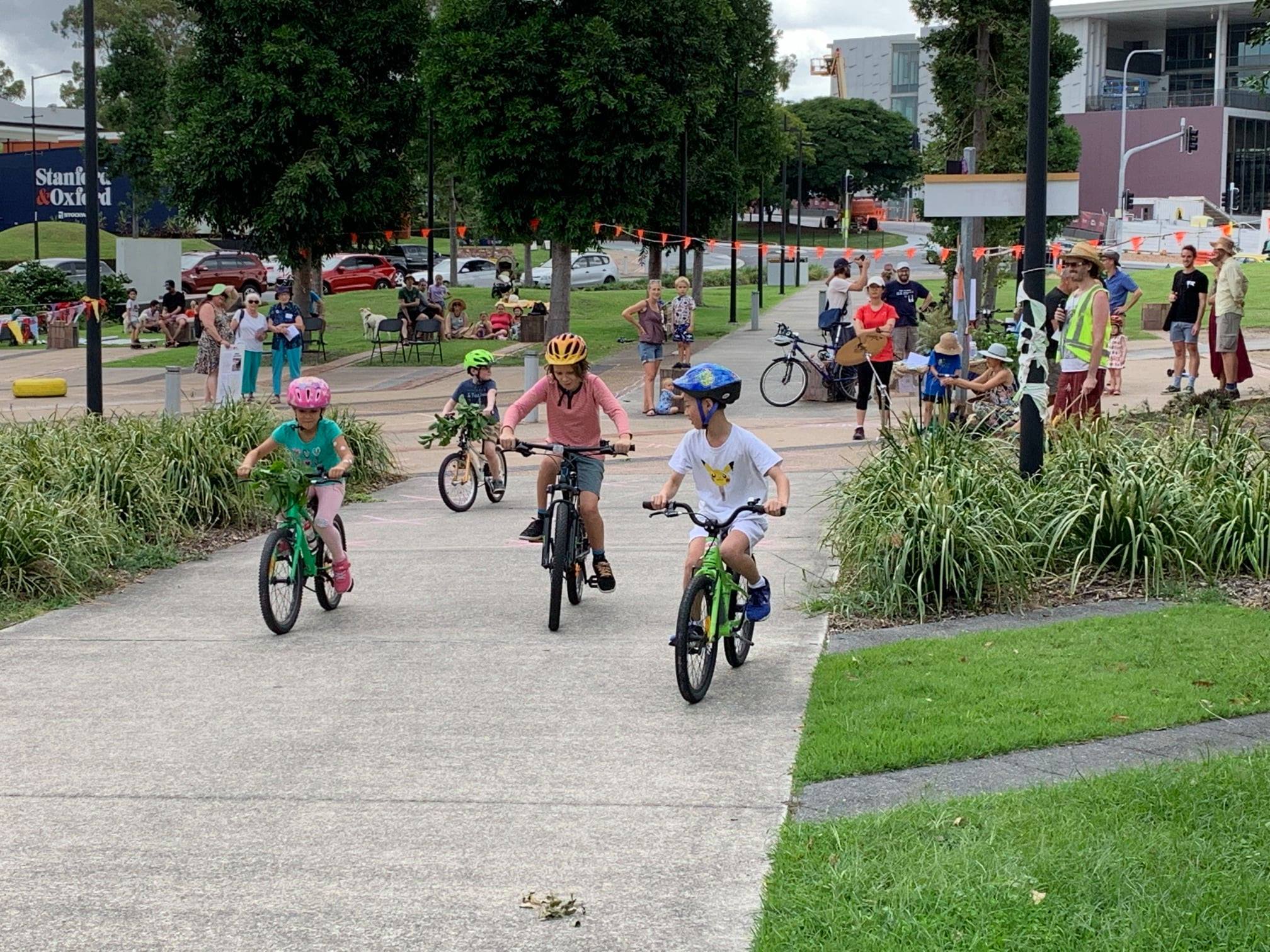
On the weekend, we went along to The Dutton Park Dash at Boggo Road Gaol Park. Promoted as a ‘celebration of people-powered transport and our beautiful public spaces’, there was a band, kid-friendly bike and scooter races, performance artists and a chance for us to connect with Dutton Park’s vibrant community.
The event celebrated car free public spaces between Boggo Road Jail and the Eco Sciences precinct. Nearby is the Dutton Park Primary School and the new high school. Locals say this is where their kids learned to ride their bikes, scooters, and skateboards. There are mature trees and grassy areas enjoyed by the hundreds of people living in the apartments across the road who want the space to stay as a people’s plaza.
Sadly, Brisbane City Council just approved a development application to turn this public open space into a commercial precinct with a large carpark (around 70% of the site) which will also effectively be a through road.
It’s hard to imagine a site less appropriate for a commercial precinct that is reliant on car parking: it is surrounded by the Boggo Road Bus Station, Park Road Station, and the new Cross River Rail Station. The Gabba Bikeway on Annerley Rd connects to the Eleanor Schonell Bridge, and to South Bank and the CBD. A new bridge over the rail lines will soon land on site, connecting to the PA hospital and via O’Keefe St to the Veloway.
Additionally, Peter from Boggo Road Futures pointed out that the final objections to the development were submitted to council at 4:30m last Friday and by 5pm the same day the Council had approved the development. Clearly they could not have read and considered the applications in 30 minutes; the process feels like a sham.
Boggo Road Futures presented their alternative vision for development of the area which focusses on the needs of the community and visitors and is sensitive to the history of the precinct. Their plan keeps trees, green spaces, open spaces, and preserves the area an active transport corridor.
Jonathan Sri, Councillor for The Gabba says, the message to the state government is: don’t sell off this publicly owned space to private developers. Use it for something that benefits the whole community.
We love that kids from Dutton Park learn to ride bikes here. When towns and cities everywhere are facing the challenge of keeping communities healthy and happy, removing open spaces used and loved by the community is not the right thing to do.
Residents say they will keep fighting to keep the area as a park for the community.
You can read more about the background to this development on our blog post from October 2020.
A near miss on the Gabba Bikeway
This one comes with a language warning: Watch the frightening moment when a driver makes an illegal turn through a red light and almost wipes out a rider on the Gabba Bikeway. The decision not to permanently close the left turn from Stanley St to the M3 (as recommended by TMR and Council traffic experts) was a purely political one. We fear it is only a matter of time until someone pays the ultimate price.
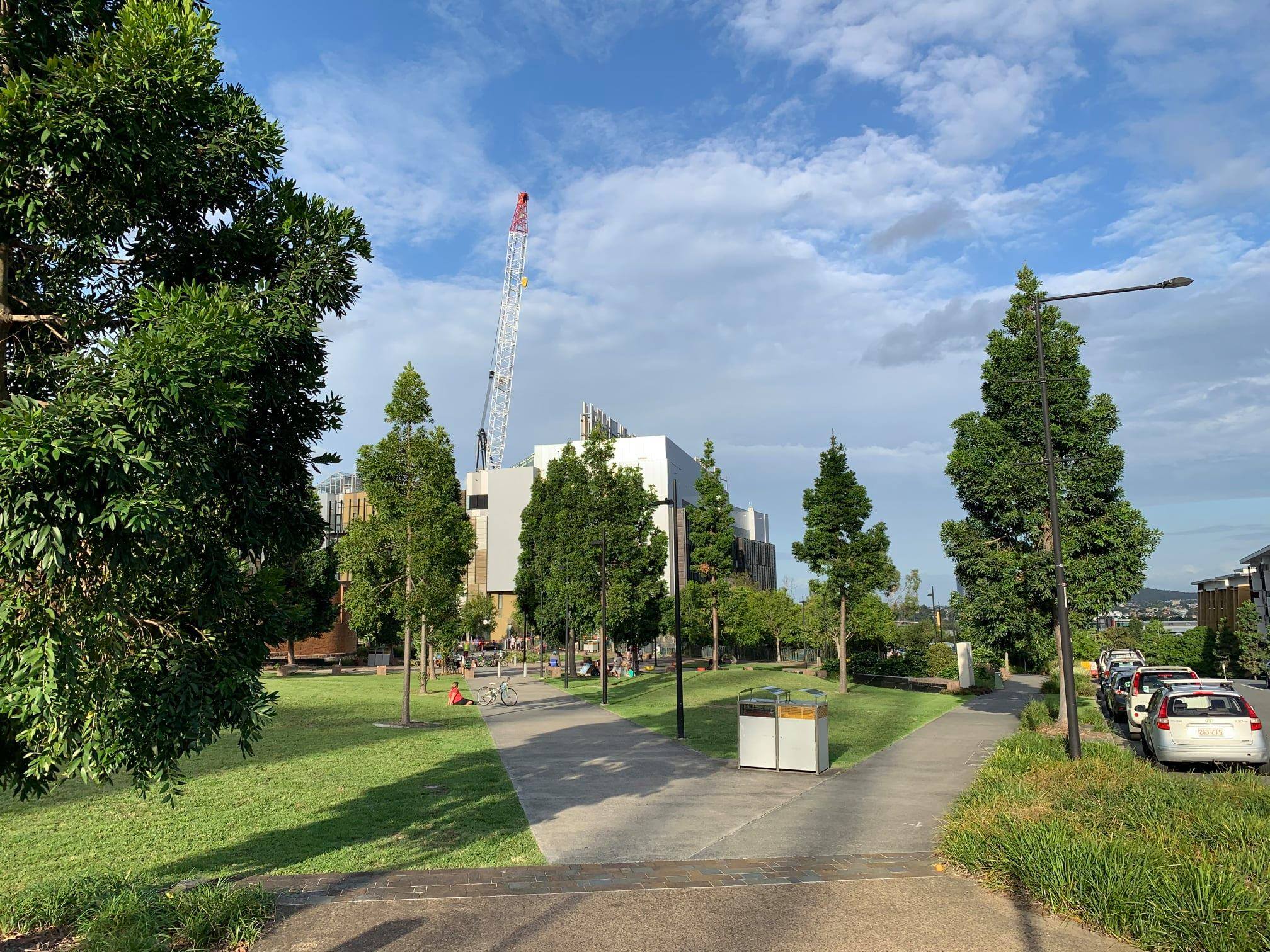
Hanlon Park, Stones Corner
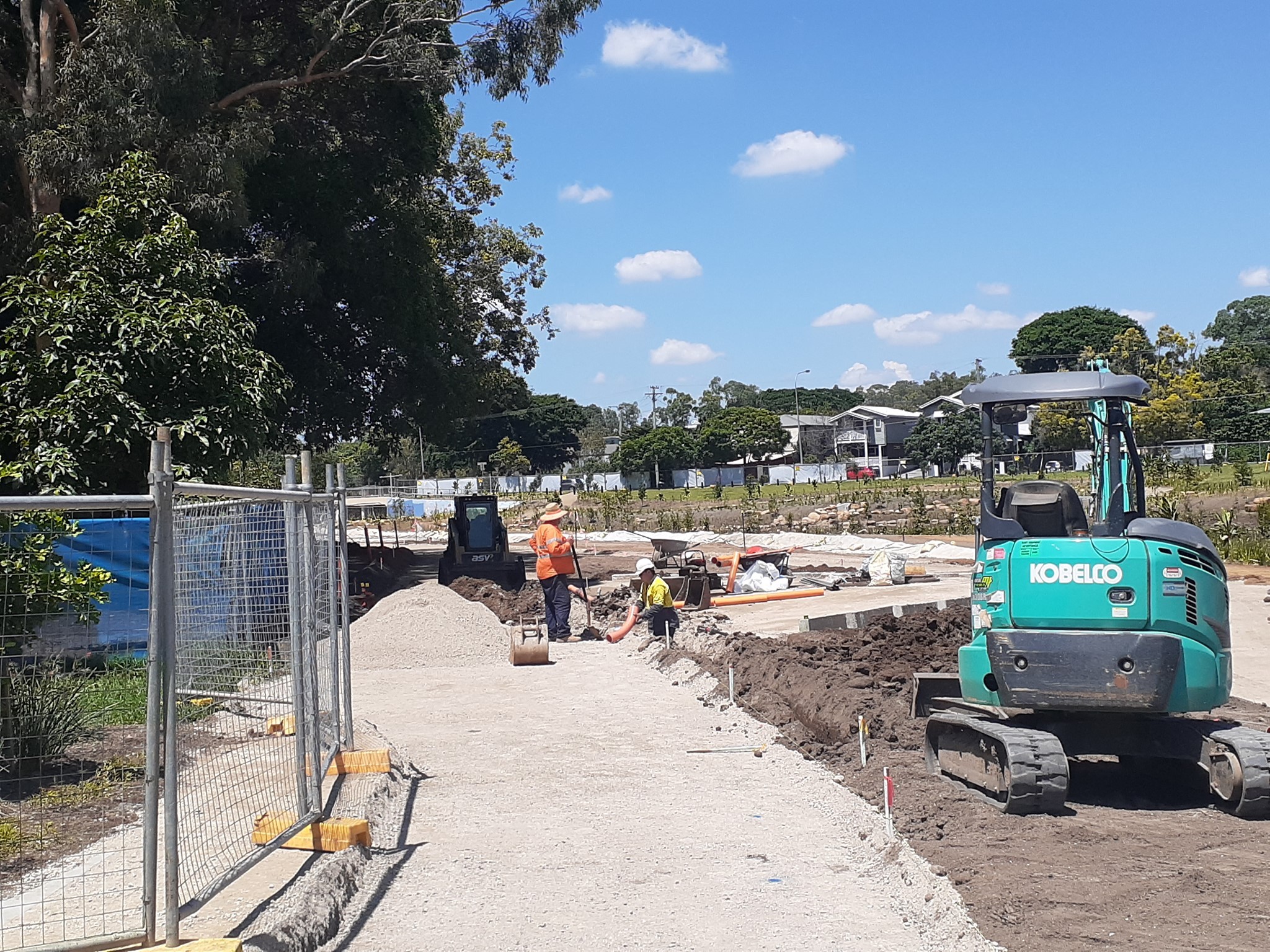
This week’s meeting of Council’s Environment Parks and Sustainability Committee included a presentation on the Norman Creek Masterplan. First drafted in 2012, with a time horizon of 2031, the masterplan has 9 stages – including the Coorparoo Creek rejuvenation, and Glindemann Park Projects which have already been completed, and the Hanlon Park rejuvenation at Stones Corner which is currently underway.
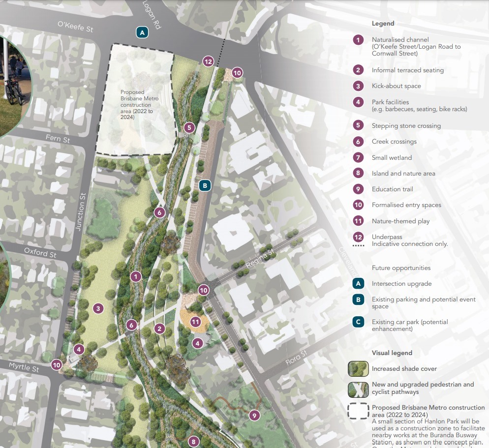

Members of East BUG Inc. were involved in the community visioning workshop for the Hanlon Park project, and it’s exciting to see progress as the concrete channel and hot open grassland is replaced by a more natural watercourse and native plantings. Apparently the local wildlife are not waiting for project sign-off before moving back in!
Work on Stage 2A has now started, with the whole project due to be completed by the end of 2021. Although it wasn’t addressed explicitly in the meeting, we understand that includes the underpass at Logan Road, allowing the Norman Creek Bikeway to bypass two really problematic road crossings. That will be very welcome indeed; it something Stones Corner Road Safety and East BUG have campaigned for for many years.


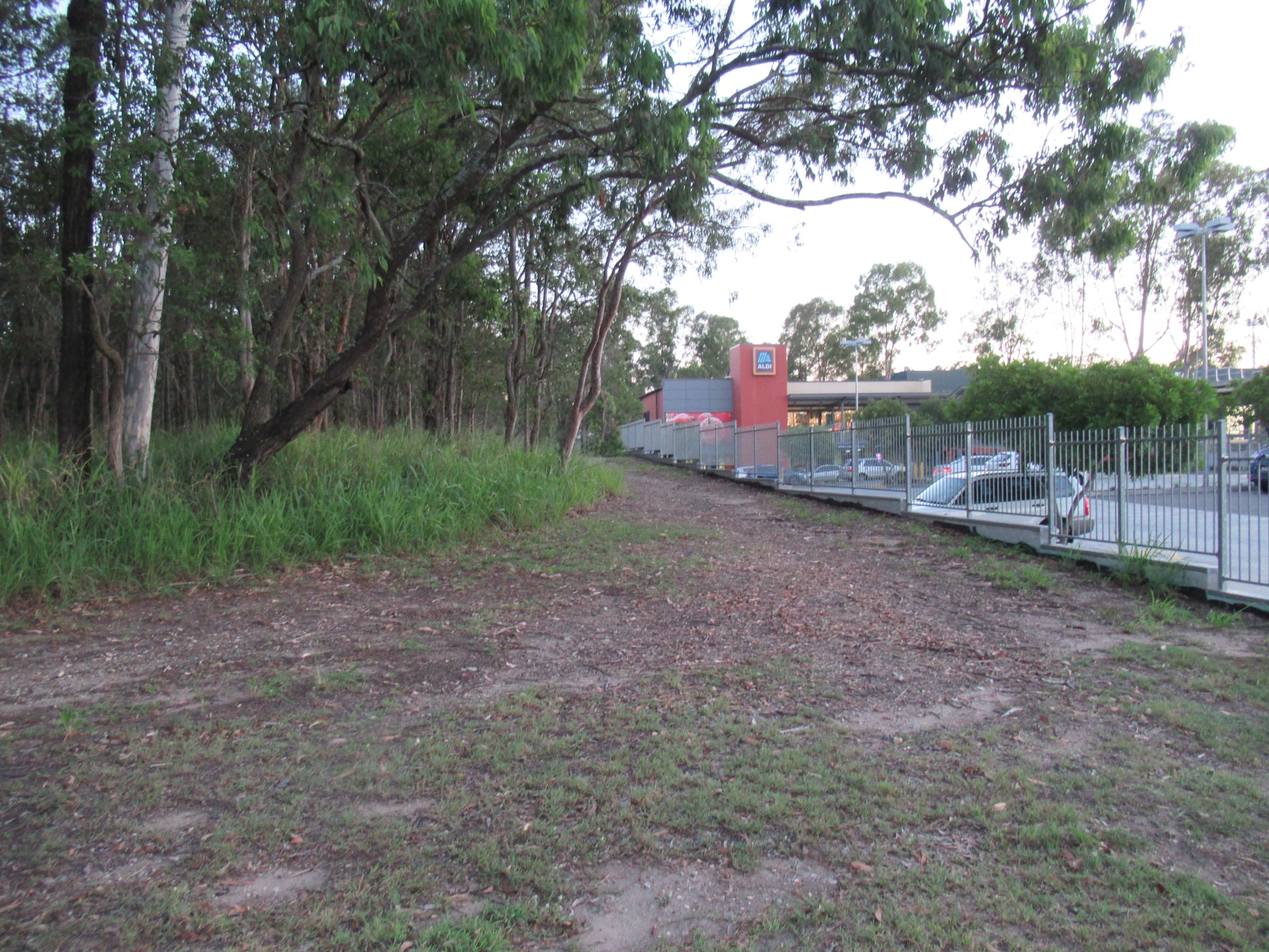
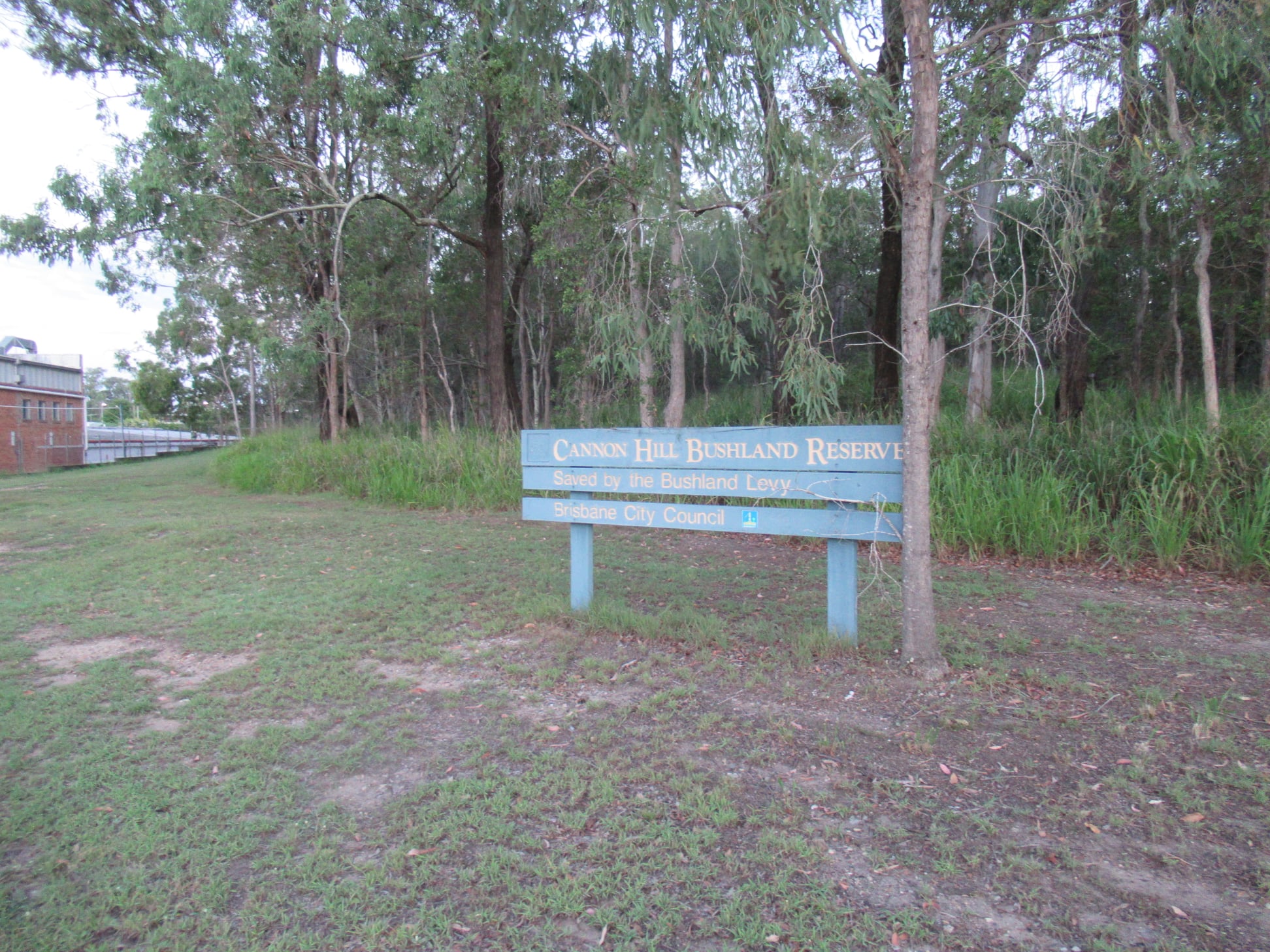
Minnippi Bikeway
Also at the “Your City Your Say” Forum on Wednesday evening, some more information was made available about plans for the Minnippi Bikeway. This follows the recent announcement by Cr Lisa Atwood and Federal Member for Bonner, Ross Vasta MP.
It appears the new bikeway will roughly follow the existing track around the edge of the Cannon Hill Bushland Reserve—behind the service station, Monte Carlo Caravan Park, Aldi and Bunnings. This makes sense to avoid disturbing established vegetation, and also because a path there is on higher ground than closer to Minnippi Creek. It’s not clear if there will be entrances to the shopping centre; in some places there is a significant height difference, but behind Aldi the path would be approximately level with the car park.
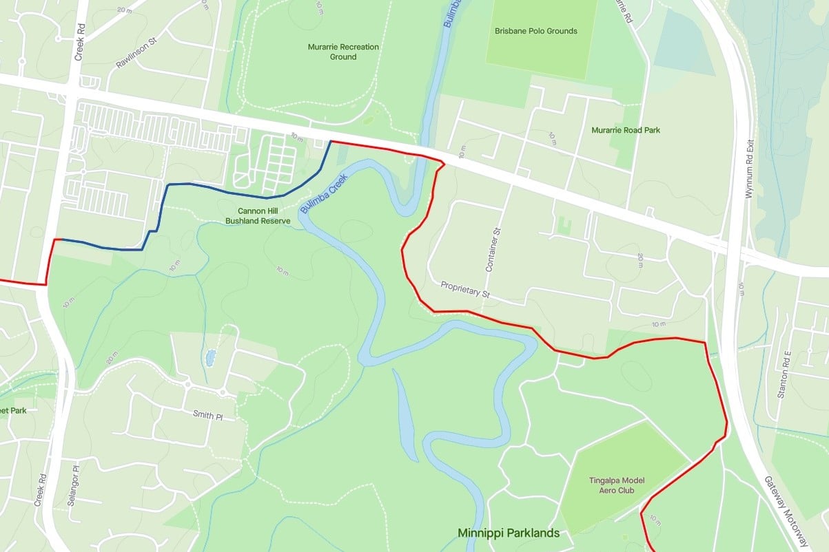


Belinda asked about the possibility of a new bridge over Bulimba Creek, but was told the existing one—which is attached to the Richmond Bridge at Wynnum Rd—is perfectly adequate. In reality it’s narrow and not in top condition. On Brisbane’s north side, a dozen or more bridges in a similar or better state have been replaced in recent years, so hopefully this one will get some love soon.


Once completed, the new bikeway will give residents who live west of Creek Road a way to access Minnippi Parklands without having to take the car in order to avoid riding on major roads. Future stages will connect to Minnippi Bvd, and then from Windrush St to Fursden Rd and complete a loop back to Bulimba Creek Bikeway in Minnippi Parklands.
Cycling Infrastructure Policy and Old Cleveland Road
Our petition requesting that the Queensland Government apply their own cycling infrastructure policy, and make better provisions for cycling on Old Cleveland Rd at the Gateway Motorway exit closed with more than 600 signatures. The current project to “upgrade” that area (ie. to facilitate and encourage more car use) will direct people on bikes off the main road and through a series of signalised intersections and conflict points. This is simply not the “high quality solution” required by the policy on a major route such as Old Cleveland Rd. (For more on this, see our blog post from January 2021).


Good policy should not be selectively applied. If there isn’t sufficient funding to complete a project that meets the needs of all road users, it shouldn’t proceed. Urban road projects that don’t provide safety for active transport users are akin to building a bridge without guard rails.
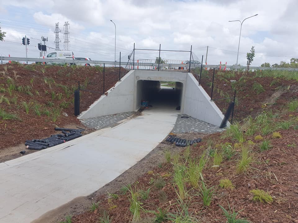
Sumners Road Underpass
For an example of good cycling infrastructure, see the underpass taking the Centenary Cycleway beneath Sumners Rd. It’s looking very close to being opened…


Hoyland St
Over on the north side, it’s a case of one corridor, two different approaches:
The cycling corridor from Bracken Ridge to Strathpine is not an easy one to navigate by bicycle. The latest developments by both Brisbane City Council (BCC) and TMR make it both easier and harder.
On the negative side, anyone who used to cycle on Hoyland St (according to Strava there is a lot that do) had a nice wide road shoulder to use until coming to the bridge over the highway when the cycling lane disappeared. Now that TMR is improving the bridge over the highway by making a diverging diamond they have added a bike lane.

BCC’s part to “bust congestion” has been to remove the road shoulder (bike lane) to add an extra traffic lane. BCC’s response to our concerns is summarised as: ‘there is a shared pathway that you can use and there isn’t room on the road for an on-road bicycle lane’.


If you look closely at TMR’s plans you will note the tiniest of slivers of green paint that at least acknowledges that some confident people might ride on Hoyland St.
Brisbane Bike Bites Short Film Competition
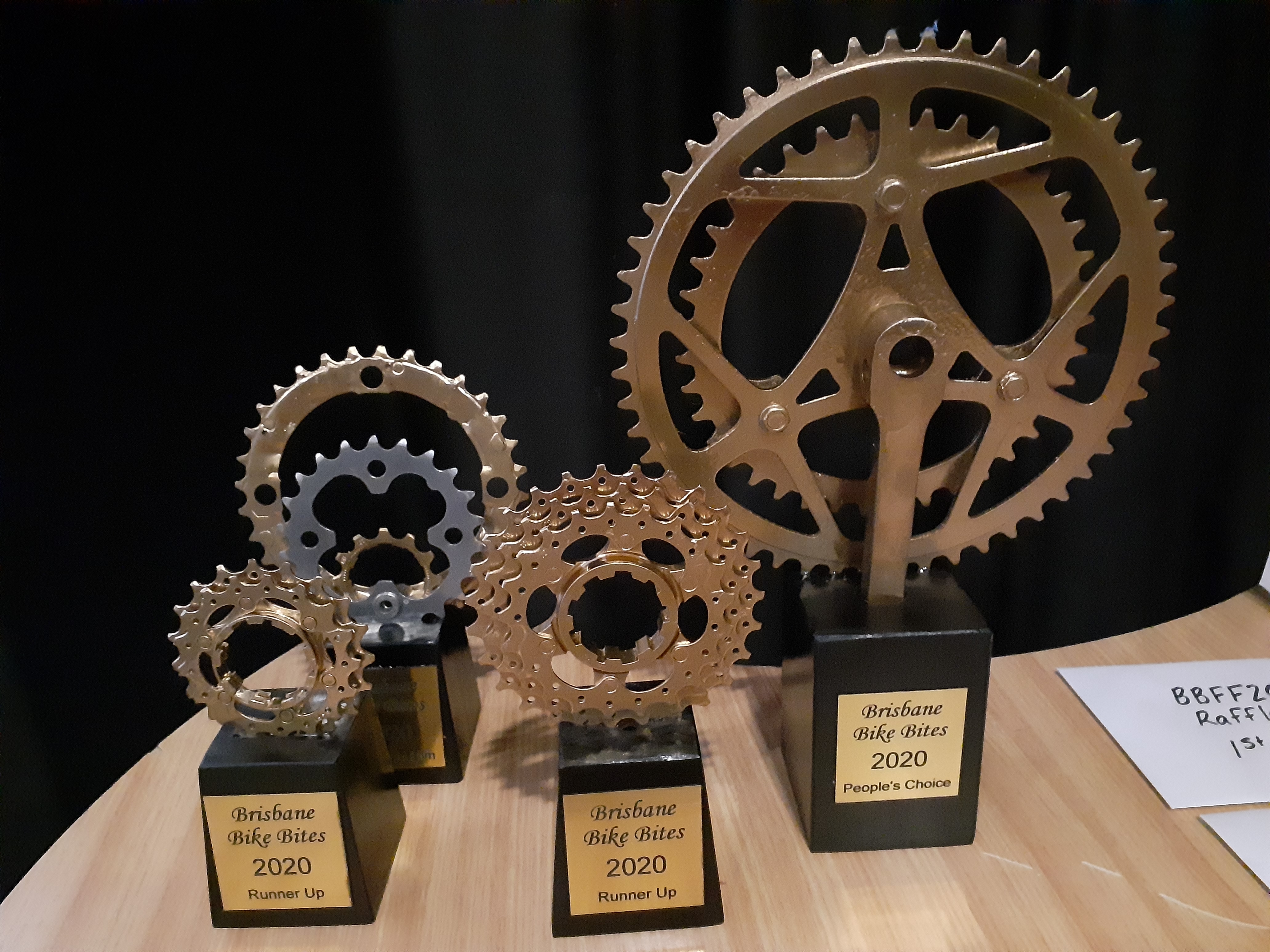
It’s time to get creative, and think about making an entry for the 2021 Brisbane Bike Bites Short Film Competition! The criteria are simple: your entry must be no more than 5 minutes long, it must be set in Brisbane or have a Brisbane connection, and it must involve bikes!
Finalists will be shown at the Brisbane Bicycle Film Festival, on 29 May (more details to come about that event). Check out this link for more information, including how to submit.
Get filming, get editing, and get your submission in. There are some great prizes thanks to Epic Cycles for the best films as decided by our judges, and the Bike Bite voted most popular on the night will win the prestigious People’s Choice Award.
