- Lockdown lifted!
- Active School Travel
- Street Trees
- Breakfast Creek Bridge
- Seeking to understand a tragedy
- Roma Street Priority Development Area
- Low-visibility bollard
- Old Cleveland Road
- Lytton Road, Morningside
- Around Australia
Lockdown lifted!
It’s great news that Brisbane is now out of lockdown since 4pm Sunday afternoon (check the government site for the rules going forward), but we have our fingers crossed for our friends in Cairns. We’re also conscious that there are thousands of families still restricted to home quarantine in Brisbane because someone in the household had been to an exposure site before lockdown. Stephen was in that position last month, but he wasn’t going to give up the chance to go for a bike ride; laps of the back yard had to do!
We’re already a bit wistful for the quieter streets we’ve enjoyed this last week though. It has been great seeing so many families having the opportunity to exercise in great weather on the streets and paths around home.
Active School Travel
After a long break, Council was back in session this week. The lockdown gave us the opportunity to tune in to committee meetings online, rather than having to attend in person at City Hall.
The Public and Active Transport Committee heard a presentation on Council’s Active School Travel Program—which is a 3 year behavioural change program available to all primary schools around Brisbane to encourage walking, cycling, scooting, and taking public transport to school. At our best performing schools, on their designated active school travel day, levels are up to 60% – sometimes as high as 70%.
But that’s still 30-40% of children being chauffeured to school. And most schools don’t perform nearly so well, even with this targeted intervention.
While the Active School Travel program is great—and we encourage parents to speak with their school about nominating if they aren’t part of the program—we think this illustrates the limitation of a behaviour change program without the support of infrastructure and policies that make it easier and safer for the whole community to rely less on their cars.
Cr Sri also pointed out the limits of the footpath decal strategy that is part of the program. While it’s not a bad thing to remind kids to stop, look, and listen when they cross the road, why aren’t we reminding drivers of their obligation to give way to pedestrians when turning?


Where is the focus on infrastructure beyond the school drop-off zone to enable safe active school travel—like slow-speed roundabouts and wombat crossings?


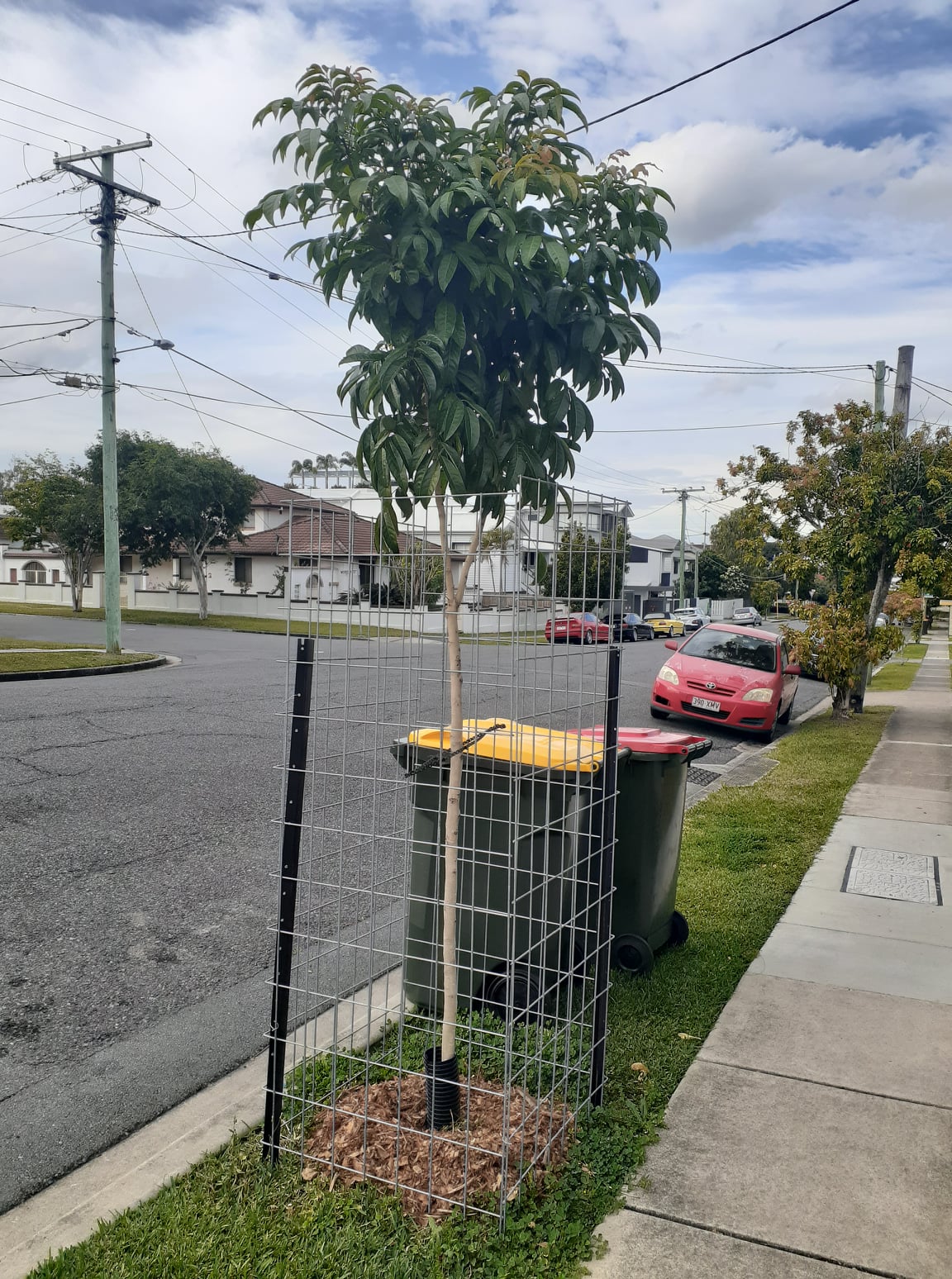
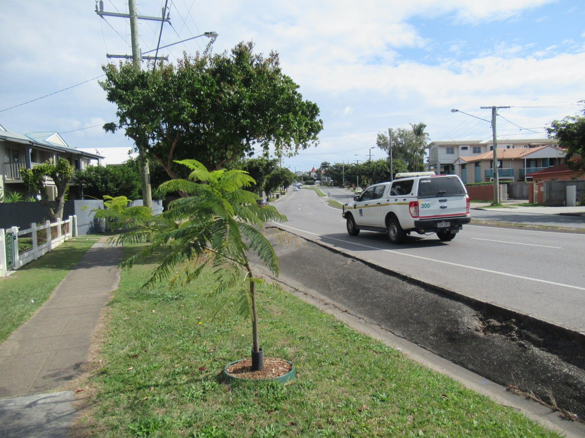
Street Trees
Council’s Environment Parks and Sustainability Committee this week had a presentation on street trees—including various approaches Council are trialling to harvest and retain water for slow-release to the roots, to promote better canopy growth. Street trees exist in a hostile environment, with poor compacted soils and surrounded by asphalt and concrete. Better water management can encourage deeper root growth, rather than a shallow spread of roots which then leads to cracked and broken footpaths.
It was great to hear that Council have a target of 50% shade for all footpaths and bikepaths by 2031. We applaud that goal. Street trees are active travel infrastructure; they make an enormous difference to how attractive it is to walk or cycle instead of jumping in an air-conditioned car.
We were interested to hear that the current estimate of footpath and bikepath shade coverage is 32%. We’re curious as to how that’s calculated. In most suburbs, it certainly doesn’t feel as though 32% of any walking or off-road cycling trip can be accomplished in the shade. Perhaps that is explained by the difference between the presence of street trees, and any meaningful canopy cover?

Breakfast Creek Bridge
According to articles in the Brisbane Times and on the ABC news site, work on Brisbane’s cycle and pedestrian bridge across Breakfast Creek near Newstead House will start before Christmas. “An amended design, which includes ideas from the community, was released on Tuesday after it was approved by Brisbane City Council engineers.”
But where was that design released? It wasn’t available on the planning site Development-i, nor on Council’s website as of 10:00pm Tuesday (but can be found here now).
All we have at this stage are some artists impressions. These indicate a separated cycleway along Breakfast Creek Road through to Newstead Ave—which is positive.

But does the updated design include feedback from the community regarding shading (not shown in the concept drawings); how does it link to the path upstream along Breakfast Creek; and what is the proposed cycle connection south toward the CBD from Newstead Ave?
Seeking to understand a tragedy
On 27 May this year, Max McDowall was cycling along the shared path on the southern side of O’Keefe St, Woolloongabba and proceeded (with a green light) to cross the busway entrance opposite Gillingham St. At the same time, a bus travelling in the same direction on O’Keefe St turned left into the busway entrance and struck Max on the crossing. Max died at the scene.
Max’s family are appealing to anyone who has had troubles at this intersection to get in touch, in order to create safe change for all. The contact details are below on the yellow flyer.
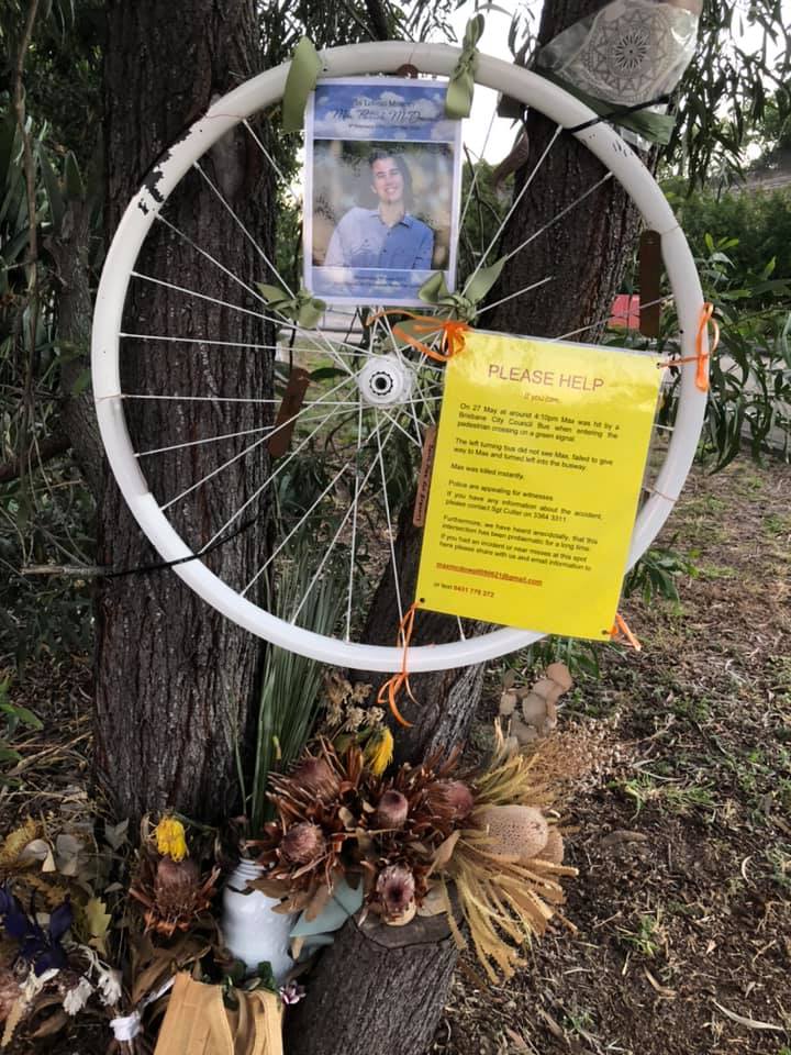

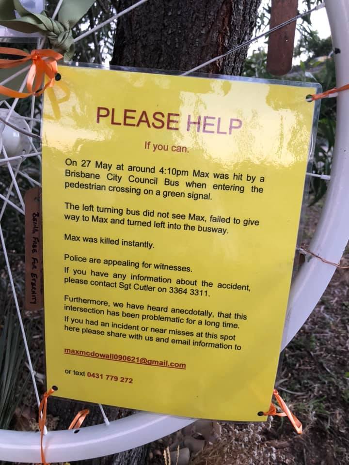
We have written to the Coroner asking for an inquest. We believe it is in the public interest to understand how this tragedy could have occurred and what must be done to ensure it could never happen again.
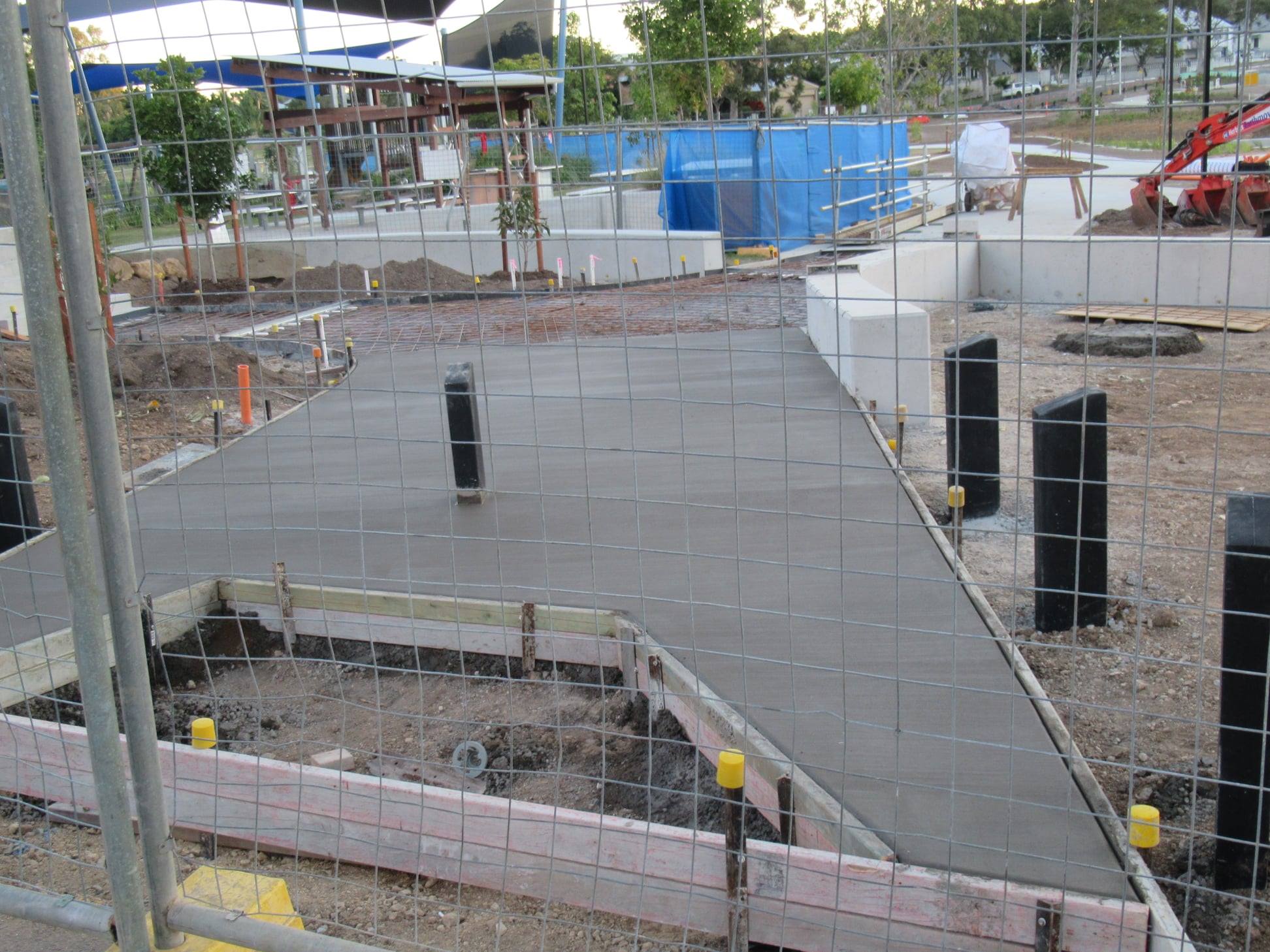
Roma Street Priority Development Area
What more thrilling way to spend time during lockdown than wading through development scheme documentation…
This week we did that with the Roma Street Cross River Rail Priority Development Area Development Scheme (even the title of it is coma-inducing), which came into effect on 30 July.
The “too long, didn’t read” version is: the provision for active transport connections (current and future) seems good. Or at least not bad. For a more detailed analysis, check out our latest blog post.

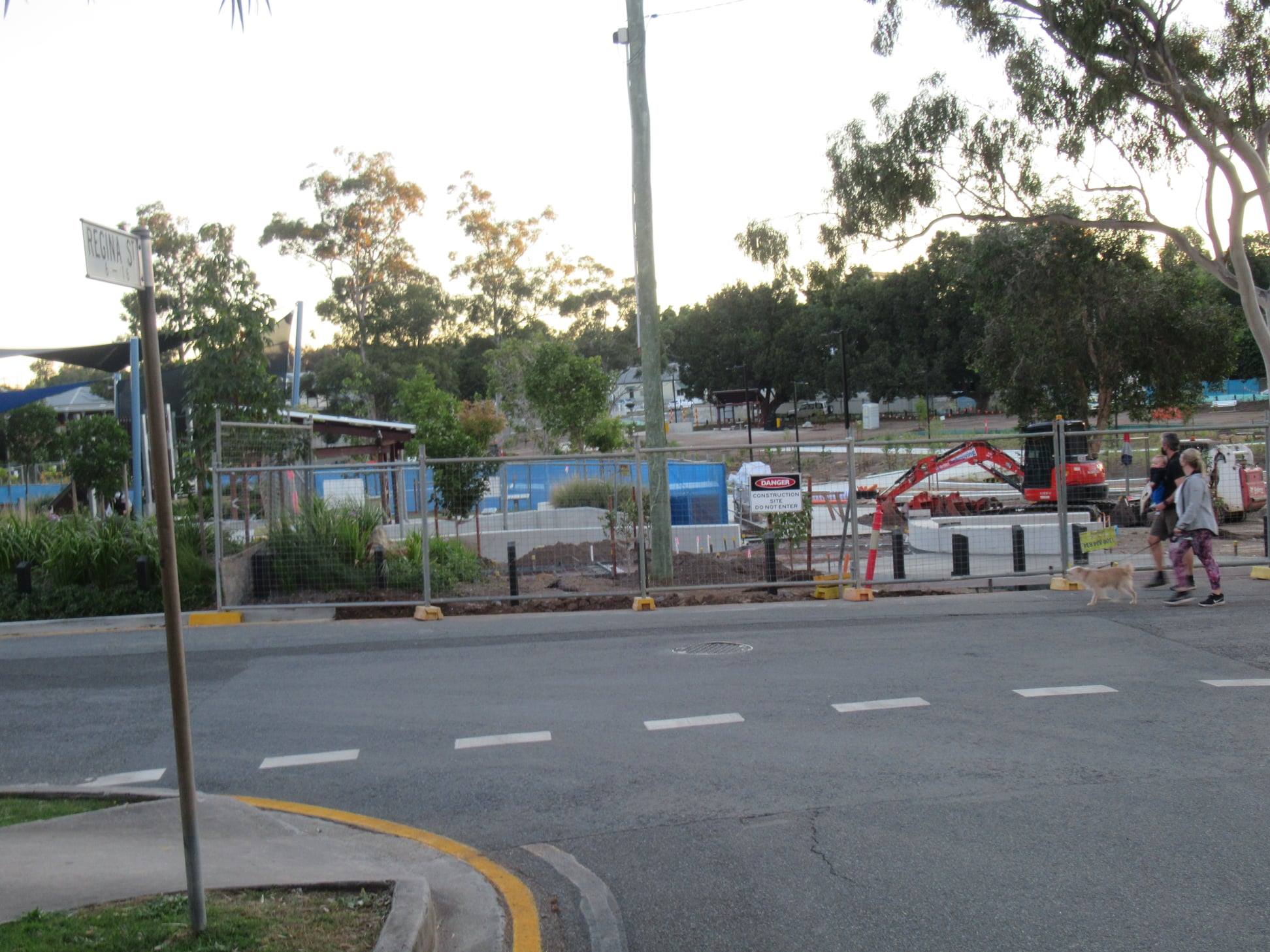
Low-visibility bollard
We’re frustrated to see an inappropriate path termination treatment being installed at the entrance to Hanlon Park, Stones Corner opposite Regina St. One of our supporters alerted us when they spotted the low black bollard, and we’ve been in touch with Council. On Friday, a council officer insisted that this path was not designed for cycling; it was intended to be a “boulevard”. Having been involved in the concept planning process for Hanlon Park, we know that’s absurd. The connection across the park from Myrtle St to Regina St is an important local connection, and has been for years. Council have installed a standard shared path termination treatment (3 tall, highly visible bollards) at the other end of this connection at Myrtle St. Even if this is not intended as a cycling route (which would be a mistake), the knee-high black wooden bollard is inappropriate for a footpath.


Old Cleveland Road
We’ll take this as a win! After being horrified that the “upgrade” of the Old Cleveland Road off-ramp to the Gateway Motorway at Belmont had removed the existing bike crossing, we’re now pleased to see that the new guard rail has been moved, and a crossing point reinstated. So if you don’t want to duel with left-turning traffic as you cycle west on Old Cleveland Road, you now have the option to follow the slip lane left, and cross the stream of traffic further along where you have a better view. (Or you can continue past Mt Petrie Road and through two signalised intersections to re-join Old Cleveland Road).


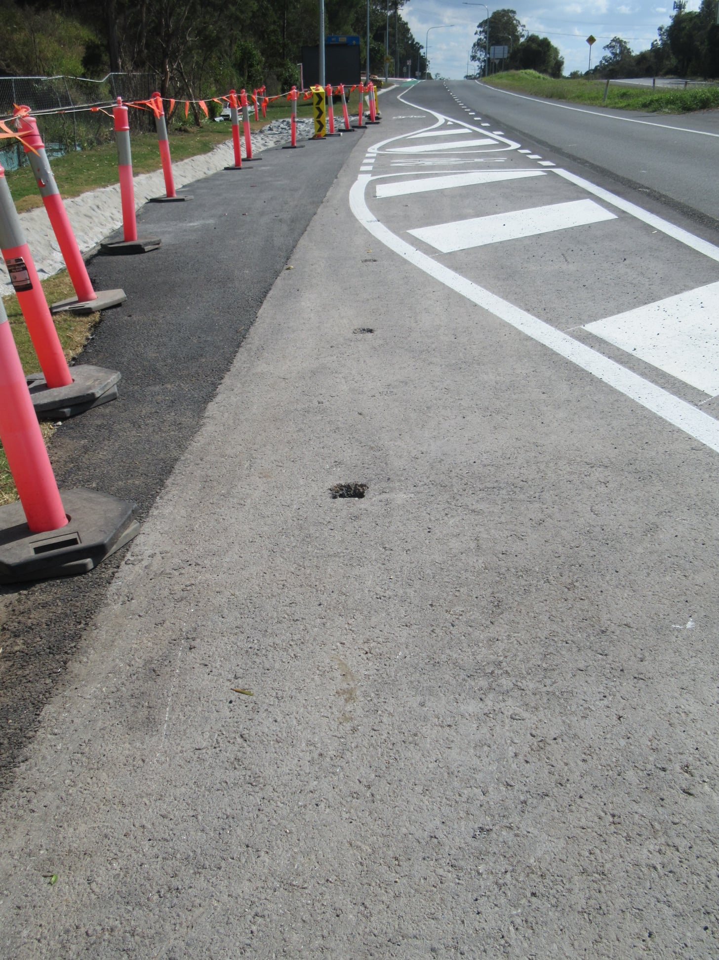
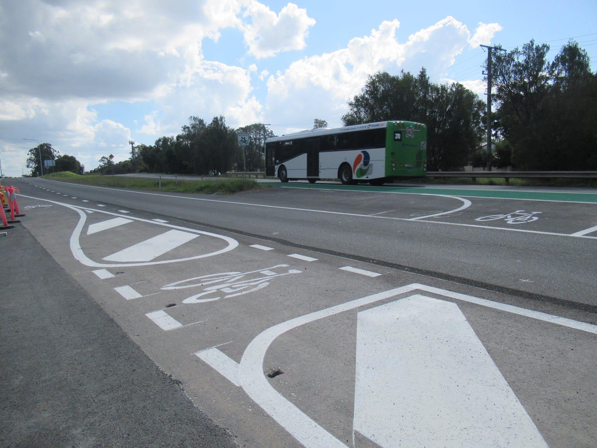

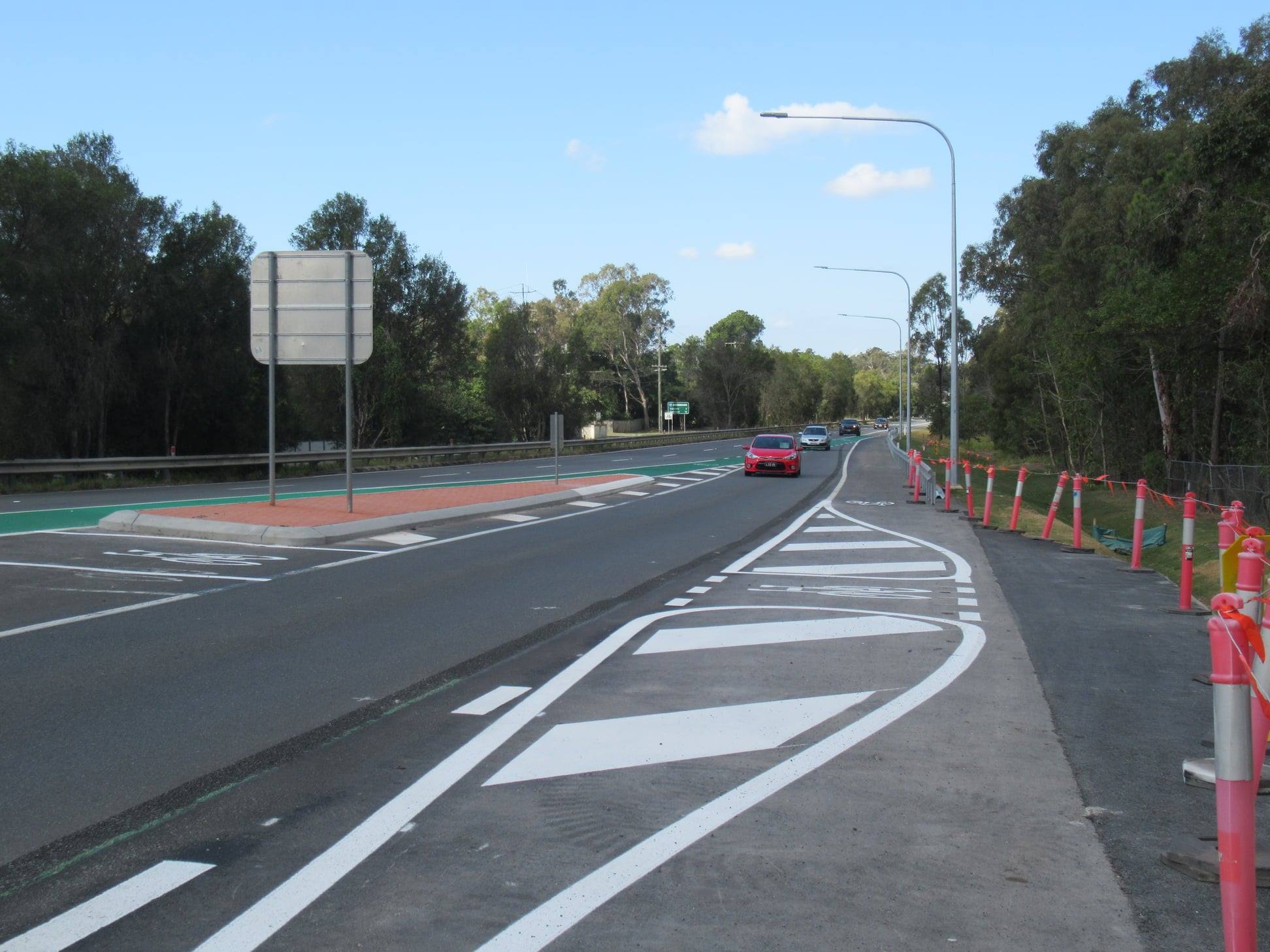


Sure, the whole area still sucks, but now just a tiny bit less. 🙂
Lytton Road, Morningside
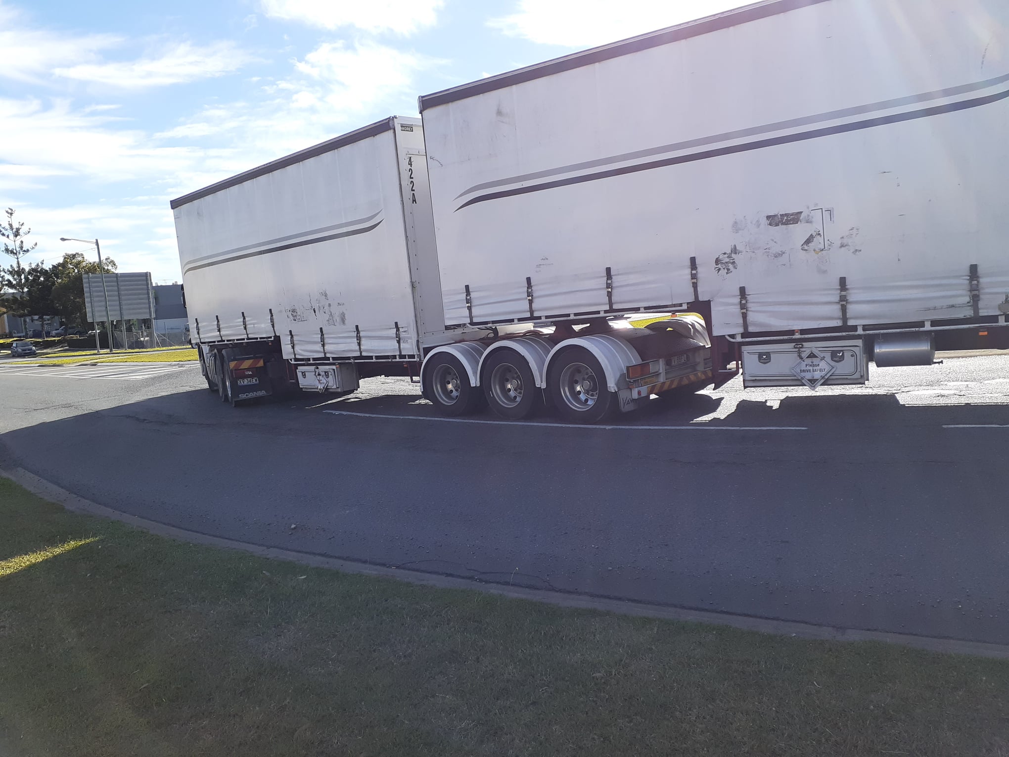
In Morningside, it’s good to see that the Colmslie Roundabout has now been fully resurfaced (not just the section that was fixed last year when the truck rolled). It was very ragged.
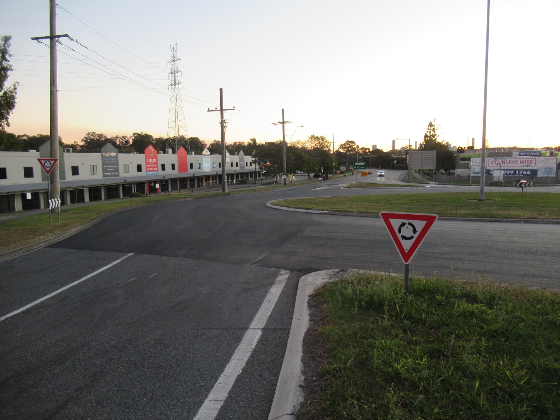


But does this mean an intersection upgrade here is a long way off?
If the resurfacing is an emergency safety measure, that seems reasonable. But it’s a pity Council couldn’t also implement urgent works to create a footpath connecting Colmslie Rd to the crossing at Barrack Road. The desire line seems fairly clear.

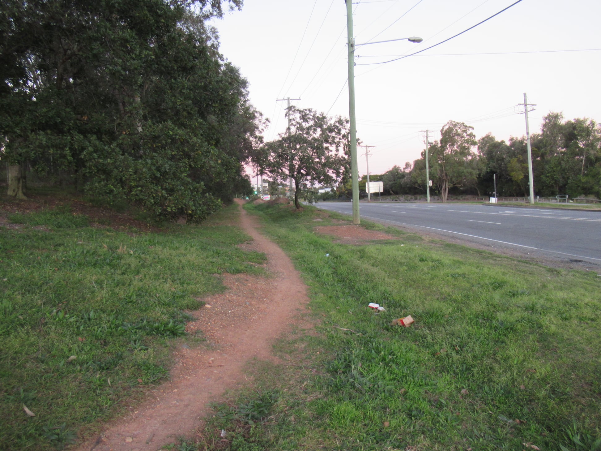
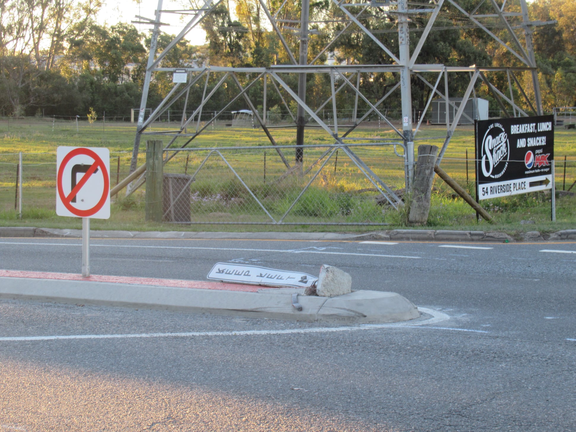
Nearby, at the intersection of Lytton Road and Riverside Place (which we’ve covered previously), it seems someone has been confused by the new configuration…

Around Australia
Great work Melbourne! Cycling along Peel St, past the Queen Victoria Markets will be so much safer and more accessible with a protected lane! Check out these images from the Amy Gillett Foundation:
Heidelberg Road is busy road in Melbourne’s east. Until recently, it had 3 lanes of general traffic in each direction, with kerb-side parking permitted outside peak. It was a very hostile place to ride a bike. Now one of those lanes in each direction has been converted into a protected cycle lane. Check out what the users have to say about it in this video from Vic Roads:
