Back in April, we provided input to the draft Roma Street Cross River Rail Priority Development Area Development Scheme. The finalised Development Scheme came into effect on 30 July 2021. You can download the document at this link.
The news for cycling is mostly good. (Although of course we have seen with Howard Smith Wharves, Queens Wharf, and other developments that comforting words in a development scheme or master plan don’t necessarily result in a good result on the ground. We will be watching development in this area closely…)
We’re happy to see the North Brisbane Bikeway connection (via the Normanby Bikeway) highlighted in the map of the structural elements, with the legend note “Upgrade major active transport connections”.

Our main concern was for the future of this connection, including the Normanby Bikeway, which is the major active transport connection from the Brisbane CBD to the northern and north-western suburbs. The Normanby Bikeway—including the underpass beneath College Rd—cost approximately $17 million in 2007. It supports around 1,200 cycle movements per day, and 450 pedestrians. We noted that numbers can be expected to grow with the completion of further stages of the North Brisbane Bikeway (recently opened to Wooloowin, and planned to extend to Eagle Junction).
The Normanby Bikeway is mentioned specifically in the Development Scheme in the discussion of the “precinct intent” for “Precinct 3” (the northern half of the development area):
“The precinct includes state transport corridors, namely railway and busway corridors. These state transport corridors are important elements within Precinct 3 and development must not compromise the role and function of these public passenger transport networks. The precinct facilitates major connections from the city centre to the northern and western suburbs including the active transport links of the Normanby Bikeway, Roma Street to Suncorp Stadium via the Barracks and Caxton Street.”
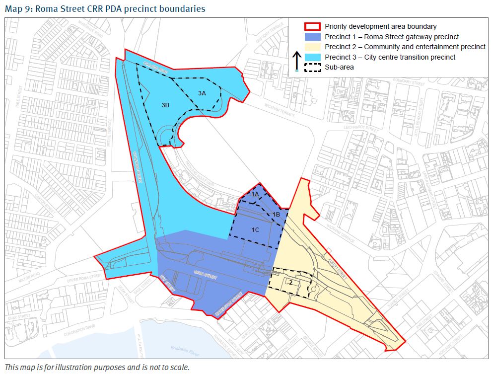
Development Scheme section 2.6.3 Precinct 3: City centre transition precinct
We asked that the requirement to preserve and enhance the Normanby Bikeway be strengthened, with an easement to protect the primacy of the through function, including during temporary events or any other “activation” of the surrounding space. We also asked that any development of the site avoid closures of the Normanby Bikeway during construction; this corridor must be treated as a primary arterial transport route.
The submissions report notes:
“Submitters raised concerns that there are no references to protecting and enhancing Parkland Boulevard and cycling facilities, and no reference to protecting the Inner Northern Busway.”
Item Number 69 in Table 11 – Summary of submissions and amendments – Development Scheme
In response:
“As discussed earlier [where?], amendments have been made to include reference to protection of local government transport and road corridors and a new item has been added at section 2.5.6. These are considered adequate to protect roads within the PDA and the SDAP protecting state transport corridors. No amendment necessary.”
That new item in the Development Scheme at 2.5.6 is as shown below:

Also in our submission on the draft scheme, we stressed that any development of the city centre transition precinct should include a high quality pedestrian and cycle connection from Roma Street Parkland to the Victoria Barracks (over Countess Street, the busway and railway infrastructure). We’re happy to see this indicated on Map 3 as a “New major active transport connection”, along with a connection from Albert St towards the Kurilpa Bridge (via the long-anticipated overpass over Emma Miller Place and Roma St to the Law Courts precinct), and a possible alternative cycle route during events at a future arena.
Section 4.2.9 Major active transport connections, lists as an objective:
“Deliver a range of major transport connections, including as indicated on Map 3: Roma Street CRR PDA Structural elements plan, which improve pedestrian and cyclist connectivity and universal access within the PDA, and resolve access arrangements for Parkland Boulevard / Parkland Crescent, that address accessibility requirements for development within the PDA and to better connect the PDA to surrounding key destinations including, Roma Street Parkland, Kurilpa Bridge, the Bicentennial Bikeway, Victoria Barracks, Spring Hill, Victoria Park and King George Square.”
The submissions report records:
There was general support for improved active transport opportunities, particularly as they relate to improved connections with:
Item Number 33 in Table 11 – Summary of submissions and amendments – Development Scheme
Suncorp Stadium
surrounding areas
existing active transport infrastructure.
In response:
“Table 9 – Infrastructure catalogue of the PDS Infrastructure plan, supported by the draft Infrastructure plan background report – Appendix E – Transport report outlines upgrades to and additions to active transport infrastructure which will support the projected increased demands on existing infrastructure within and surrounding the PDA.”
There is no Table 9, but we assume this refers to Table 8, the “Infrastructure catalogue” which lists “other infrastructure” that may be delivered by state government, other infrastructure providers or by developers who may be
required to deliver or preserve the ability to provide this infrastructure by a condition of a PDA development approval.
Under “Pedestrian and cyclist movement”, Table 8 lists infrastructure “as required to service the PDA and may include enhancements to the local and principal pedestrian and cycle network.” This may include:
- pedestrian access across Roma Street to Roma Street Station (various) delivered as part of CRR transport project works (tunnels and stations) and future development along Roma Street frontage
- potential major active transport bridge from Roma Street to Roma Street Parkland that may be delivered as part of a potential major sport, recreation and entertainment facility or other development outcome
- potential major active transport connection from Roma Street Station / a potential major sport, recreation and entertainment facility to the existing Palace Barracks/Caxton Street link should this be achievable through redevelopment and Inner Northern Busway realignment works
- Parkland Boulevard Cycle Street
- on street cycle network allocations and markings
- Albert Street Green Spine delivered in partnership with BCC including for a potential major sport, recreation and entertainment facility
- pedestrian access across Wickham Terrace delivered as part of potential major sport, recreation and entertainment facility intersection works
- potential major active transport bridge (across Roma Street) from Emma Miller Place to the existing Queensland Place ramp link delivered as part of a potential major sport, recreation and entertainment facility or other development outcome
- alternative cycle connection from Emma Miller Place to Roma Street Parkland delivered as part of a potential major sport, recreation and entertainment facility
- potential shared active transport bridge from Roma Street Parkland to Victoria Barracks that may be delivered in conjunction with a future Victoria Barracks redevelopment project
- pedestrian laneway (cross block link) between North Quay and Roma Street
- pedestrian laneway (cross block link) between North Quay and Garrick Street
- pedestrian laneway (cross block link) between Roma Street and the plaza opportunity area
- casual cycle parking facilities (various), and
- publicly accessible, vertical transport link connecting the existing Parkland Administration building level to Wickham Terrace.
As for the actual implementation and timing of any of those connections, section 4.2.9 of the Development Scheme outlines the intent [for the Delivery Authority] to investigate the timing, funding, ownership and management arrangements for these connections with BCC and TMR.
So, no timing, and no budget (not that you would normally expect that in a development scheme), but it’s good that the intent and objectives are stated.
We are also pleased to see that the PDA-wide criteria require that any development within the area:
- provides generous publicly accessible space, major active transport connections, pedestrian laneways and connections that enhance the functioning of the western parts of the city centre and its public realm. [2.5.2(1)]
- ensures public spaces and parklands are linked to create a highly interconnected public space and parkland. In particular, the Albert Street to Roma Street Parkland gateway link, achieves a minimum unencumbered width of 6m, and incorporates design treatments to manage potential interactions and conflicts between pedestrians, cyclists and users of other personal mobility devices. [2.5.2(3a ii and iii)]
- ensures the design of vehicular access, on-site servicing and parking does not compromise the walkability, cycling or activation of the street frontage; does not compromise active transport connections to public passenger transport or cause vehicular and pedestrian conflict. [2.5.2(8)]
- facilitates safe, attractive and convenient pedestrian and cyclist connections between public passenger transport stations and surrounding streets and public spaces that cater to current and future high volumes of pedestrian and cyclist traffic 24 hours / 7 days per week. [2.5.2(4a)]
- incorporates Crime Prevention through Environmental Design (CPTED) principles into the arrangement and design of buildings and public and private spaces to create a safe and inviting environment for day and night activity. [2.5.1(3)]
- provides facilities to support the storage and charging of e-bikes, e-scooters or other electric micro-mobility devices within end of trip facilities for a non-residential use, and dedicated secure spaces where a residential use. [2.5.1(7)]
Overall, this looks like a good result for active transport. We look forward to the intelligent development of this pocket of inner-city land in a way that enhances and supports active transport.
