- Getting out of Brisbane on the trails
- Veloway overpass at O’Keefe St
- Ipswich Motorway Cycleway underpass at Oxley Creek
- Enoggera Creek Sport and Recreation Precinct
- Hoping to cross the street in South Brisbane
- People-friendly suburban centres
- Width of shared paths
- Minnippi Bikeway at Cannon Hill
- Bridging Perrin Creek at Morningside
- In the west: Mt Crosby
- Carseldine Urban Village
- CBD bike lane barrier trip-up
- Inspiration: Sydney
- Uncovering ants and a secret bikeway
Getting out of Brisbane on the trails

We’ve been quiet on social media for a few days while a number of us have had time out away from Brisbane – by bike of course!
Have you had a chance to check out the rail trails in our region? We’ve written a blog post with links and photos from some of our favourites.
Veloway overpass at O’Keefe St
Finally this week, an announcement we’ve been excitedly waiting for: Minister Mark Bailey MP and Joe Kelly MP both posted on social media that TMR are about to start consultation on V1 Veloway bridge over O’Keefe St. We’ve only seen a few artists impressions so far, but believe it will continue the current Veloway from the south under the motorway, and then loop back up to go over O’Keefe St on the western side. This will bypass the dangerous Carl St crossing and the wait at the signalised crossing. We’ll share further details as soon as we have them.

The was a little more from the Brisbane Times. From the images you can see the plan for it to curl up in the road reserve on the south-west corner (over the top of the shared path at the end of Regent St).
This is a fantastic investment that will make cycling between the CBD and the south eastern suburbs easier, safer, and quicker. It will also reduce potential for conflicts with pedestrians around the O’Keefe St signalised crossing and Buranda Busway entrance, and mean that motor vehicle traffic is stopped less often while people cross the road. We’re looking forward to being able to share the details next week.
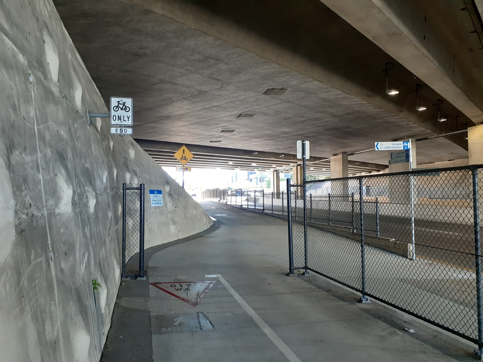
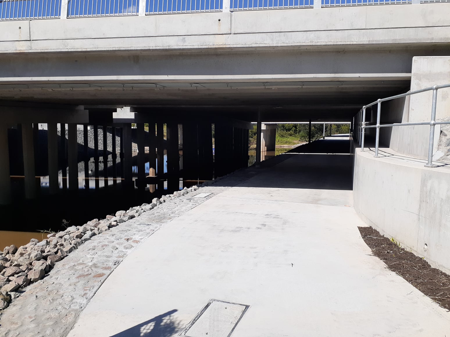
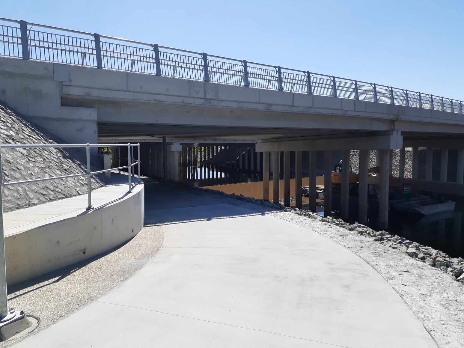
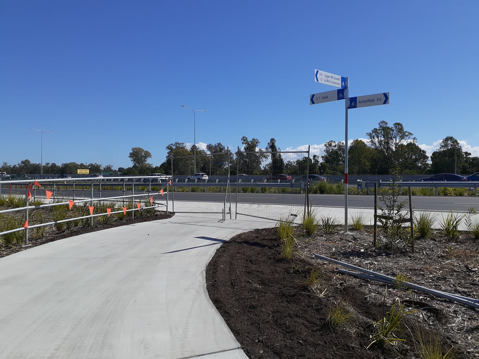
Ipswich Motorway Cycleway underpass at Oxley Creek
Also from social media, we saw reports that the Ipswich Motorway upgrade project (stage 1) is finally complete. Hopefully this means the underpass at Oxley Creek is finally open. It was looking very close last Saturday.


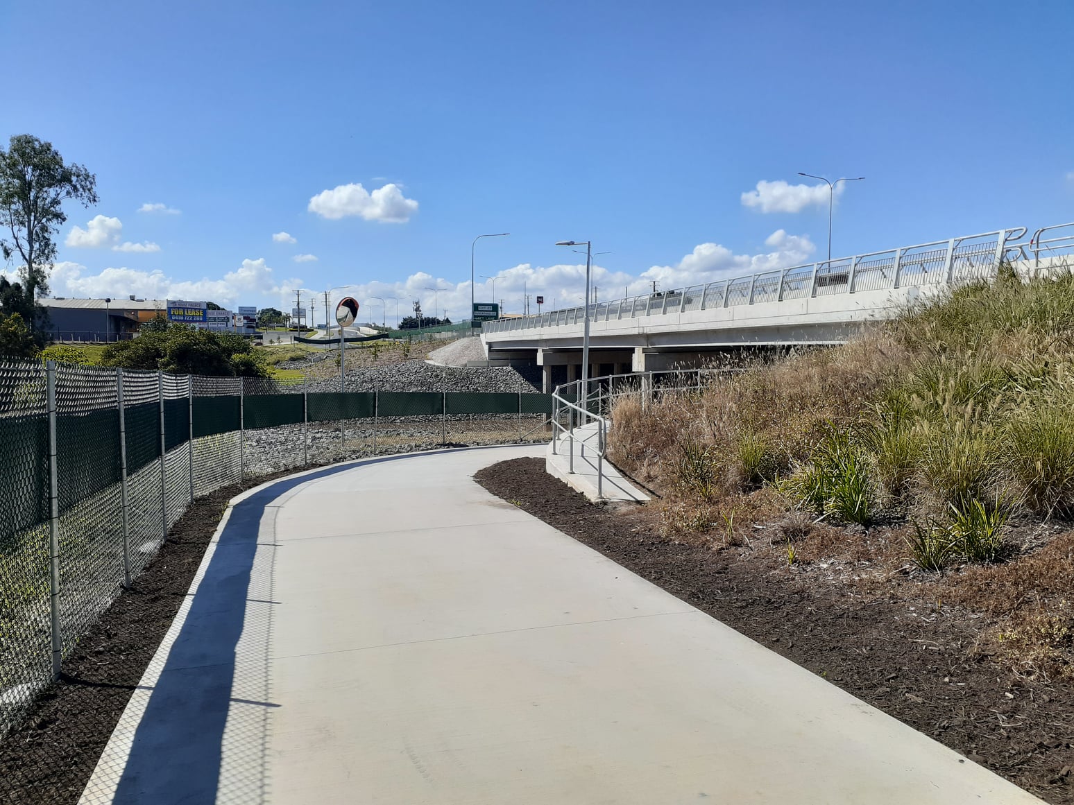
Remember that this connection wasn’t included in the original plan for the motorway upgrade, but with some determined lobbying, and support from Minister Mark Bailey MP, the project has achieved great outcomes for cycling – both north and south of the motorway.
Work on a path connecting along Granard Rd to Balham Rd, Rocklea is also well underway. But we are still feeling frustrated by the lack of connection at the other end to Bannerman St at Oxley.
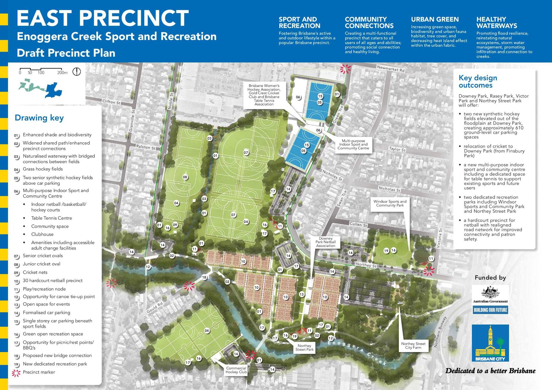
Enoggera Creek Sport and Recreation Precinct
Input to Brisbane City Council’s Enoggera Creek Sport and Recreation Precinct Plan closed this week. This was our input:
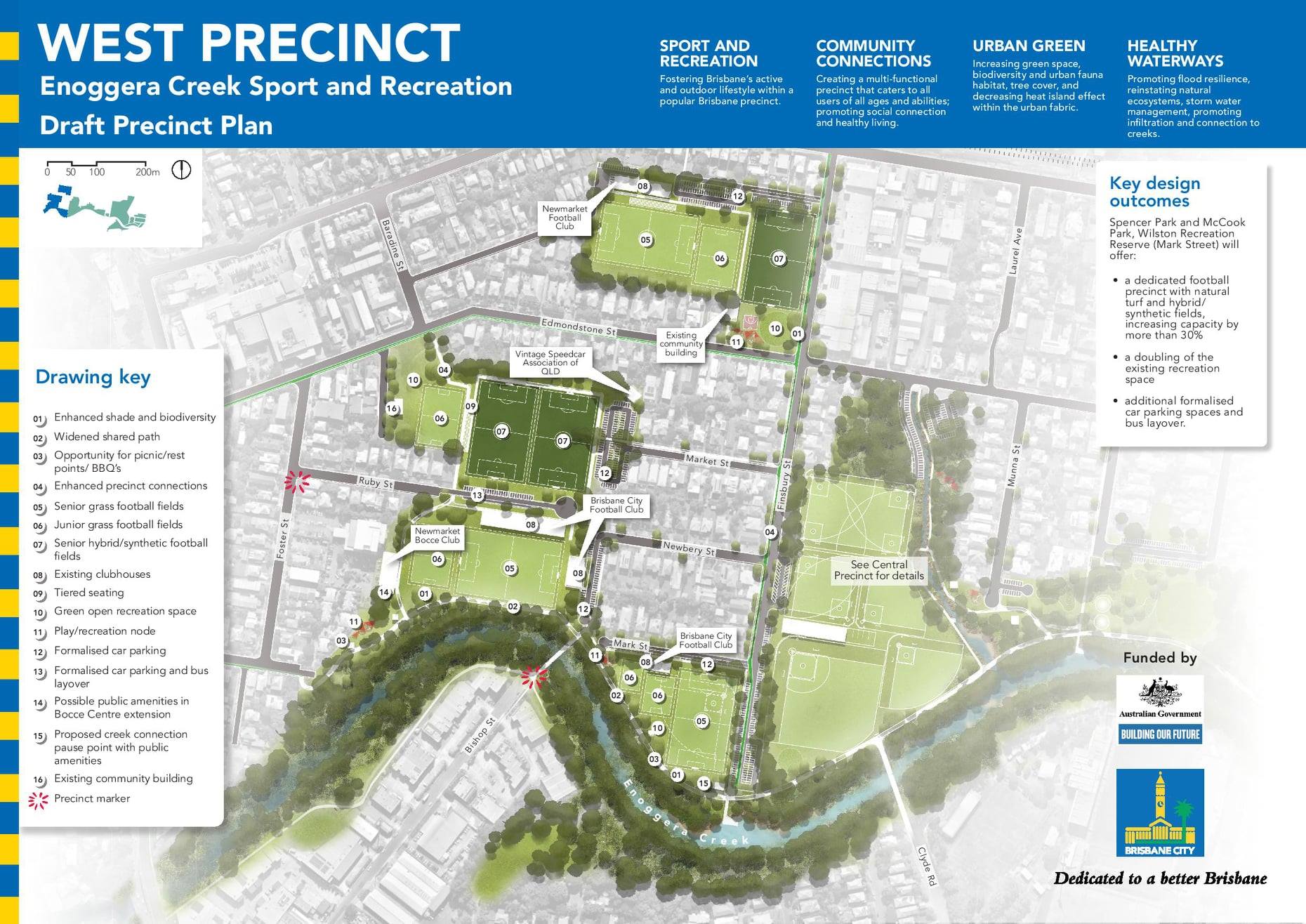

- This is the perfect opportunity to upgrade the popular Enoggera Creek Bikeway to separate cycle and pedestrian traffic – similar to the Kedron Brook Bikeway. This is especially important for the section west of Granville St, which serves as a major cycle-commuting link from the north-western suburbs, as well as a popular recreational path. Separation will make the area safer and more enjoyable for everyone.
- Don’t increase the area of park that will be paved over and dedicated to car parking; instead look to reduce the amount of carparking. Car parking is supply-driven; the more car parking is available, the more people are encouraged to drive as the most convenient option. The focus should be on providing people good alternatives to reach the park by cycling and walking – including walking from nearby public transport.
- Provide convenient bike parking at all facilities, under cover/shade where practical, and ensure this is suitable for locking a variety of bikes – such as cargo bikes, kids bikes, trailers, etc.
- [West Precinct] Improve the cycle connection from Edmondstone St at Baradine St through the park to the Enoggera Creek Bikeway so that it doesn’t zig-zag around the fields. This is supposed to be a major cycling route (according to Council’s own plans), and now is the ideal opportunity to smooth out this connection.
- [East Precinct] Support the new walking and cycling bridge across Enoggera Creek from the end of Gould Road; the more connections for walking and cycling, the easier it will be for people to choose healthy travel options.
- [East Precinct] Connect the eastern end of the Enoggera Creek Bikeway to the Bowen Bridge Road path. Currently the link at the corner of Victoria St and Edgar St is completely missing.
You might also like to suggest: - [Central Precinct] Provide a separated cycle facility along Noble St (rather than just painted markings). This is a major active transport connection through to Kedron Brook Road.
- [West/Central Precinct] As above, for Finsbury St, provide a separated cycleway to link at Newmarket Road with a future north-west cycleway, following (roughly) the rail corridor.
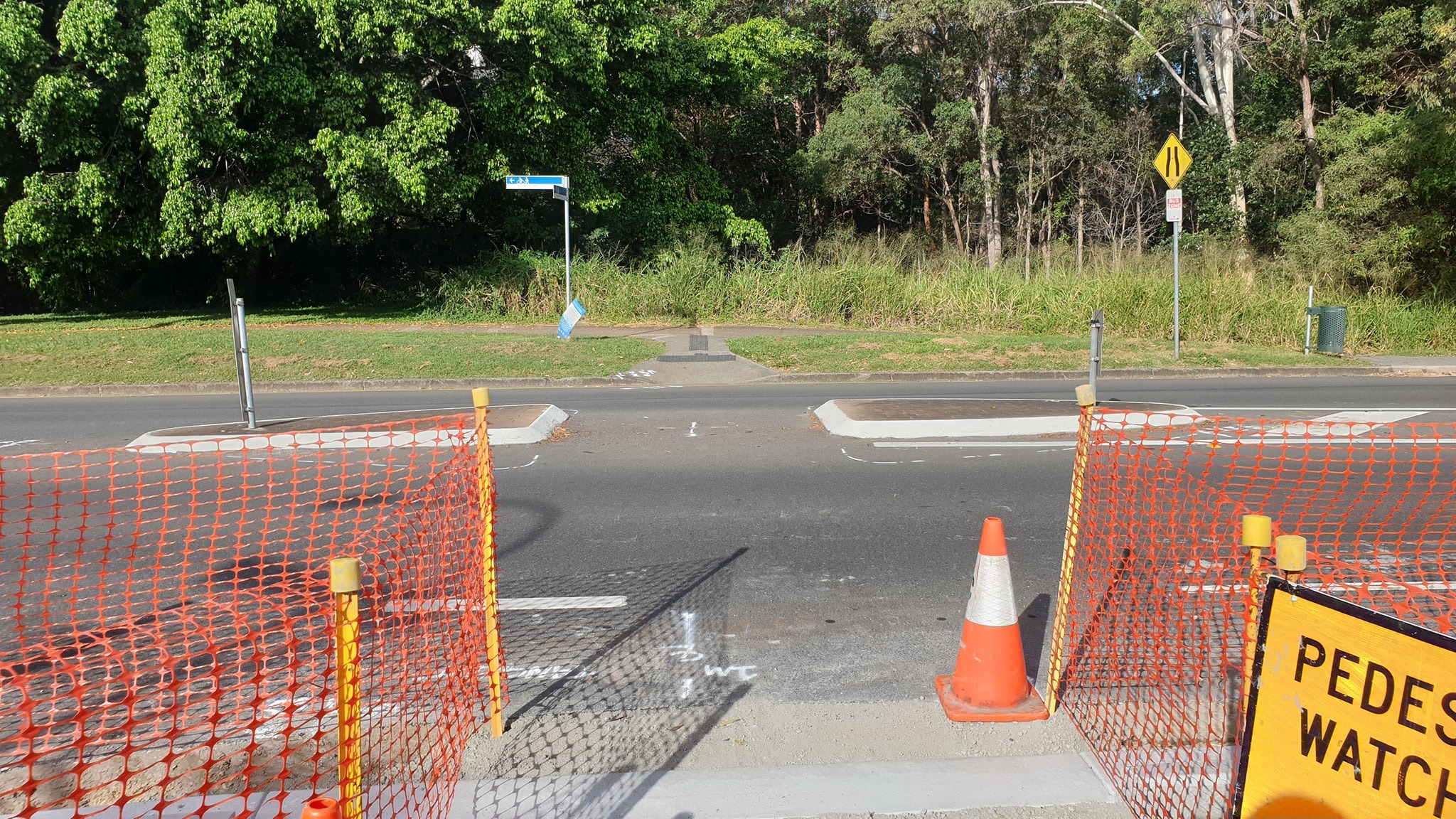
Hoping to cross the street in South Brisbane
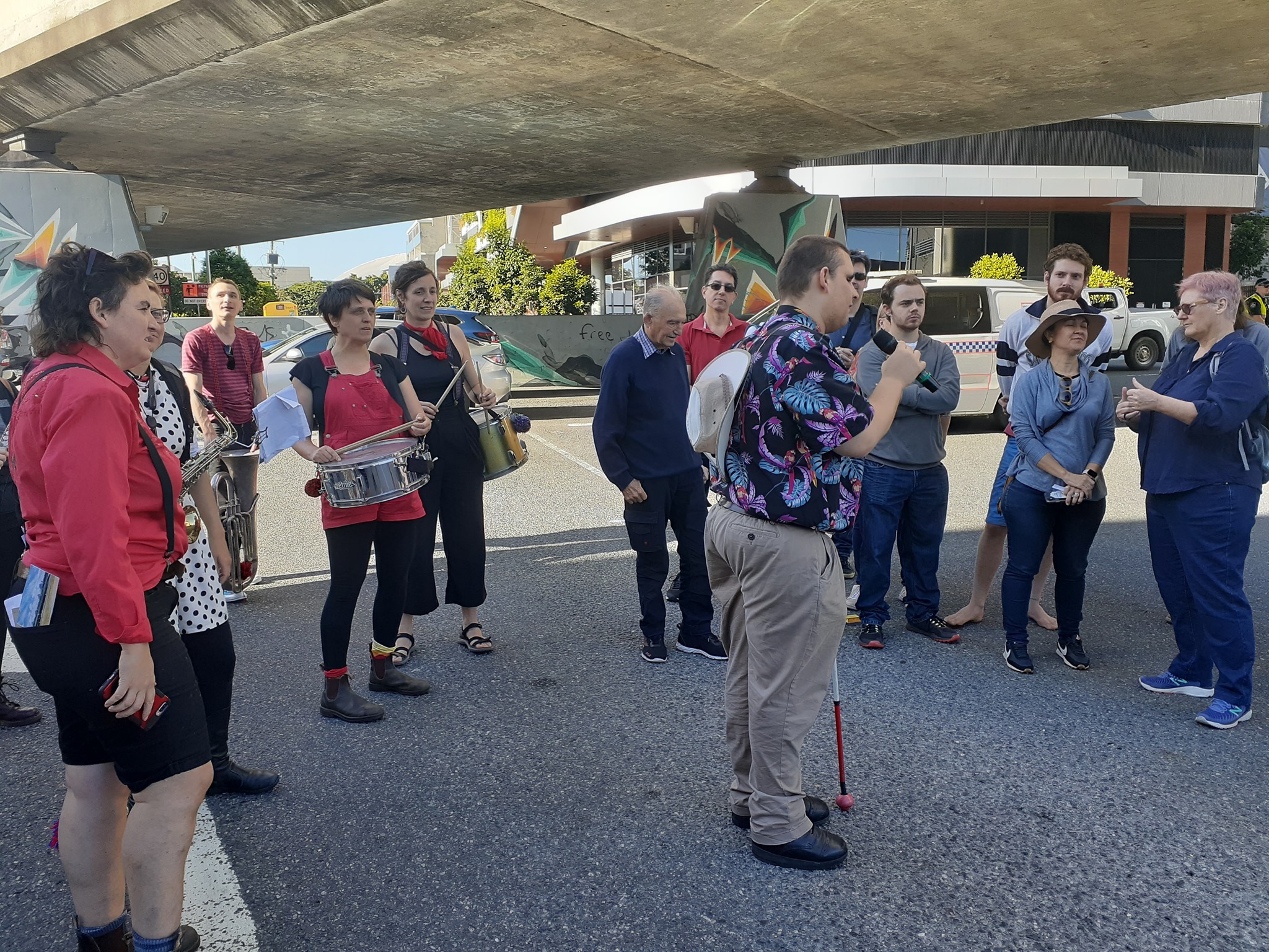
Brendon doesn’t particularly want to be an activist—he just wants to be able to cross the street to get to work, shops, and the community facilities in his neighbourhood. But on Wednesday morning he led a march onto the road which briefly blocked motor vehicle traffic on Hope St and Peel St in South Brisbane. Brendon has been asking for a pedestrian crossing on Hope St for over 2 years now.
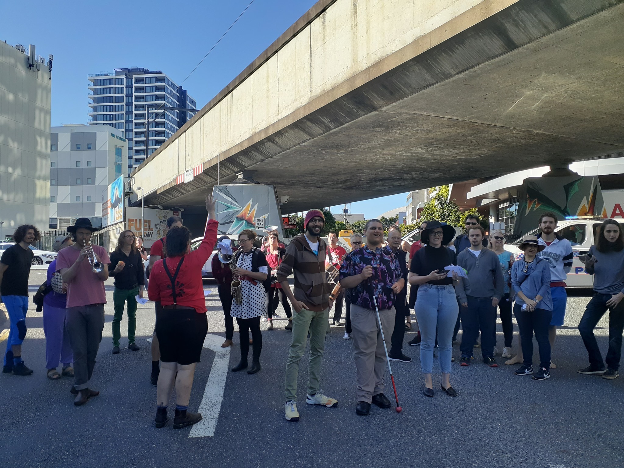

“Right now, I cannot cross my own street, Hope Street, to access West End. Hope Street is the missing link for me to access my neighbourhood. Motorists just do not give way to pedestrians.
I want to live independently, not constantly in fear about accessing my community. The inaccessible design of the neighbourhood makes it really hard for pedestrians with a disability to access the community.”
Brendon, Hope St resident
Apparently Brisbane City Council has responded, saying they can’t install a crossing on Hope St as there is a signalised intersection 180m away. They’re basically saying that a long detour in the opposite direction on narrow shabby footpaths to a poorly designed intersection is OK for Brendan and others like him with vision or mobility impairments because the most important consideration is to minimise delays for people who are driving—even in peak hour.
With that sort of thinking it’s not hard to see why levels of car-dependency in Brisbane are so high. We need a radical shift to achieve an inclusive, healthy, and sustainable city.
Thanks to Jonathan Sri, Councillor for The Gabba, Amy MacMahon MP for South Brisbane, and the awesome Riff Raff Radical Marching Band for supporting Brendon’s action. It should not take this sort of community action to get attention!
(Brendon also discovered that the form for notifying police of a community action was totally inaccessible for anyone with a limited vision, so he may have achieved another step by getting changes to that process.)
People-friendly suburban centres
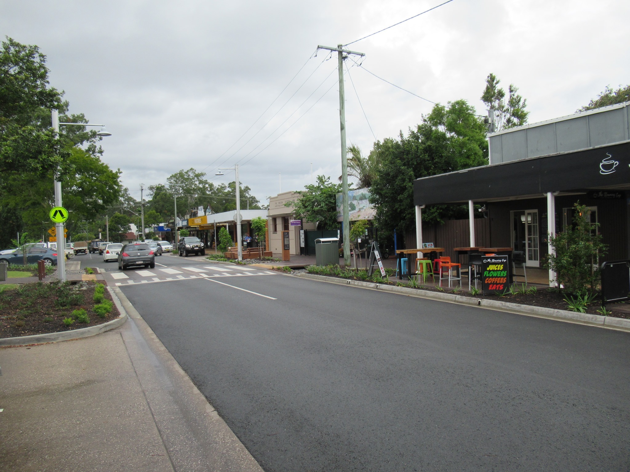
On our recent travels we noticed that Cribb St, in the Sunshine Coast town of Landsborough has recently had a facelift. It’s amazing how much more inviting it feels now after the street has been narrowed, the traffic calmed, and car parking removed from directly in front of the shops. Now the local businesses are visible and much more inviting, with room for outdoor dining or to catch up for a chat. We really like the wombat crossings (raised pedestrian crossings) – particularly on the side street, so that pedestrians have obvious right of way and a level pavement. One objection we’ve heard in Brisbane is that buses can’t handle speed platforms – but that doesn’t appear to be a problem in Landsborough.


We can think of a few local suburban “high streets” around Brisbane that could benefit from this sort of treatment. Where would you nominate?
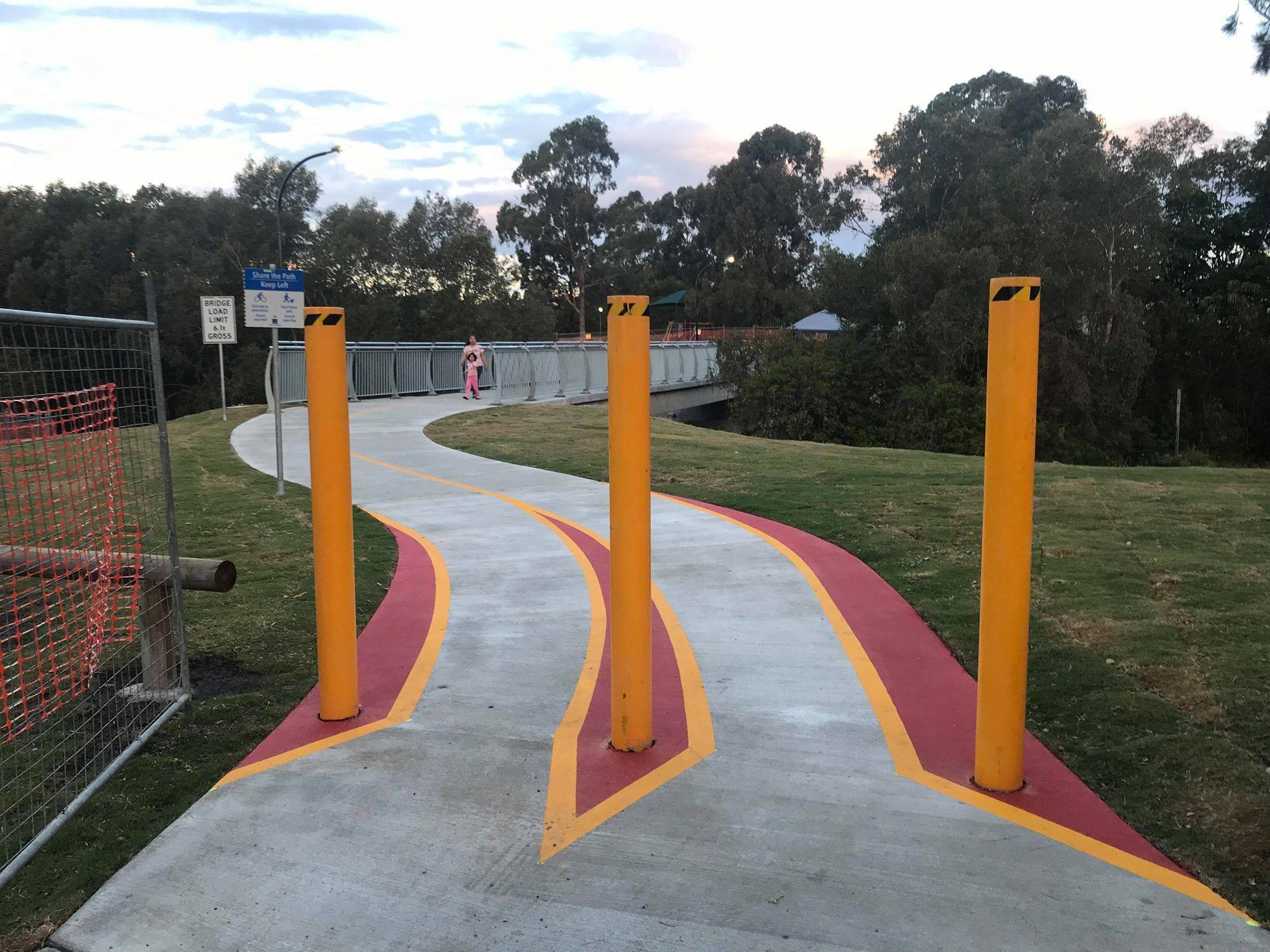
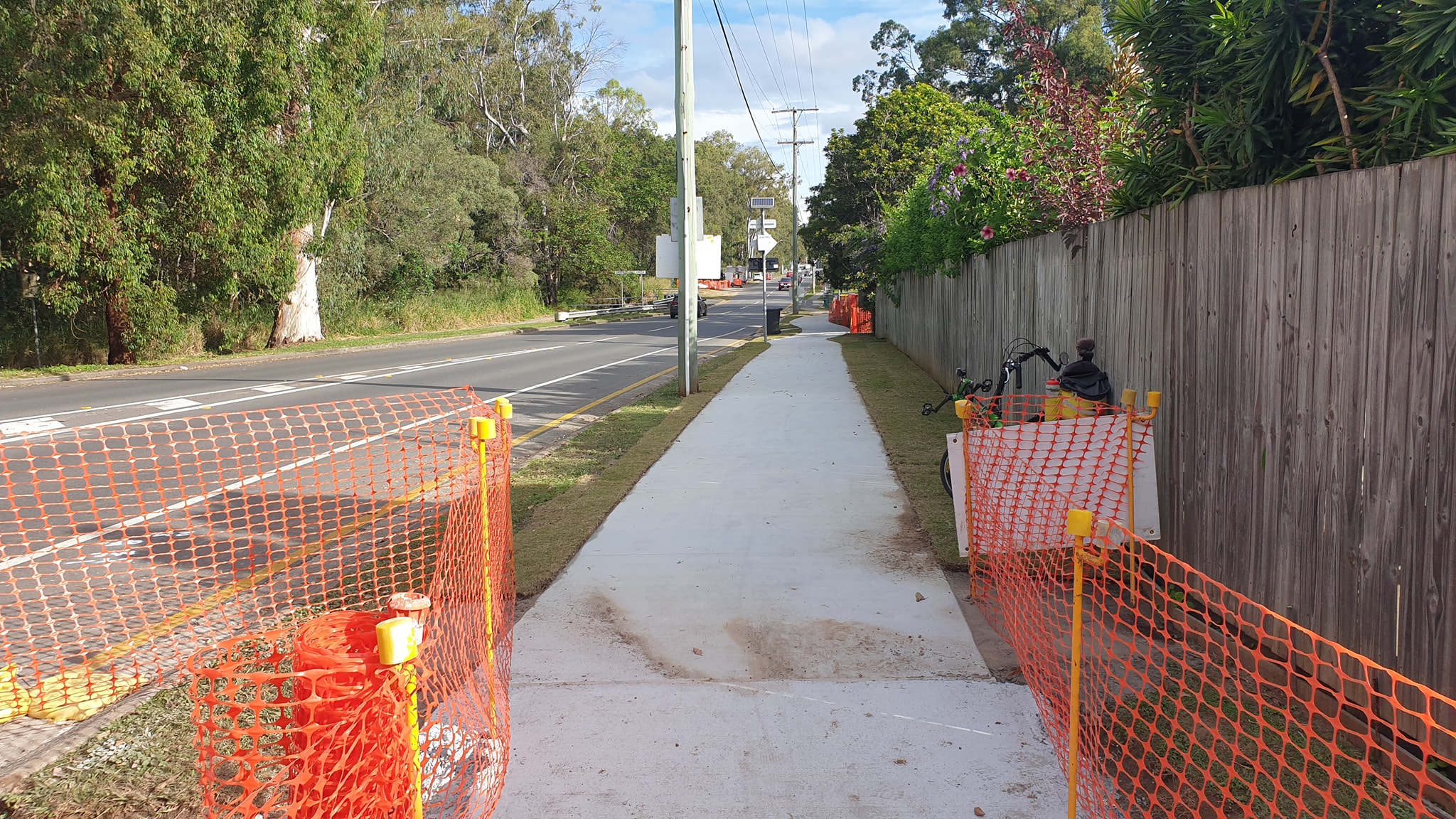
Width of shared paths
Belinda from East BUG Inc. recently caught up with Ross Vasta MP about a number of Brisbane City Council active transport projects in the Bonner electorate being funded with support from the Australian Government. These include an extension to the Minnippi Bikeway behind the shopping centre at Cannon Hill, and the Wakerley Bikeway along Rickertt Road.
Belinda raised concern that the Wakerley Bikeway is only proposed to be 2.5m wide, which is the minimum specified for a shared path under the Austroads standards and not really suitable for principal cycle route like Rickertt Road.

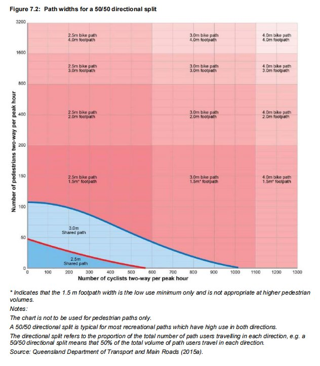
Having spend time living in The Netherlands, Ross understands the value of comfortable cycle paths that allow for social cycling side by side. The moving envelope for a person on a bike is 1m, so a 3m path allows two people cycling (or walking) side by side to comfortably pass a person travelling in the opposite direction. 2.5m is functionally not much different to 2.0m in that it requires everyone to regularly shuffle to single file. (Of course the gold standard for higher-use paths is to provide separated space for people walking and for people cycling.)
In other parts of Brisbane we’ve seen projects to widen older paths to 3.0m – such as the Enoggera Creek Bikeway near St Johns Wood Scouts which was widened to 3.0m last year and the SE Freeway Bikeway at Annerley. Our message: building to a high standard initially will create a much more inviting active travel option immediately and save money in the longer term.

Since the Australian Government are funding the path construction underway at Rickertt Road, Wakerley (which is on a principal cycle route), that really should be 3.0m rather than 2.5. Hopefully Ross can help convince council officers who have claimed that 2.5m is “plenty” rather than sub-standard as we’ve tried to highlight.
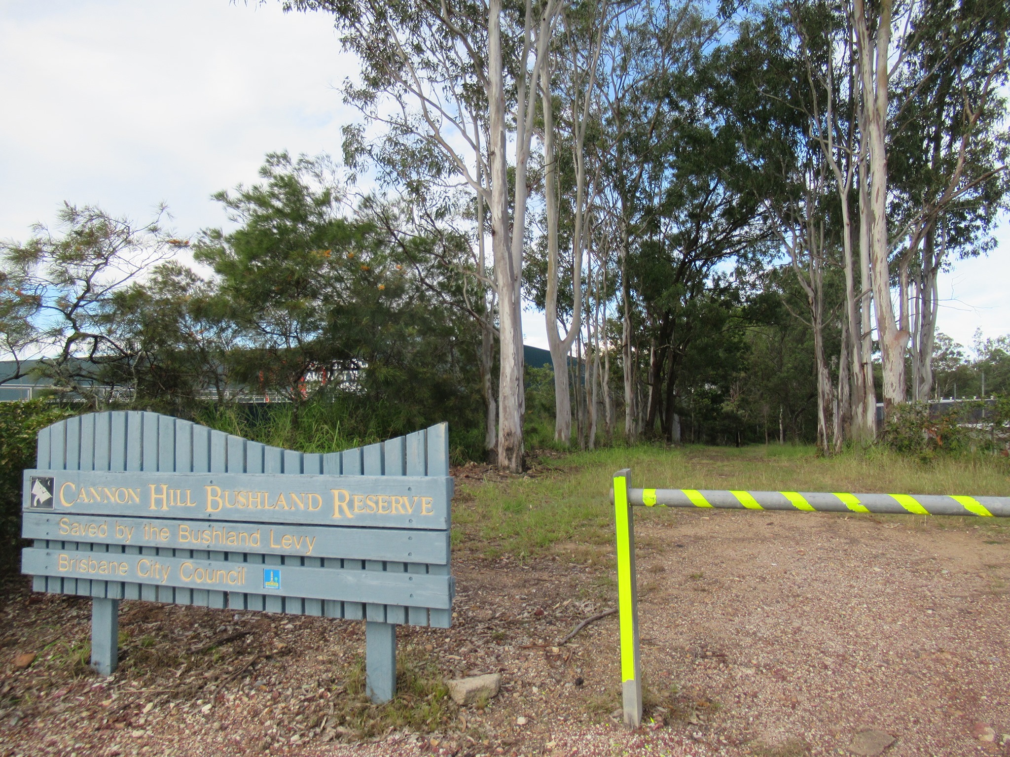
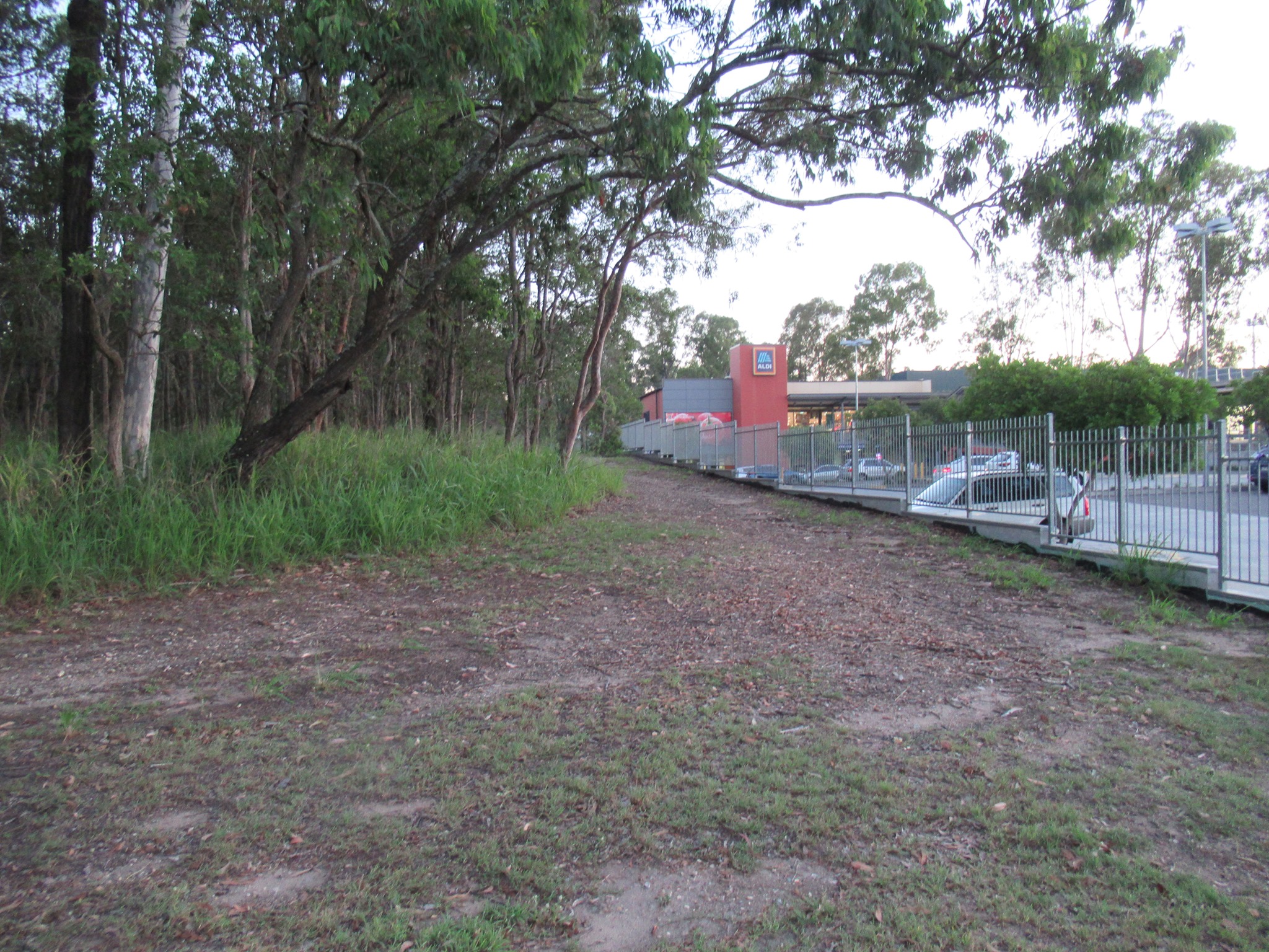
Minnippi Bikeway at Cannon Hill
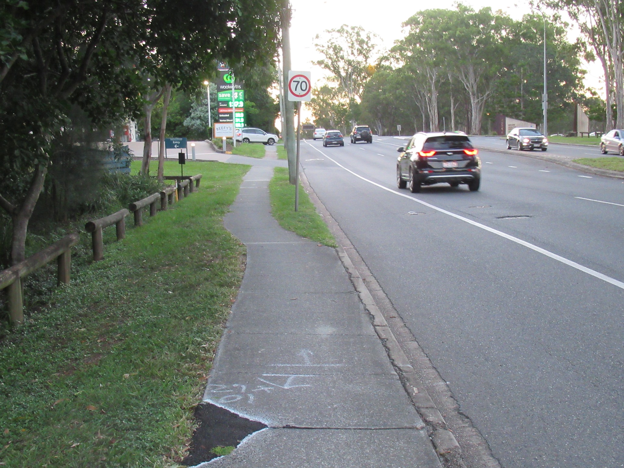
Belinda also spoke with Ross Vasta MP and Cr Lisa Atwood about the planned extension to the Minnippi Bikeway, which will connect from Creek Rd, behind the Cannon Hill Shops (along the fire track), to Wynnum Rd and the Bulimba Creek Bikeway at Bulimba Creek. This will be a 3m wide path behind the shops, but narrower along the Wynnum Rd frontage. (Still a vast improvement on the current extremely narrow footpath). Council are investigating connections into the shopping centre (including to Bunnings and Aldi), but there are some level differences to contend with.

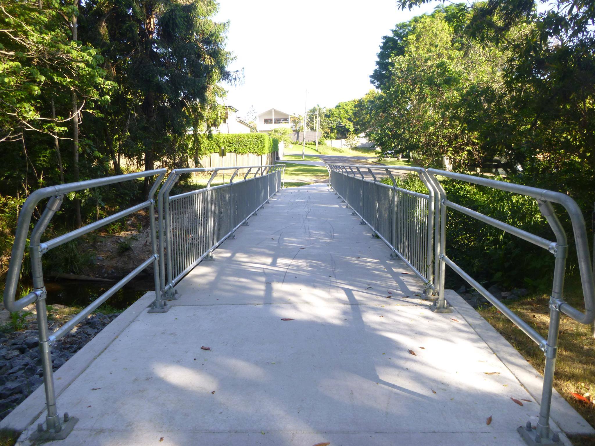
Belinda pointed out that the pedestrian/cycle bridge over Bulimba Creek at Wynnum Rd is narrow, and in quite poor condition. In recent years Council has replaced and upgraded dozens of bridges like this on the north side of the river, and it would be good for this one to receive some attention.
It was great to hear from Cr Atwood that there are plans afoot to connect the bikeway behind the Minnippi residential development from Windrush St to Boorabin Dr and Bilan St, Carina.
Bridging Perrin Creek at Morningside
In recent years, Brisbane City Council has had a building blitz with pedestrian and cycling bridges on the north side of the river, but seems to have ignored the southside. One connection that would be incredibly valuable in Morningside is a link across Perrin Creek, connecting Algoori St from Beverley St to Junction Rd. It would improve local active travel routes – including for students at Balmoral State High School and Cannon Hill Anglican College, and to help people access shops, child care, parks, public transport, and other community services.
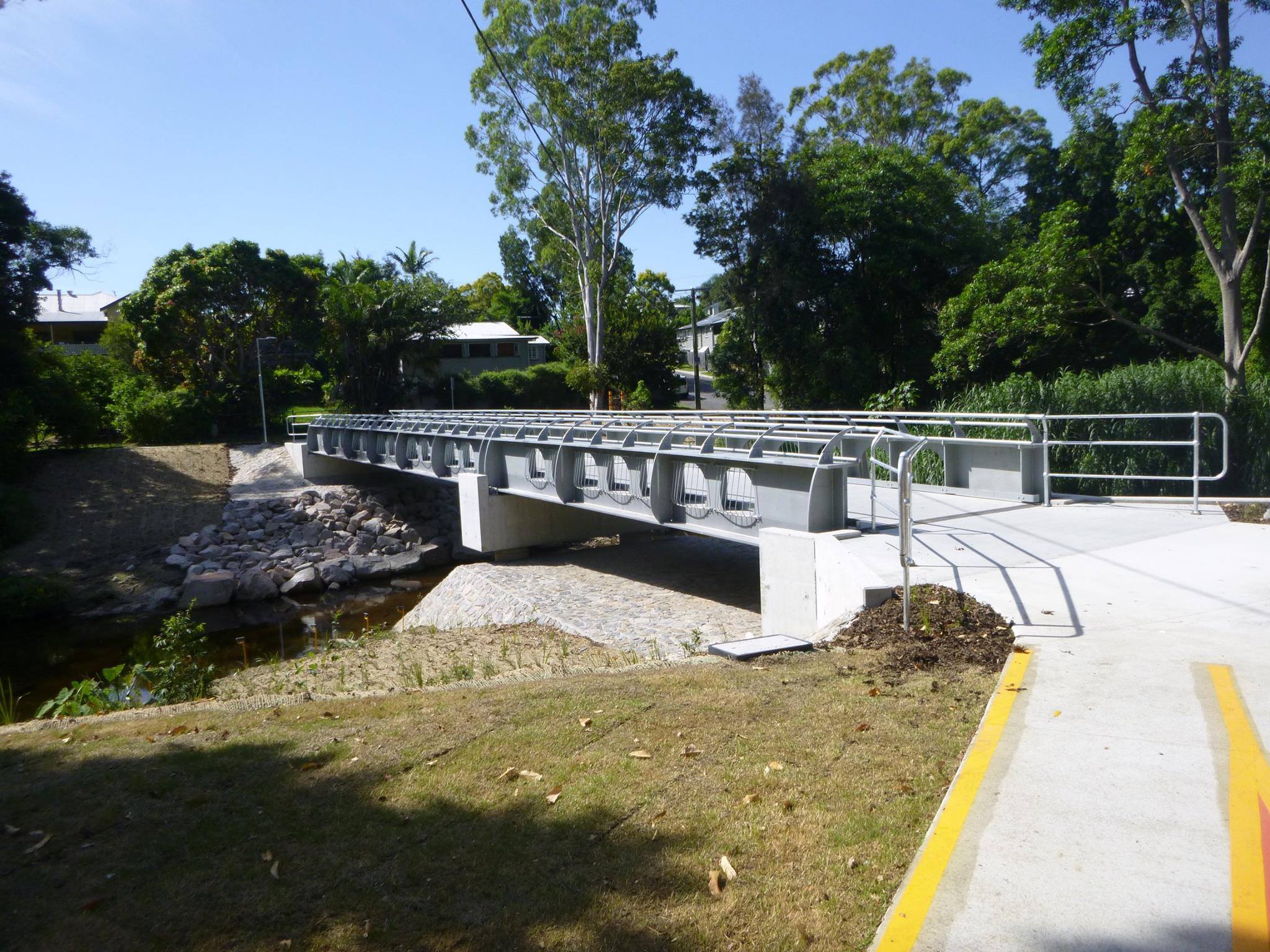
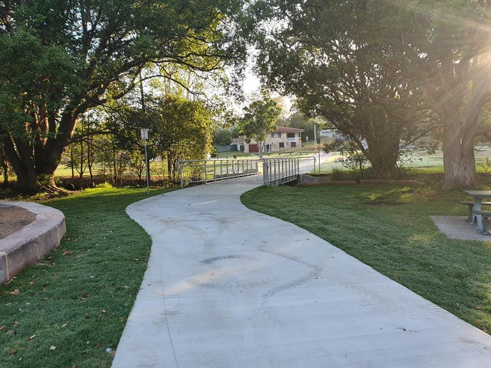


Cr Kara Cook recently led a petition to get this missing link on Council’s budget. We’re a little concerned that the mention is only for a culvert crossing given how flood-prone the land is around the tennis centre, but we’ve signed anyway, and look forward to seeing more detail soon.


In the west: Mt Crosby
Did you know that SEQ Water is building a new two-lane road bridge across the Brisbane River at Mt Crosby Weir? That’s not terribly exciting to us in itself, but the good news is that the existing heritage bridge, which was built in 1927, will be converted to a pedestrian and cycle bridge. Engineering assessment of the old bridge is starting next week. You can find out more about the project here.

Thanks for the heads up Cr Greg Adermann.
Carseldine Urban Village
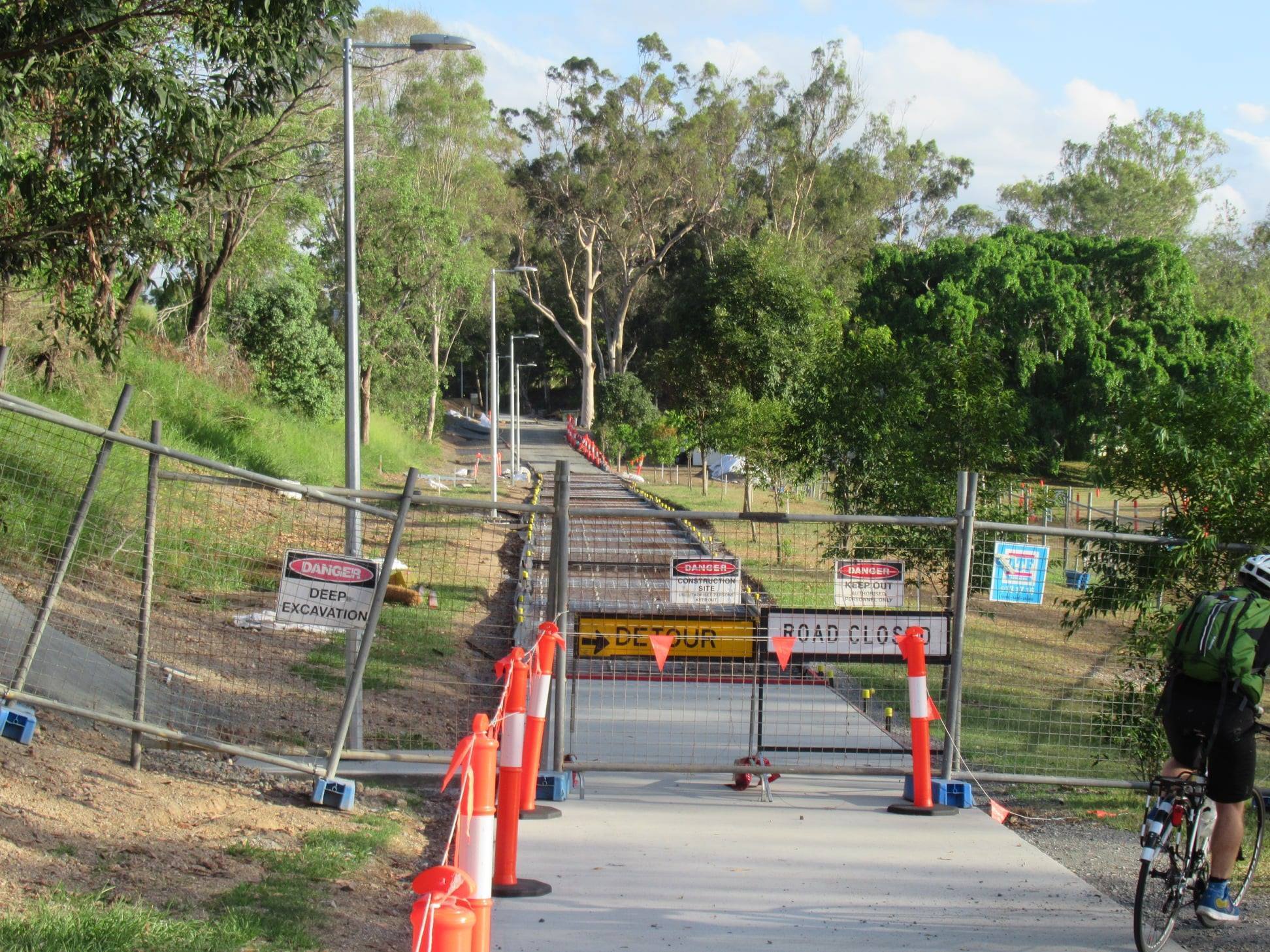
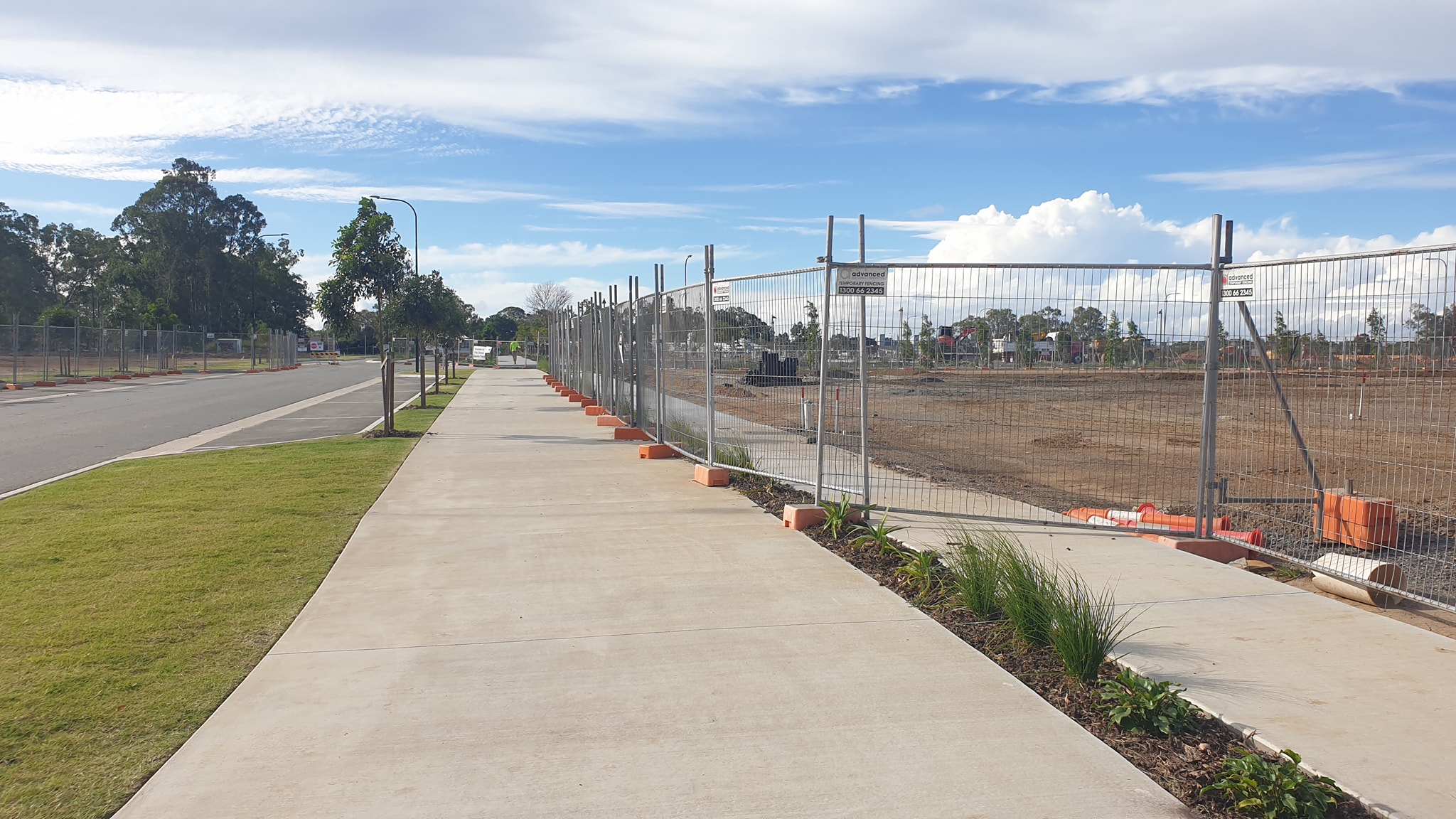
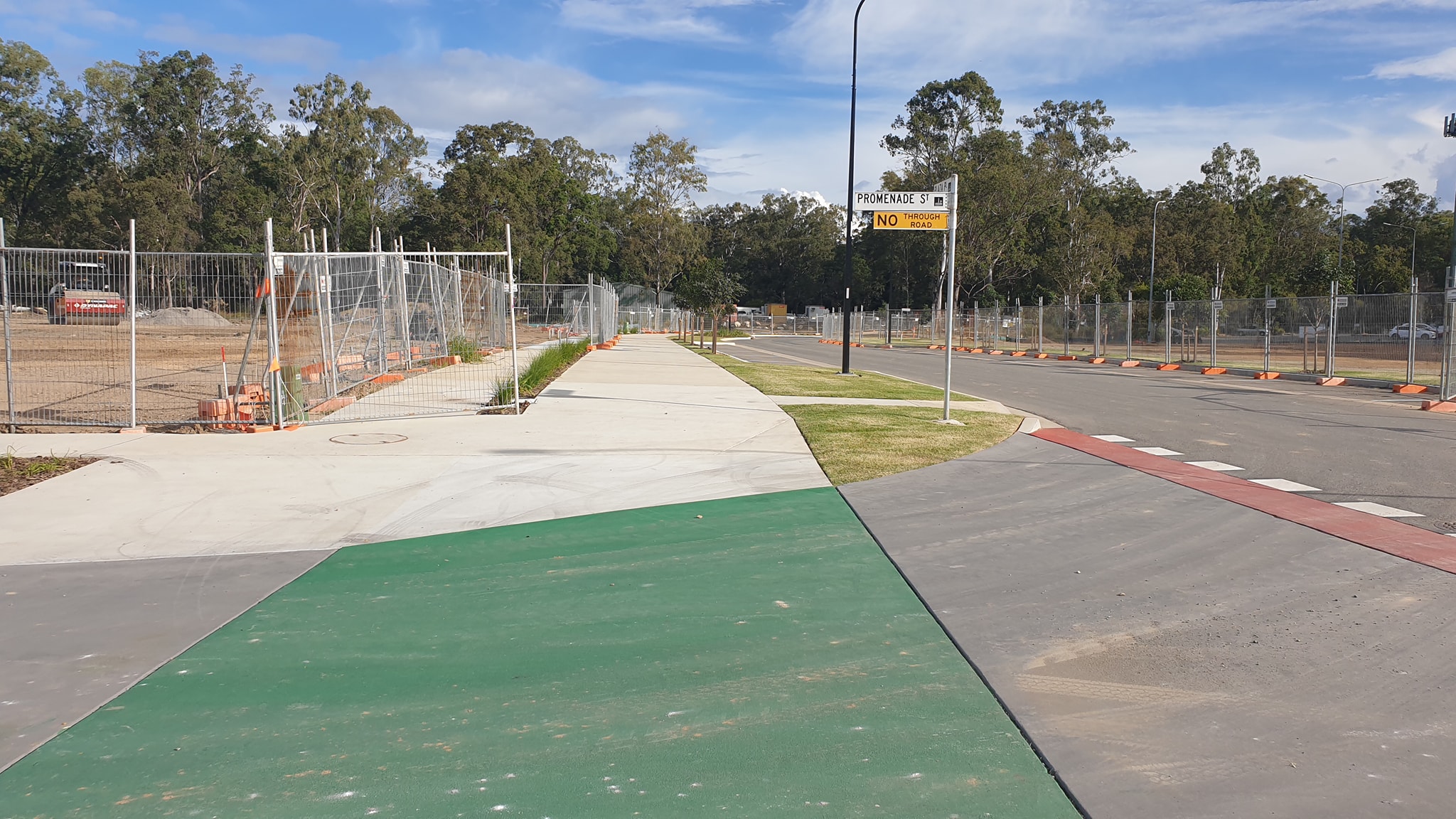
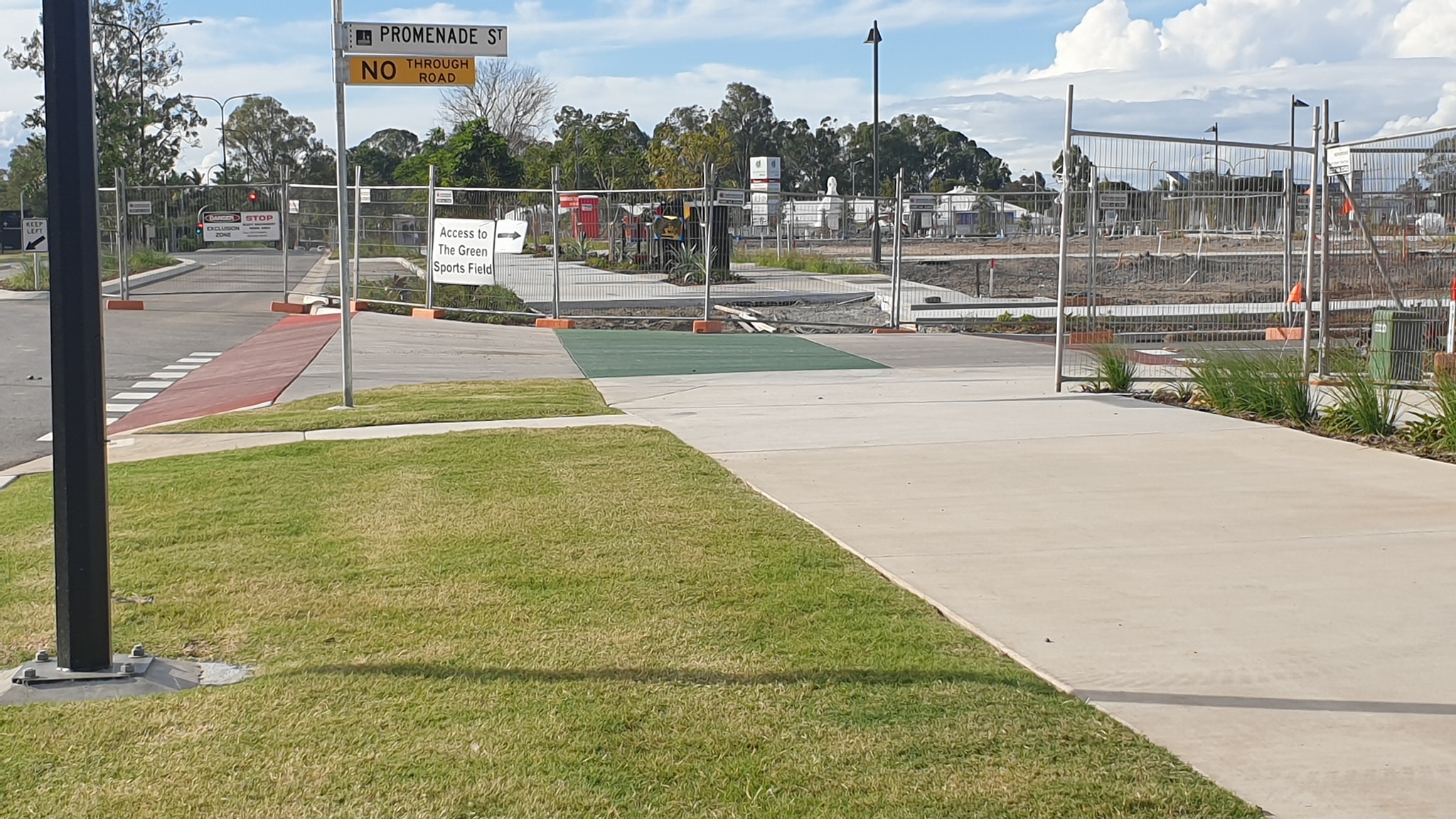
Over to the north side now, and North BUG report that there’s good progress being made at the Carseldine Urban Village, main access road. The road, bikeway and footpaths almost complete. Workers say they are aiming for a May 6th opening! The bikeway is on the eastern side of the road, so crossing Beams Rd to continue eastbound only requires one light crossing.


Also access from the western side has improved with a new wider path at the end of the Cabbage Tree Bikeway at Dorville Rd. Road crossings are also being upgraded with a wider island at the crossing to the path on the eastern side of Dorville Rd.
CBD bike lane barrier trip-up
We’re sorry to hear about the injuries barrister Mr Nolan sustained when he tripped while walking/running across George St recently. We suggest that the real problem is how long pedestrians are held up at the signalised crossings, with many getting fed up waiting by an empty road and crossing mid-block – as seems to be the case here. (Crossing within 20m of a signalised crossing is illegal, so it’s unlikely a barrister would be doing so.)
We don’t support pedestrian fencing that prevents people crossing at the most convenient location. However we do think that the upright wands on the Elizabeth St cycleway help make it more visible to pedestrians (who are focused on the danger of approaching motor vehicle traffic) than just the low yellow curb which is all that remains on George St.
The George St bike lane (for just one block between Turbot St and Herschel St) was installed in 2009, and is now quite faded and depleted. It would be good to see more attractive and permanent barriers demarking and protecting Brisbane’s CBD cycleways – perhaps like the planter boxes many other cities have used.
Inspiration: Sydney
Looking good Sydney!
- Shady trees

- Protected cycleway
- Wide, uncluttered footpaths
- Car-share spaces
- Slow-speed traffic environment
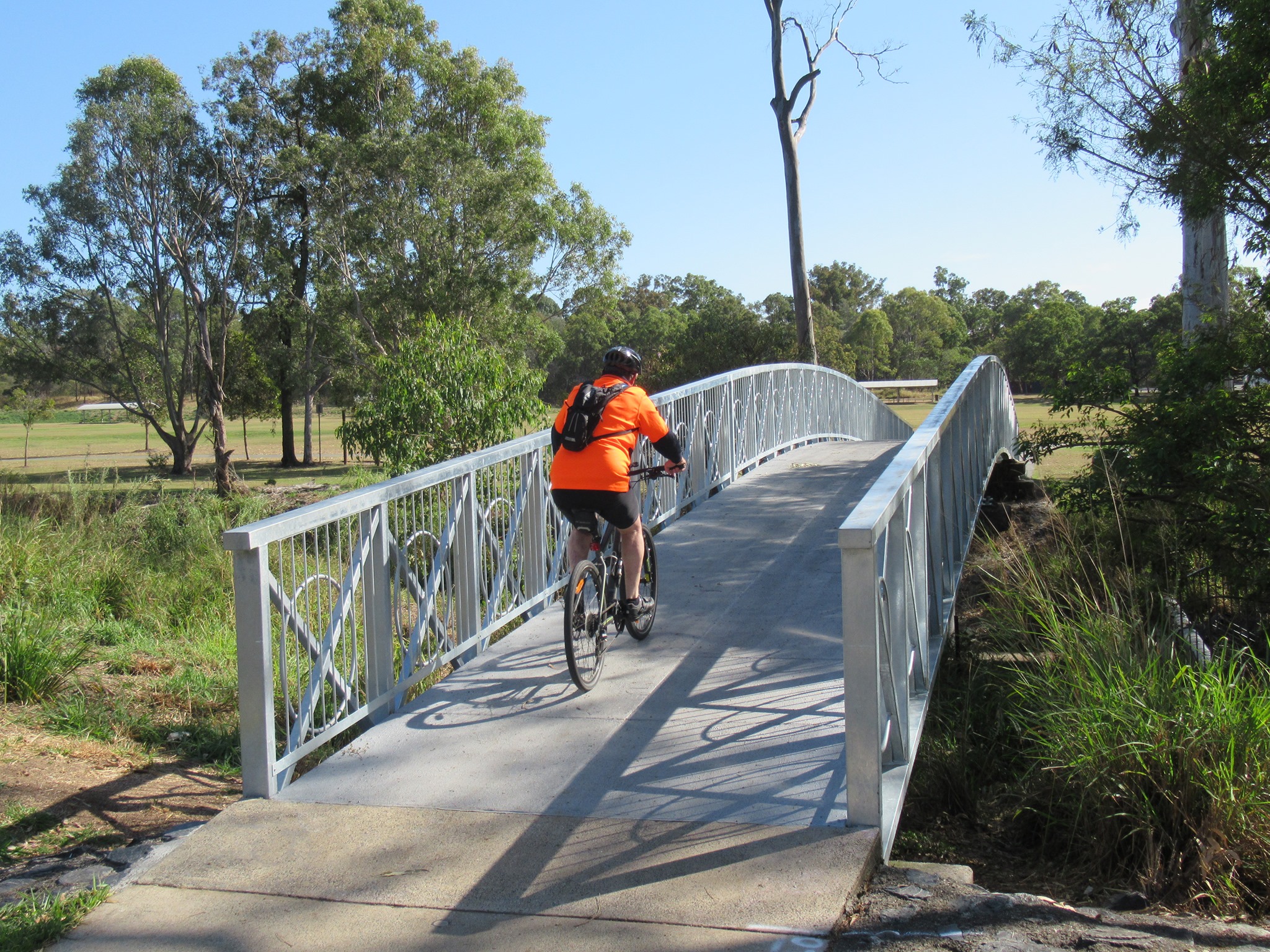
Uncovering ants and a secret bikeway
One of the advantages of getting around by bike is you see things you’d otherwise miss in a car. Like fire ant nests.
Red Imported Fire Ants arrived in Brisbane in 2001, and have steadily spread. Biosecurity Queensland is spearheading the fight to eradicate them, and Chris from Brisbane West BUG has become a bit of an expert at spotting them from the saddle. He gives you some tips on what to look for, and how to report (hint: take photos of the ants and send them in via https://ants.daf.qld.gov.au)
Is this one of the oldest segregated bikeways in Brisbane? The Windermere Bikeway in Sinnamon Park, between Burdekin Drive and Furness Crescent, was built sometime before December 2007. It’s unique compared to most of our shared path bikeways in that, while it’s still basically a shared path, it has a marked cycle path on it, with pedestrians intended to use the section next to it, and there are sections where the pedestrian and bike paths are separated by garden beds.
