- North Brisbane Bikeway
- Stones Corner underpass
- Path termination treatments
- Centenary Bikeway lighting improvements
- Green Bridges
- Granard Rd, Rocklea
- Healthy Messaging
North Brisbane Bikeway
Thanks to Brisbane North BUG for setting out the reasons why the best route for the bikeway from Wooloowin to Clayfield is via Eagle Junction (EJ). The dotted line on the map below is the missing 1,400 metres of what will be a 40 kilometre bike route from the centre of the city out to Redcliffe.

Here are some of the reasons why the best route for the bikeway from Wooloowin to Clayfield is via Eagle Junction (EJ):
- Two-thirds of people cycling along Dickson Street are headed to or from Toombul and points beyond. This is because of the high-quality paths that have already been built, including the Jim Soorley Bikeway, the Gateway North Bikeway, and connections to the airport.
- The All the Way to EJ link will be safe, convenient, and easier to build than less direct alternatives. Most of the infrastructure will be a short section of separated bikeway along busy Dickson Street, and a crossing at Junction Road. The rest of the route will use quiet streets that are already safe.
- The bikeway will provide safe connections to the shops, restaurants and services at Eagle Junction for people in nearby suburbs including Wooloowin, Albion and Lutwyche.
- The bikeway will open up a convenient active transport connection to the city for people in the densely populated areas around Toombul and Nundah, where more unit blocks are being built all the time.
- The alternatives promoted by local politicians will be significant detours. Getting from Eagle Junction to Bridge Street via Lutwyche is 4.2 kilometres further than a direct route via Dickson Street. Toombul to Bridge Street is 2.8 kilometres further via Lutwyche.
- Safe, connected, direct bikeways get more people cycling, benefiting their health, cutting traffic congestion, and helping the environment.
Join us on the Safe streets family ride – All the Way to EJ on Sunday 13 February to check it out for yourself. Help us demonstrate that people on bicycles are not something any street needs “saving” from.
Stones Corner underpass
We’re not the only ones excited to see progress on the Norman Creek Bikeway underpass at Stones Corner! Check out this video from Stones Corner Road Safety group:
The timing is a little depressing: if you want your kids to be able to cycle safely to school it seems you need to start campaigning for safe infrastructure at least 5 years before they are born. Thanks to everyone who gets involved in campaigns for better infrastructure and conditions for walking and cycling across the city. Every step makes the next one a little easier.

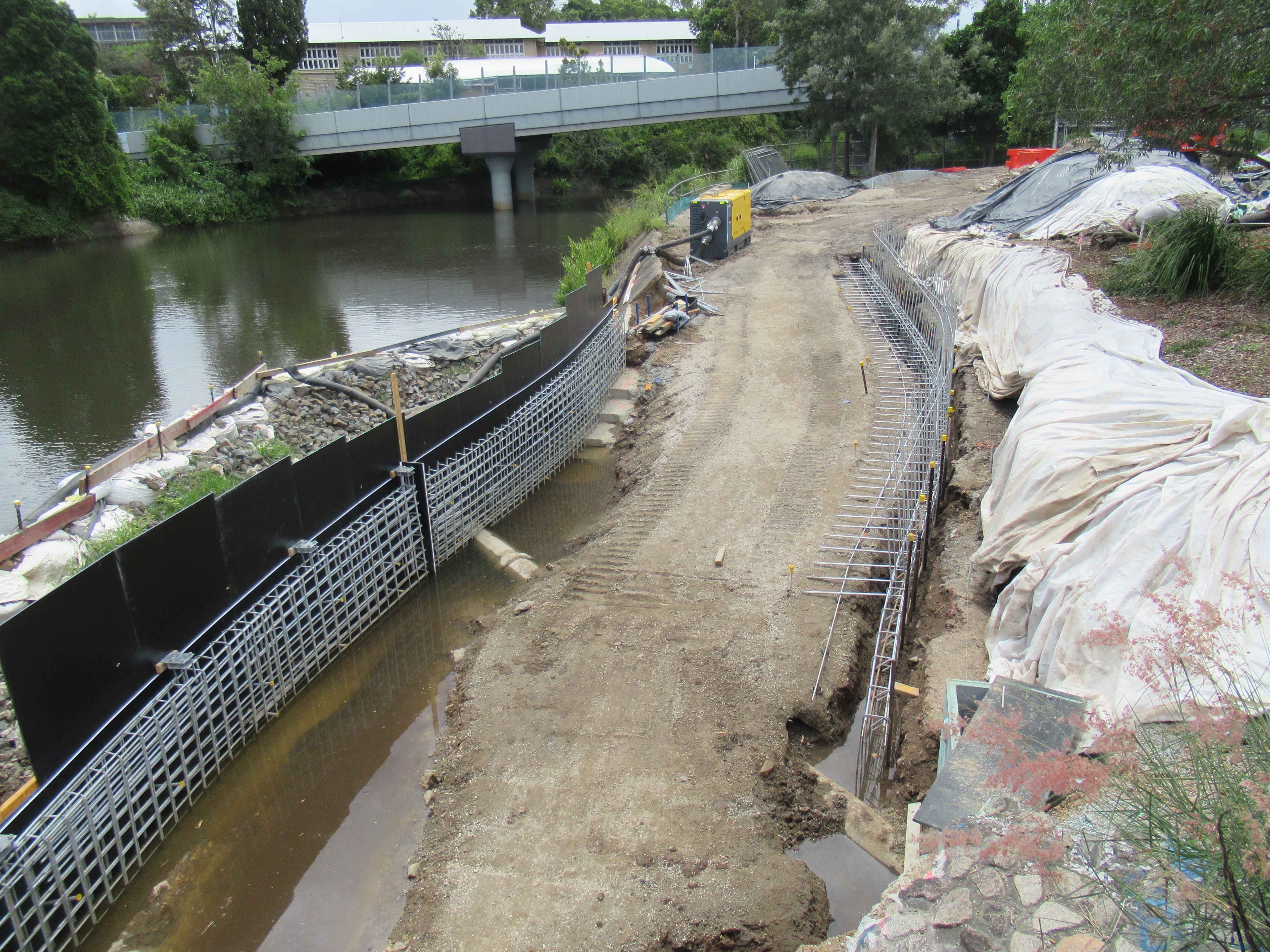
Obviously there are challenges with building in a flood zone, but it has been great to see how well the realigned creek and park has handled some significant rain events during construction.
Let’s hope the kids will be riding safely to school in Term 1.
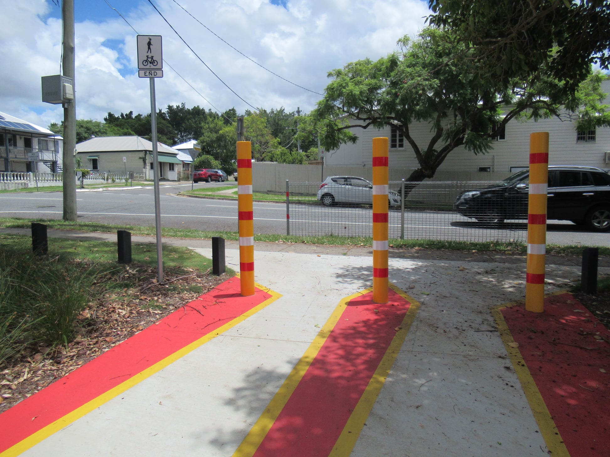
Path termination treatments
Nearby, this is a not-so-great piece of infrastructure at Stones Corner: the main connection between the Norman Creek Bikeway and the V1 Veloway (plus the PA Hospital Bikeway towards Dutton Park and the Eleanor Schonell Bridge) is via Fern St. But Brisbane City Council have designed the path from Hanlon Park in a way which will make crossing Junction St really awkward. We understand that they want to prevent people cycling straight out onto Junction St without checking for traffic (and as usual, motor vehicle traffic is prioritised), but we don’t think forcing people through an awkward dog-leg is a good solution.
There’s a similar treatment at the pathway near Myrtle St.
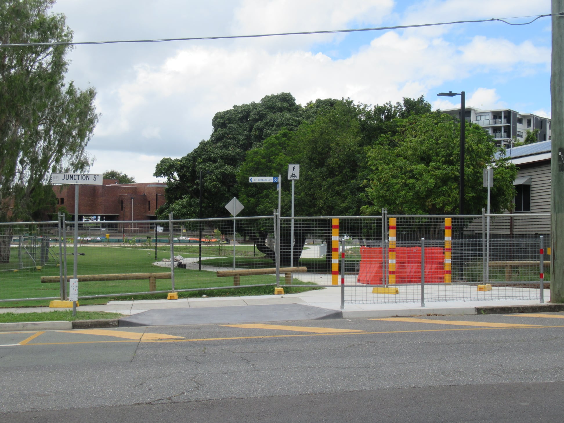
Is it really the best termination treatment for people riding bikes (including trikes, cargo-bikes, and trailers) to force them into a right-angled turn onto a narrow footpath?? You would not see this design in a true cycling city.
Centenary Bikeway lighting improvements
As the days get shorter and the Centenary Bikeway gets darker, light is at the end of the tunnel. Department of Transport and Main Roads is starting work on adding more lighting between the Fig Tree Pocket Road crossing and Musgrave Street. This section of bikeway gets very dark, so additional lighting will be very welcome, particularly for evening commutes.


Be aware of workers over the next couple of months and look out for traffic control.
Green Bridges
Toowong to West End Green Bridge consultation: Unfortunately the information session planned for Saturday was been cancelled (presumably due to COVID), but there is another coming up next Saturday (12 February 2022) at the West End Markets in Davies Park, West End from 6am-2pm. Get along and support this project if you can.

Granard Rd, Rocklea
The finishing touches took a while due to availability of materials, but it’s good to see the Granard Rd cycle connection between Ipswich Rd and Balham Rd, Rocklea is now complete. (The directional signage to Oxley and Darra is out by 90 degrees though.)
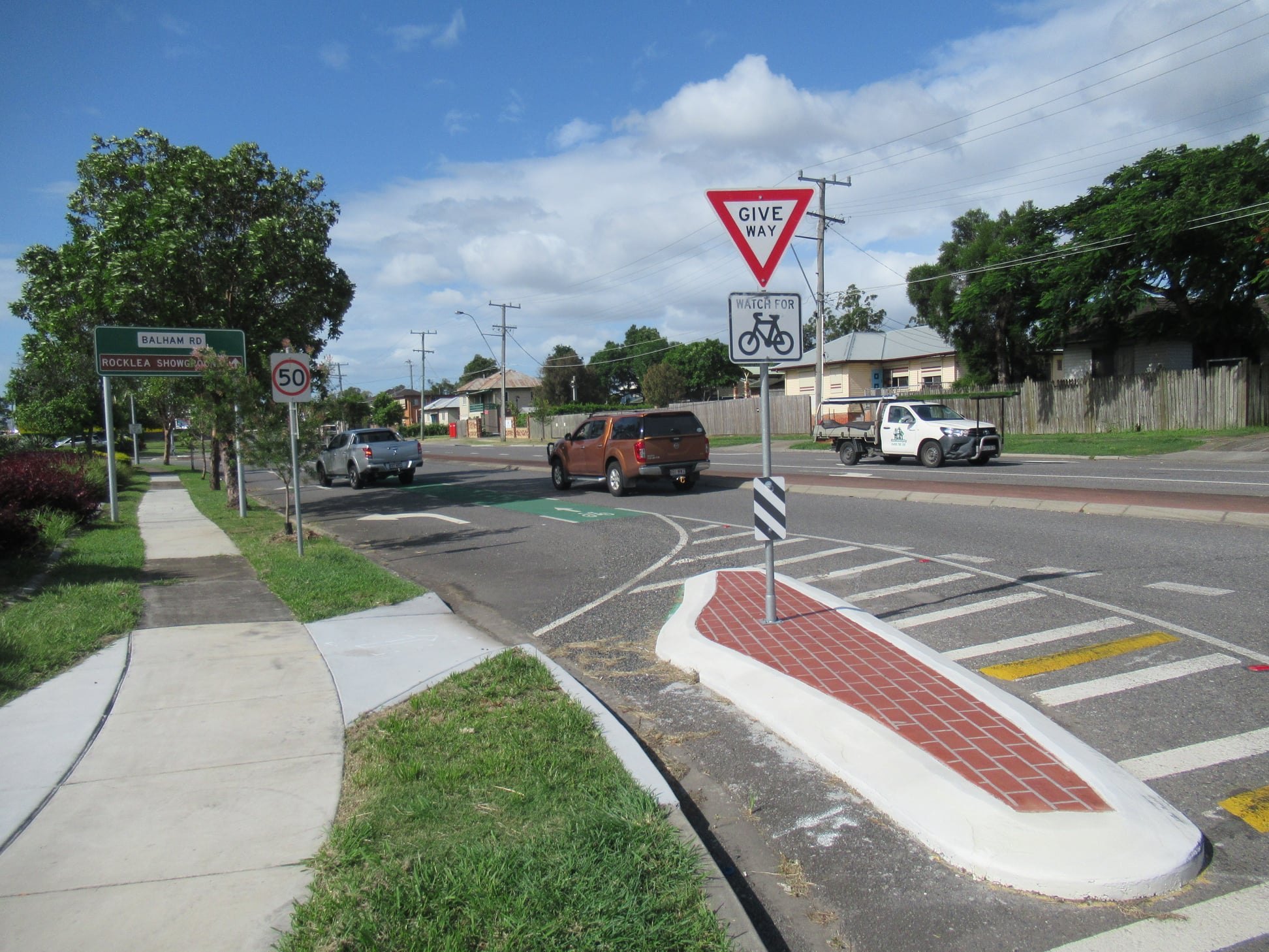
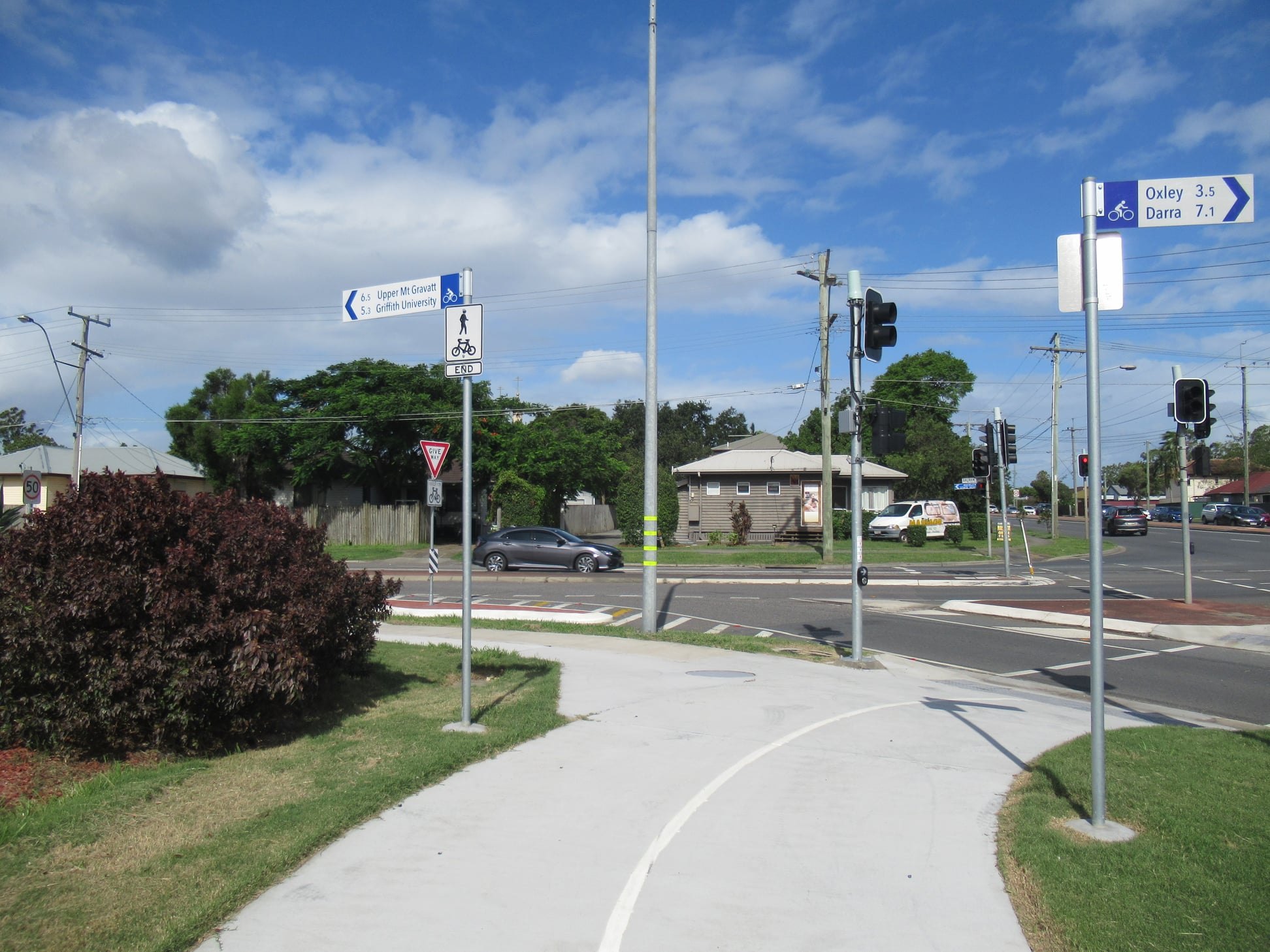


Granard Rd itself is not great for cycling due to the volume of heavy vehicle traffic, so we recommend the detour north along Balham Rd, Marshall Rd, and through Short Street Park to reach the next section of bikeway along Riawena Rd if you’re heading east.

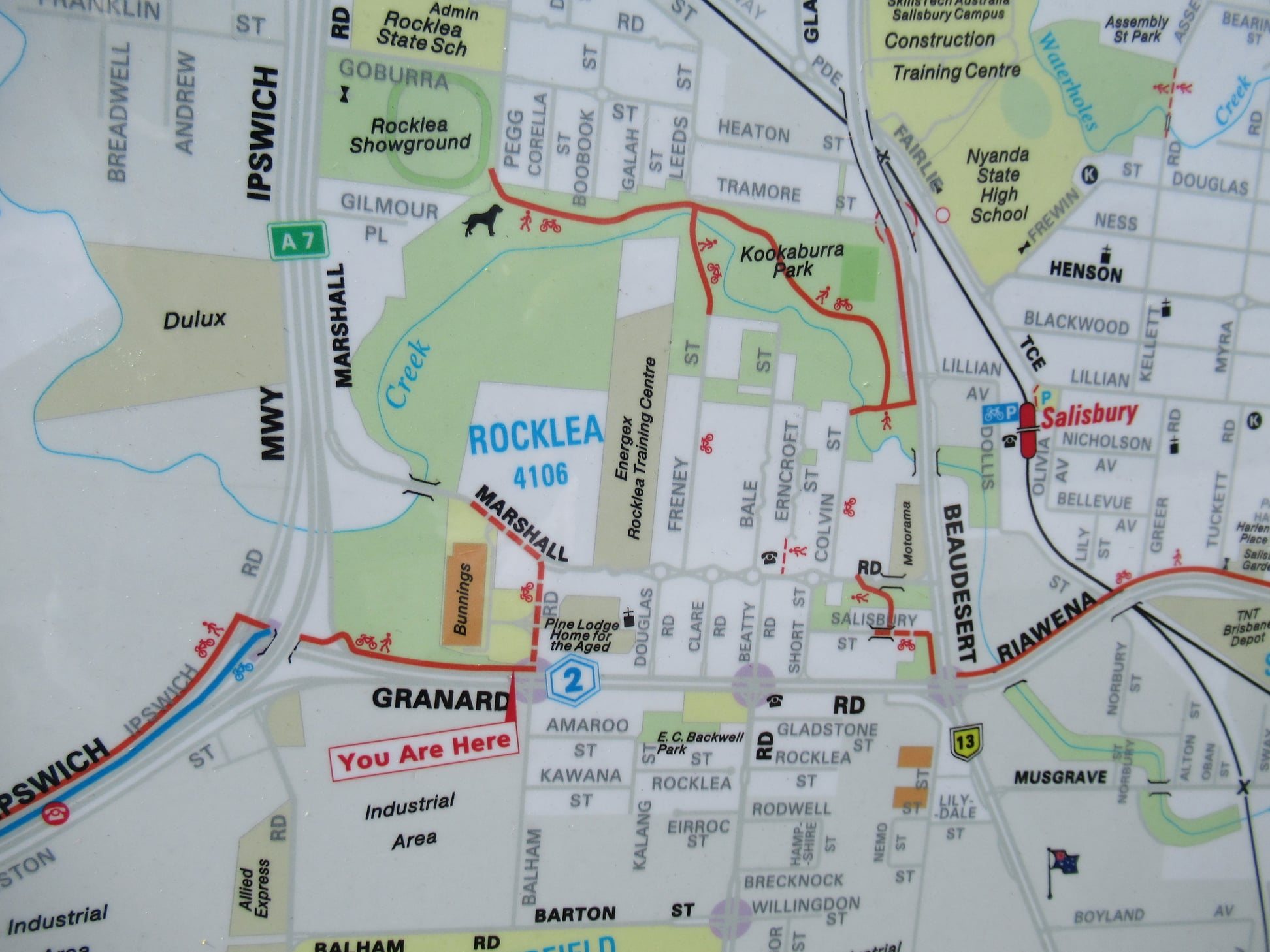
It would be great to have this link filled in; we believe TMR have undertaken investigations, but we haven’t yet heard an outcome or timing of any future action.
Healthy Messaging
CBD BUG have noted that it’s great to see Queensland Health promoting cycling as a way to stay healthy. The BUGs fully support this messaging but it also needs to be applied in practice; to the best of our knowledge we are still waiting for casual bicycle parking to be installed at the RBWH main entrance which is run by Metro North Health.
