Following preliminary community engagement in late 2019, Brisbane City Council have now opened consultation on the preferred landing options for the proposed walking and cycling bridges between Toowong and West End, and between West End and St Lucia.
Belinda went along to the first of the consultation session on Saturday 28 November to find out some more information and inform our position on the desirability of the different options.
The case for a bridge connecting West End to St Lucia is perhaps not as obvious as that for a connection from West End to Toowong, but we think the real value is in delivering these two bridges together.
In combination, this pair of bridges could provide a car-free cycling (and walking/running) route with gentle gradients connecting the Bicentennial Bikeway along the river at Toowong to the University of Queensland. Currently, the options are either a slow, steep, and difficult route along the ‘back-streets’ including Jerdanefeld Rd and Hiron St, or braving motor vehicle traffic along hectic multi-lane Sir Fred Schonell Drive. (Unfortunately, Council are strongly opposed to improving Sir Fred Schonell Drive to make it safer and more attractive for walking and cycling.)
This link would also improve active travel options to the University of Queensland for people from West End and the inner south-side, as well as from Toowong, Milton, and most of Brisbane’s western suburbs. Improving active travel connections to the University will encourage more staff and students away from driving – which will pay dividends to residents of the St Lucia peninsula. A bridge to West End would also provide those St Lucia residents better access to frequent bus services.
So, in light of that, let’s take a look at the various options put forward for locating a walking and cycling bridge between West End and St Lucia.
Note that the following discussion is not a formal endorsement by the BUGs of any individual option. We aim to contribute to informed discussion that will help lead to the best possible outcome for Brisbane residents, now and in the future. We encourage respectful conversation about the issues and opportunities; and hope this can be an opportunity to bring the community together, rather than flame division.
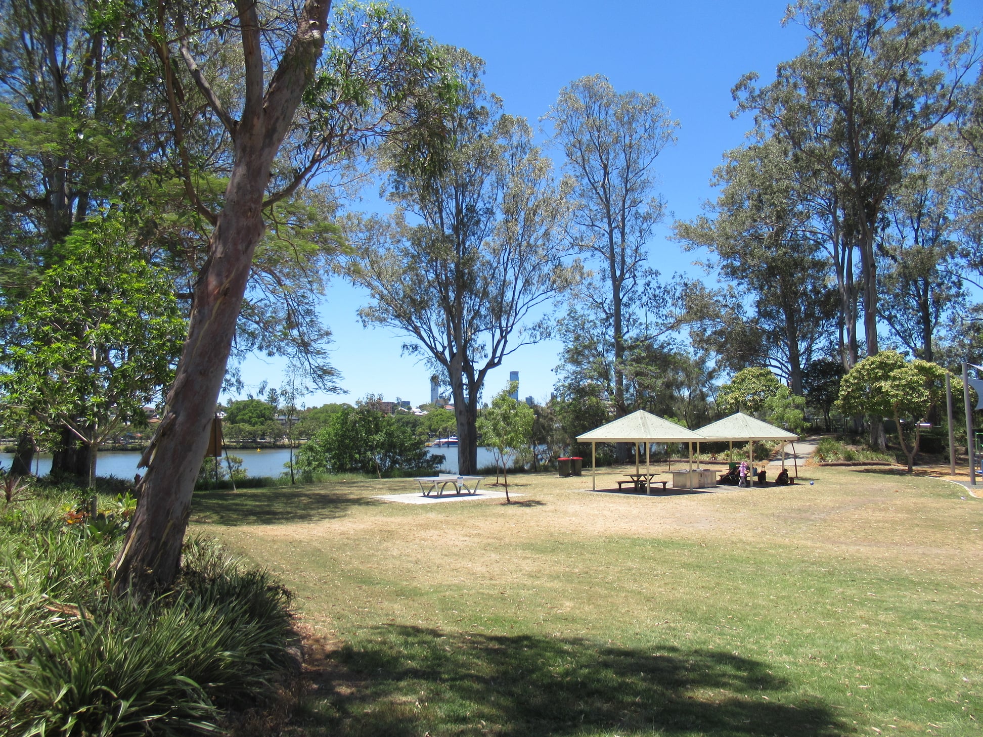
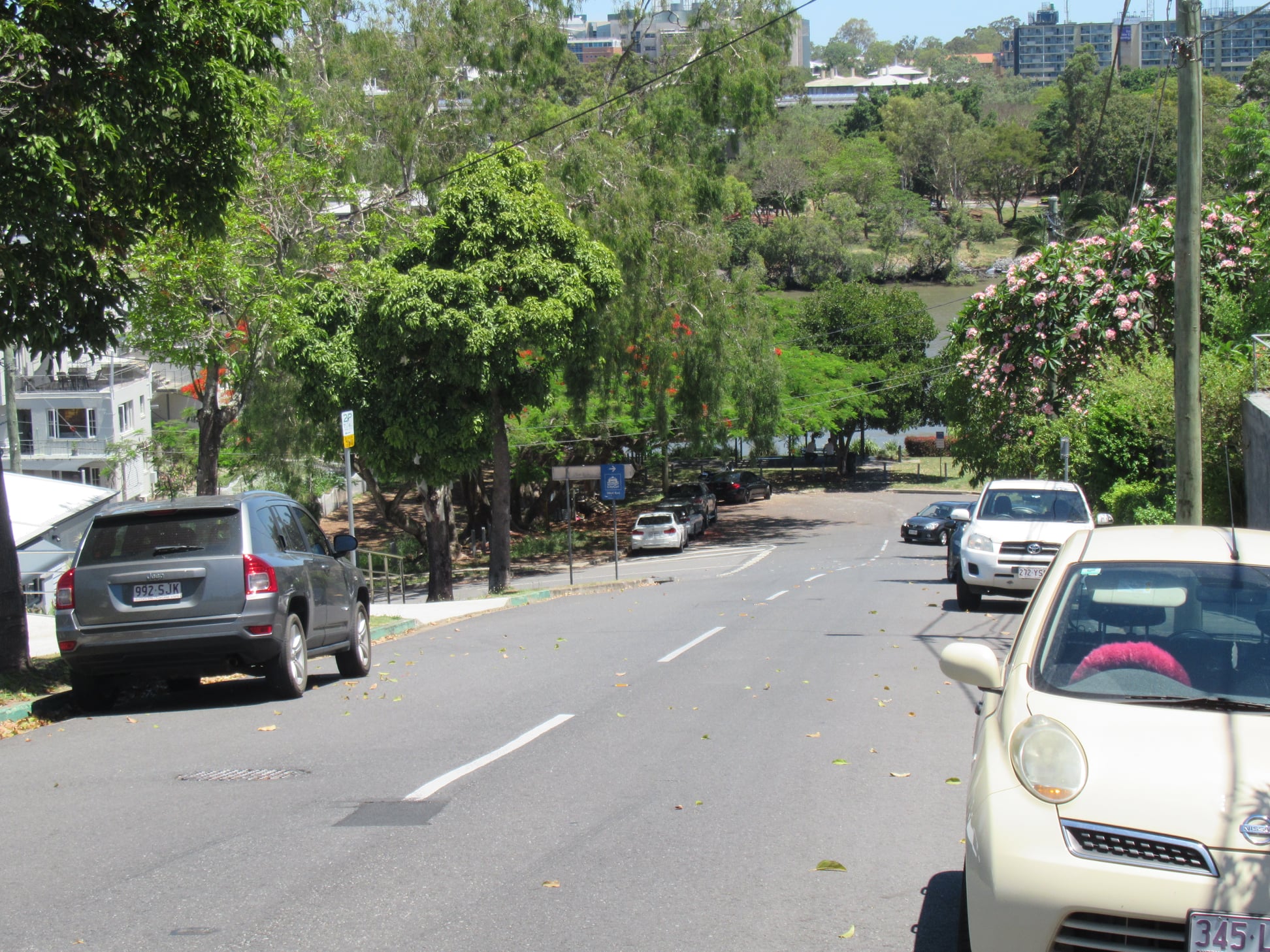
Option A – Guyatt Park
From a connectivity perspective, option A makes a lot of sense. It would connect from Orleigh St to Macquarie St, where there is then a relatively flat, low-traffic route to the University of Queensland. it would also link Guyatt Park with Orleigh Park, creating an long linear park along the river, and giving residents on both sides more options for accessing green space.
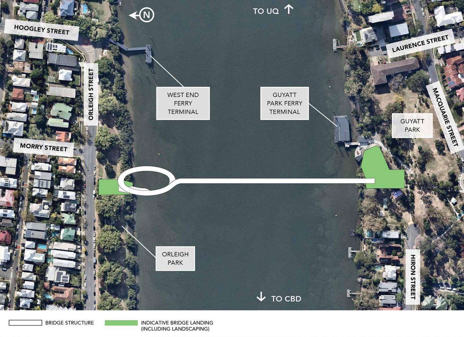
This option would not require any resumption of private property. (Note that none of the proposed landing sites require resumption of property at St Lucia, but options B and C would involve property resumptions for the West End landing).
However, option A has sparked protests from residents about the impact on local green space; both at Orleigh Park (where a spiral structure and connecting path would result in some loss of usable green space near Morry St), and at Guyatt Park.
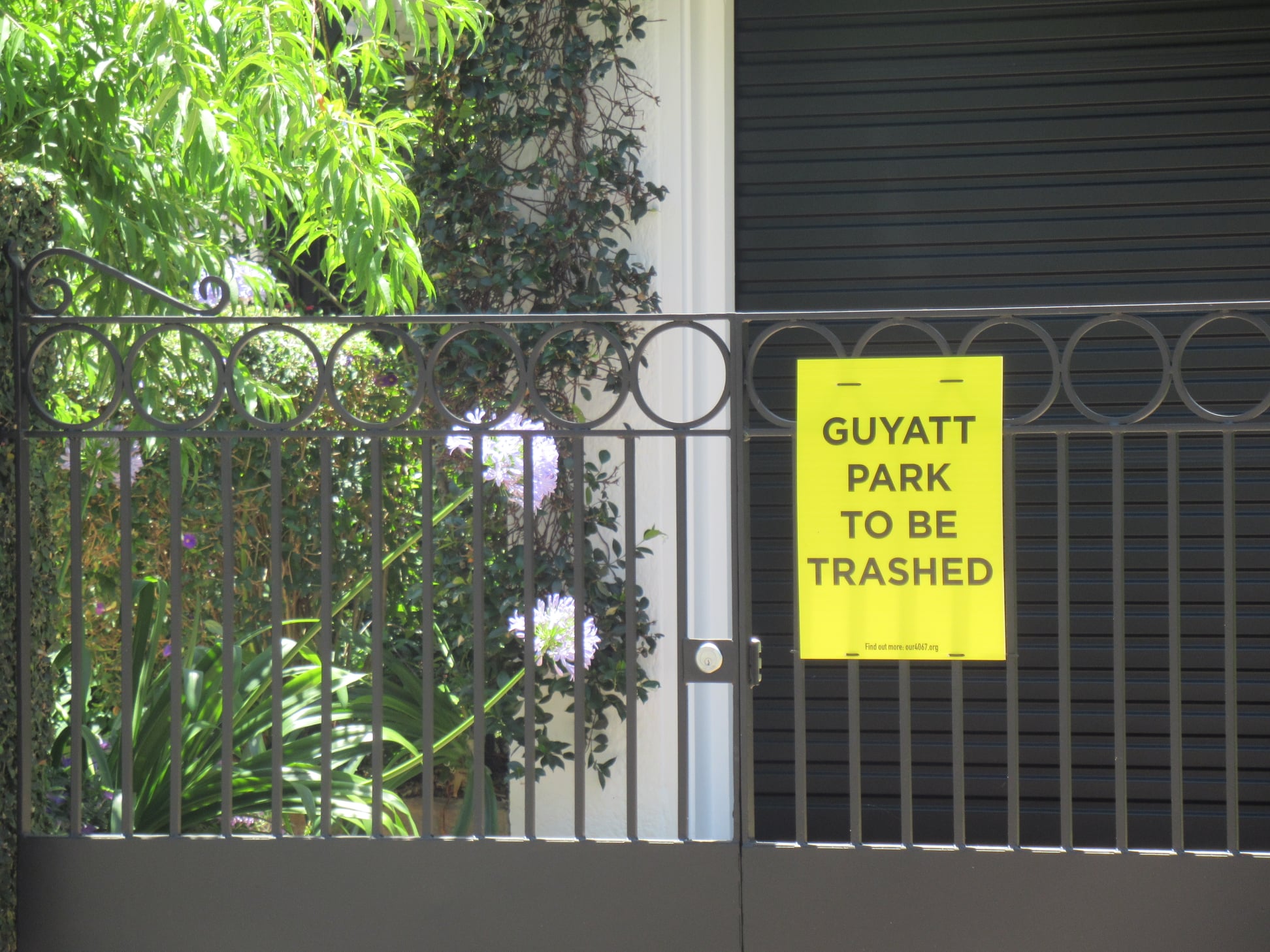
Some St Lucia residents have gone as far as claiming the bridge landing would “trash” Guyatt Park. That seems a little over the top, but we do wonder why the plans suggest a landing point just downstream from the ferry terminal in an area with BBQs, picnic tables and a playground, rather than on the eastern side of the park which is largely open space. Council officers were not able to provide a definitive answer to that question on Saturday; perhaps it relates to clearance for the ferry operations? It would be good to understand the constraints; it would be a shame if this landing option was rejected on the basis of impacts that could be avoided.
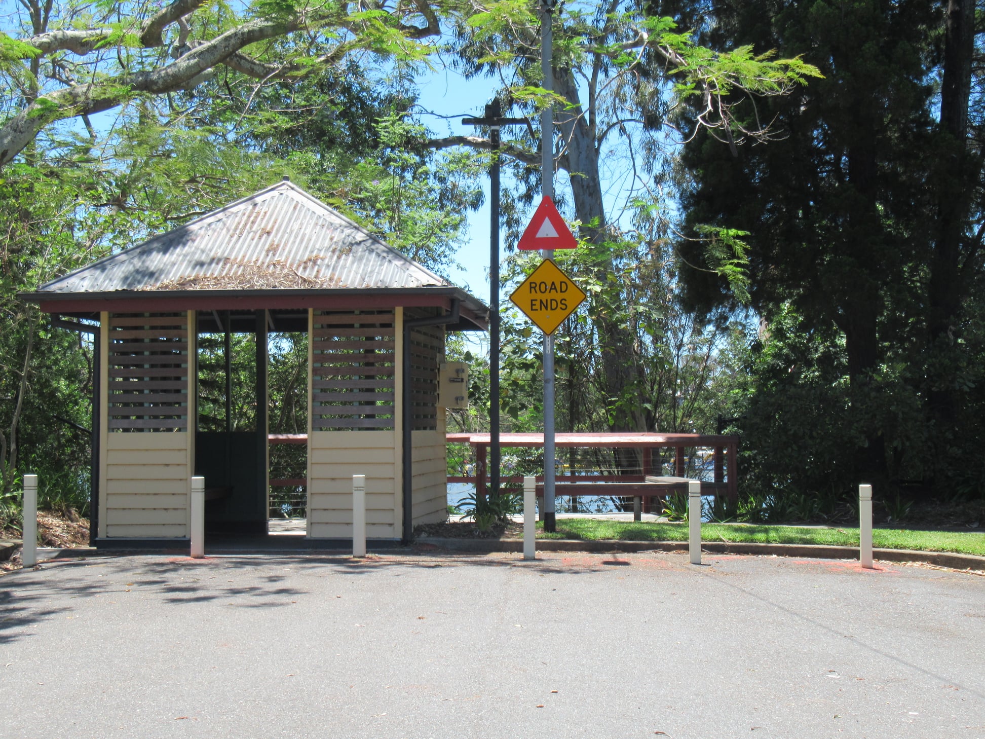
We’d also like to understand why the bridge could not land at nearby Laurence St. That’s the site of a previous ferry terminal, and the land there remains zoned for public transport. A landing at Laurence St would seem similar to a landing at Munro St (proposed option B).
At the weekend consultation session, Council officers cited the heritage status of the old ferry terminal as the reason Laurence St was off-limits, but that seems strange given:
- There appears to be room for a green bridge landing adjacent to the old shelter without impacting it – in the same way the old ferry terminal buildings at Bulimba and Hawthorn have been incorporated into the new terminals, or how the heritage stonework at the corner on Edward and Alice St in the CBD is proposed to be retained in the plans for the bridge to Kangaroo Point.
- There are examples all around Brisbane where heritage infrastructure has been moved or removed to make way for roads (eg. Kingsford Smith Drive and Lytton Rd) or to suit the plans of private developers (eg. Howard Smith Wharves and Lambert St, Kangaroo Point).
We also note that the “Guyatt Park to be trashed” sign spotted on a nearby resident’s fence lists the web site our4067.org which is no longer active, but which was previously registered to the St Lucia Community Association. James Mackay – who is now councillor for Walter Taylor Ward – was previously president of that group, and was quite outspoken when a bridge from St Lucia to West End was included in the University of Queensland’s 20 year Master Plan. From St Lucia News:
Speaking for the neighbourhood, the President of the St Lucia Community Association, James Mackay, expressed his animosity towards the UQ’s plans for expansion, including its public transport plans.
James Mackay, now Councillor for Walter Taylor
“It’s an abomination. The impact will be horrendous.”
Trashed. Abomination. Horrendous. Really? It’s just a bridge for walking and cycling. Wait until these people discover the impact of roads and cars!!
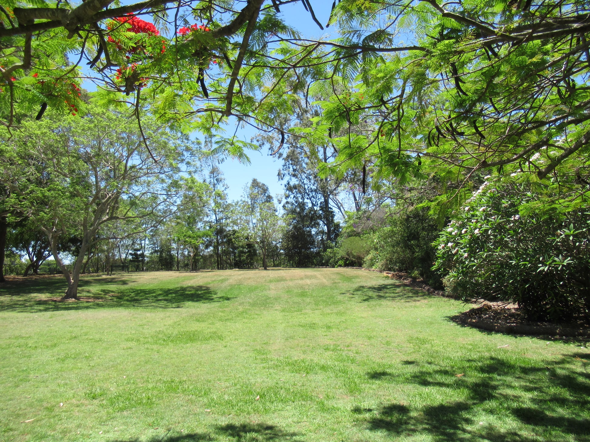
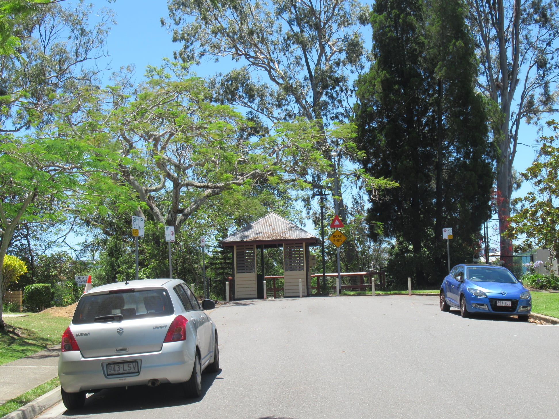
Option C

Option C appears to be the one so far favoured by St Lucia residents, as it lands closer to the University, between the Toowong Rowing Club and St Thomas’s Kindergarten. Although this would also impact riverside green space, it appears to be an area that is less well used, and not as controversial as Guyatt Park.
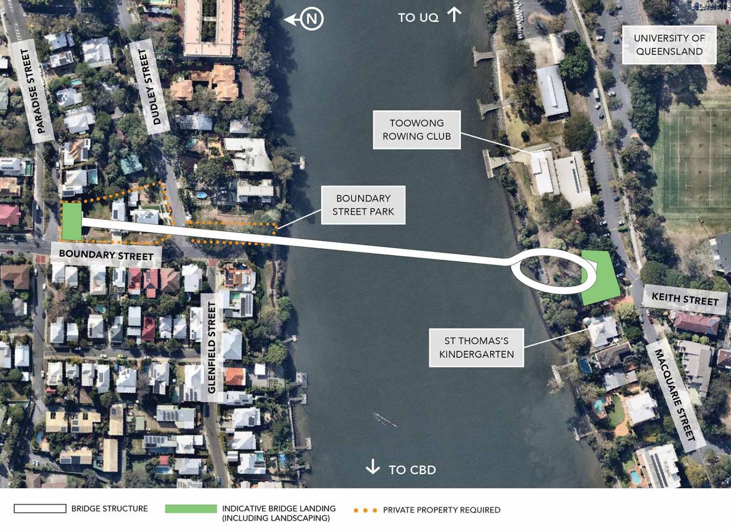
However, with the proposed landing point half way up Boundary St at West End, this option misses much of the connectivity value of Option A.
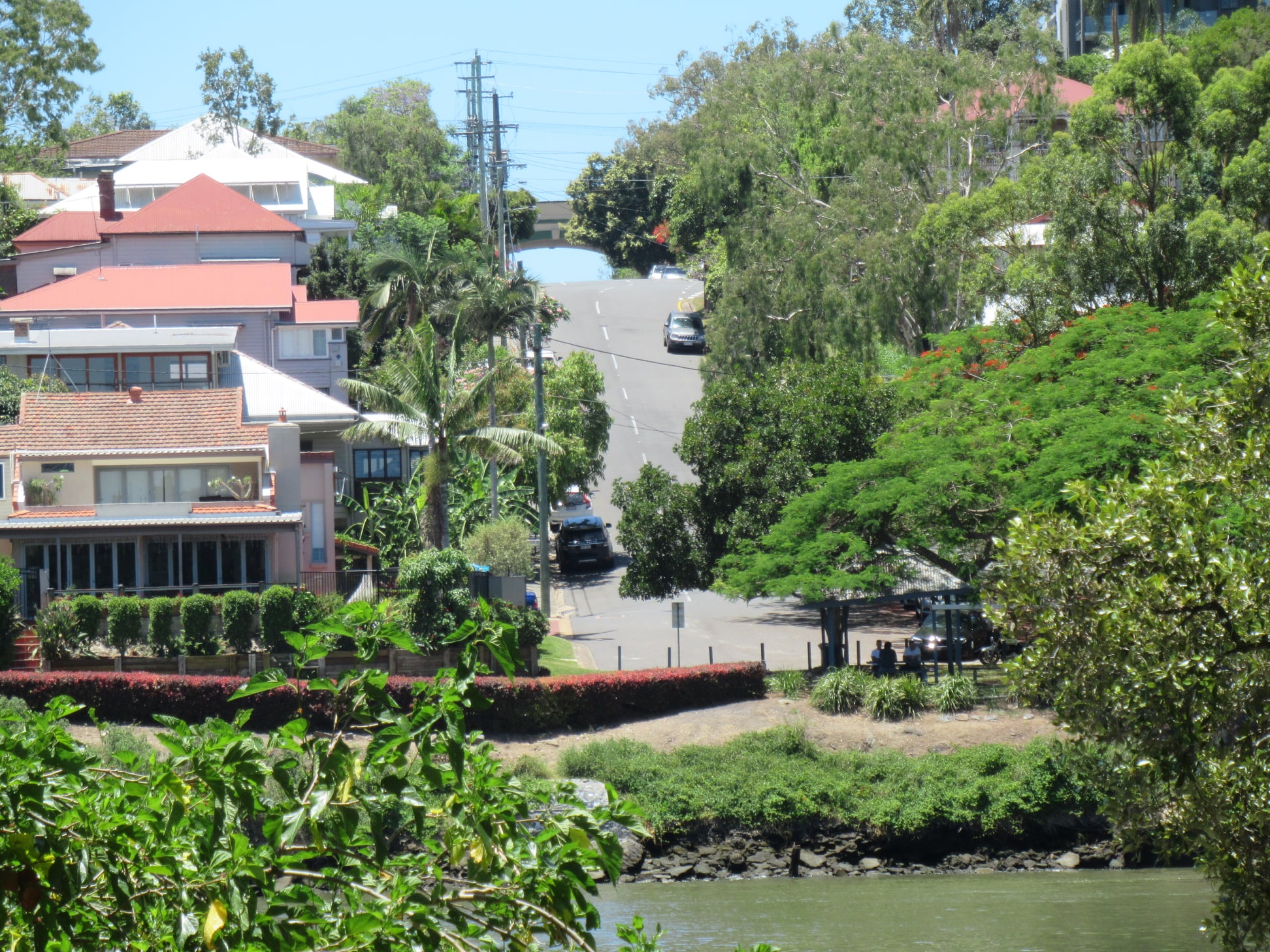
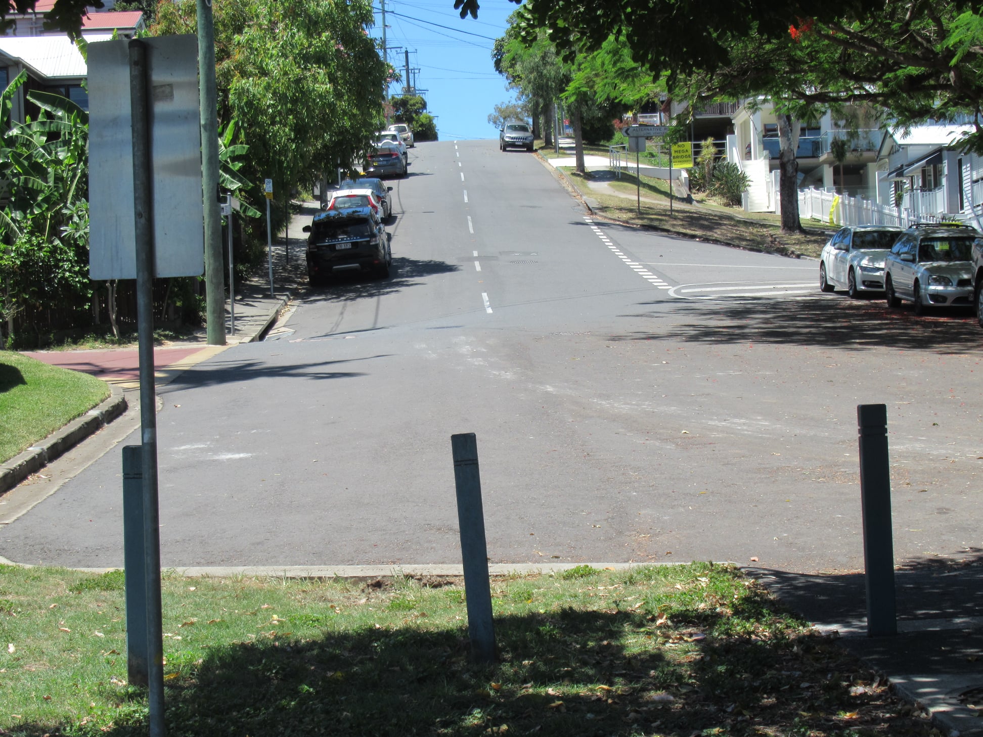
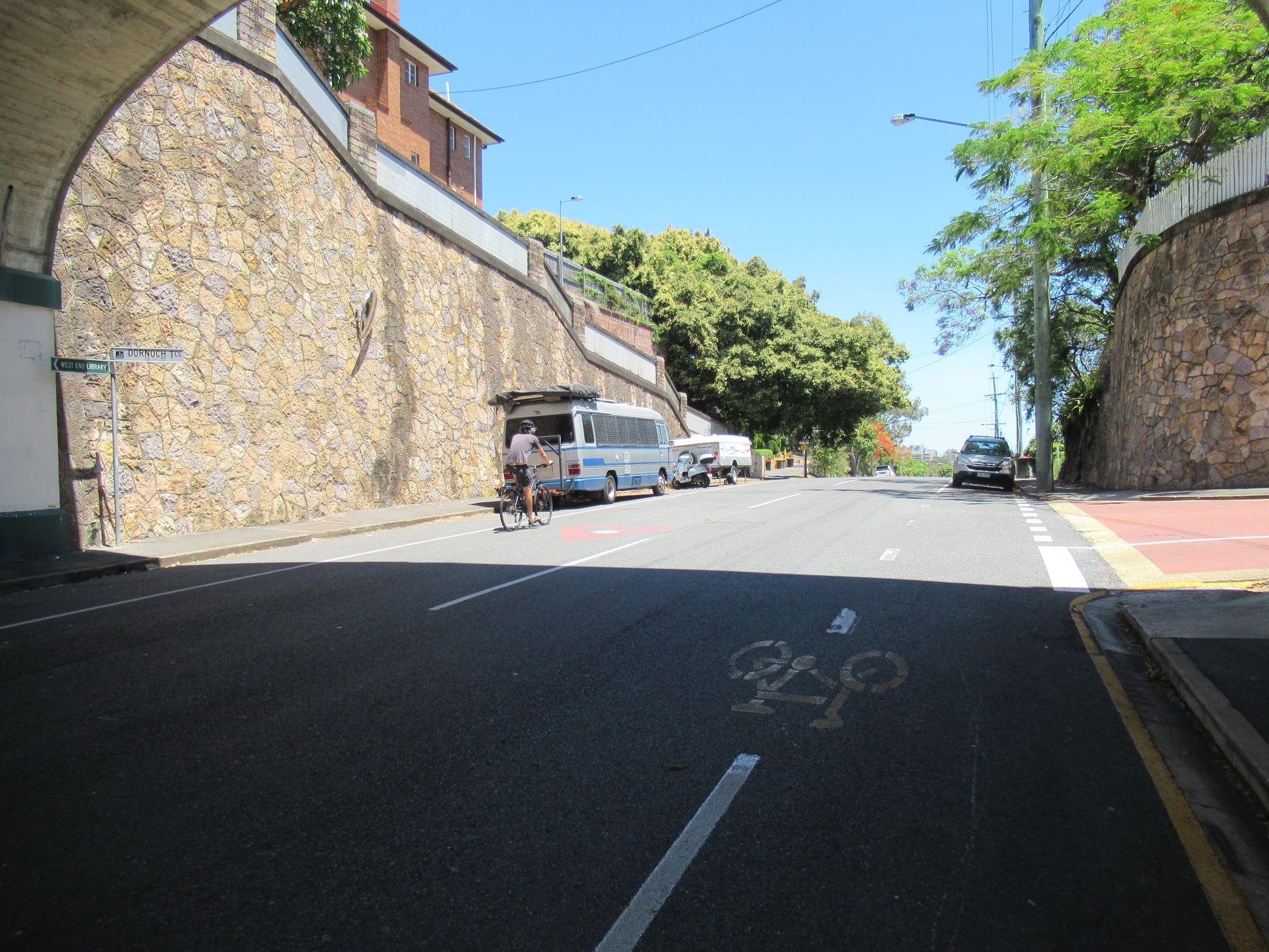
Boundary St is steep; it is a tough ride up from the river to the proposed bridge landing. It’s also a long, steep ride or walk from the commercial precinct on Boundary St, and there’s no good connection to Dornoch Tce which is the main east-west cycling route.
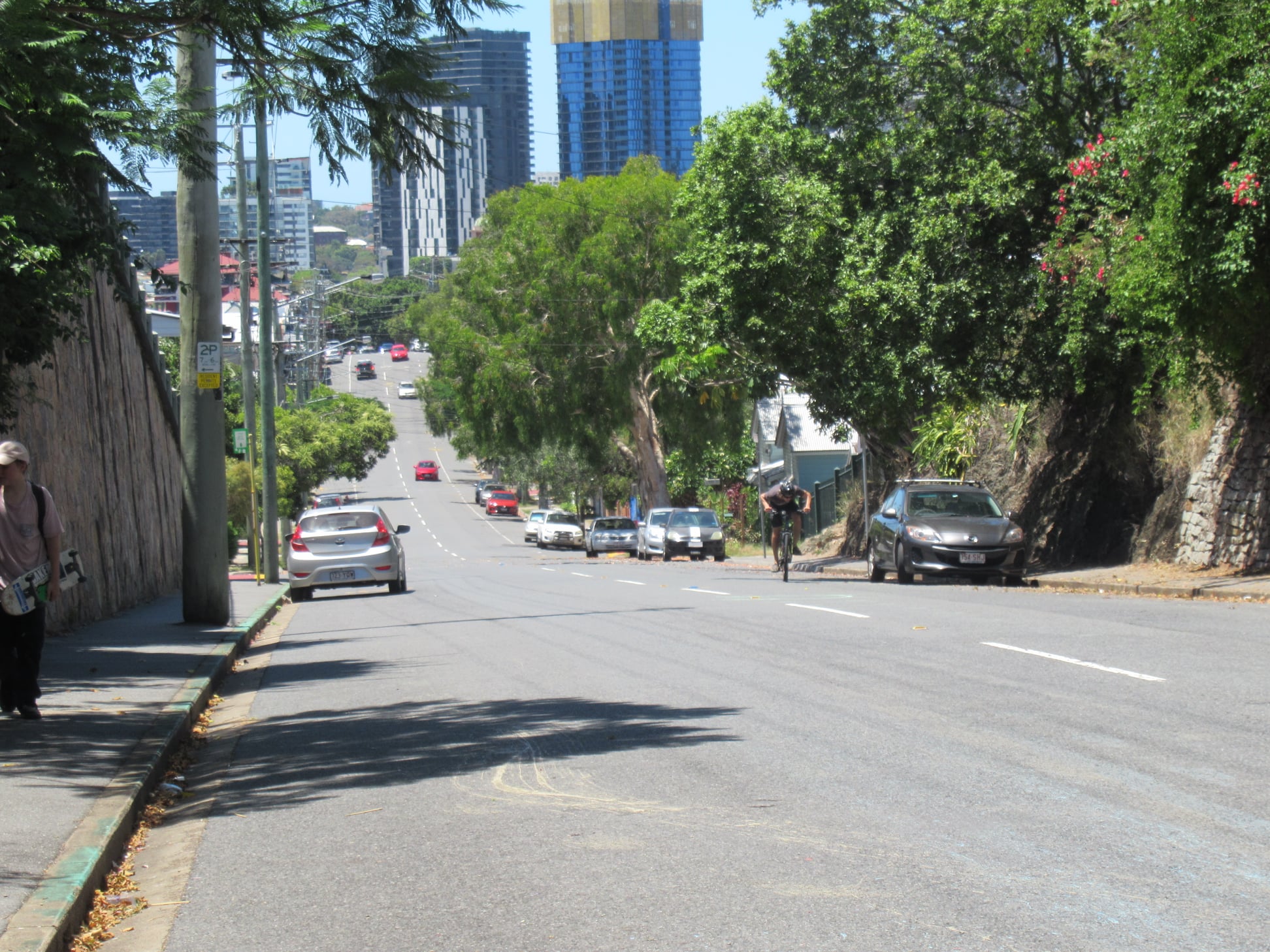

Bus connectivity at Boundary St is also problematic – there’s no good location for a high-frequency bus turn-around.
But the main issue we see with the proposed Boundary St landing is that it would require resumption of multiple private properties – which are not just empty blocks, but people’s homes. It would also significantly impact on a number of other neighbouring properties. A walk around the local streets demonstrates strong and well-organised opposition to the proposal.
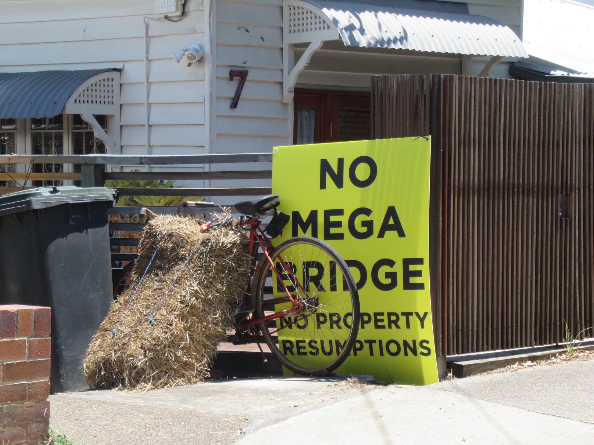
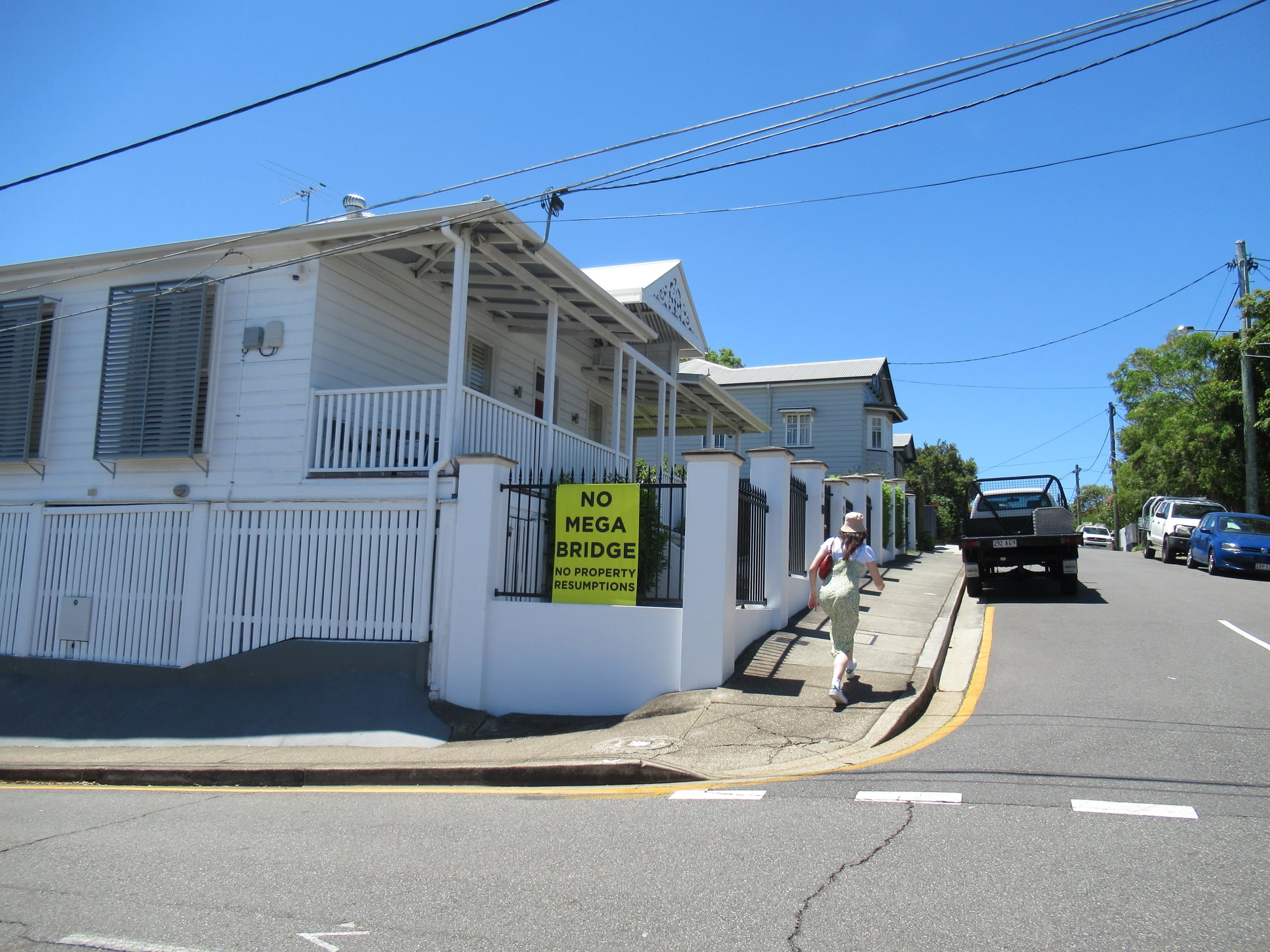
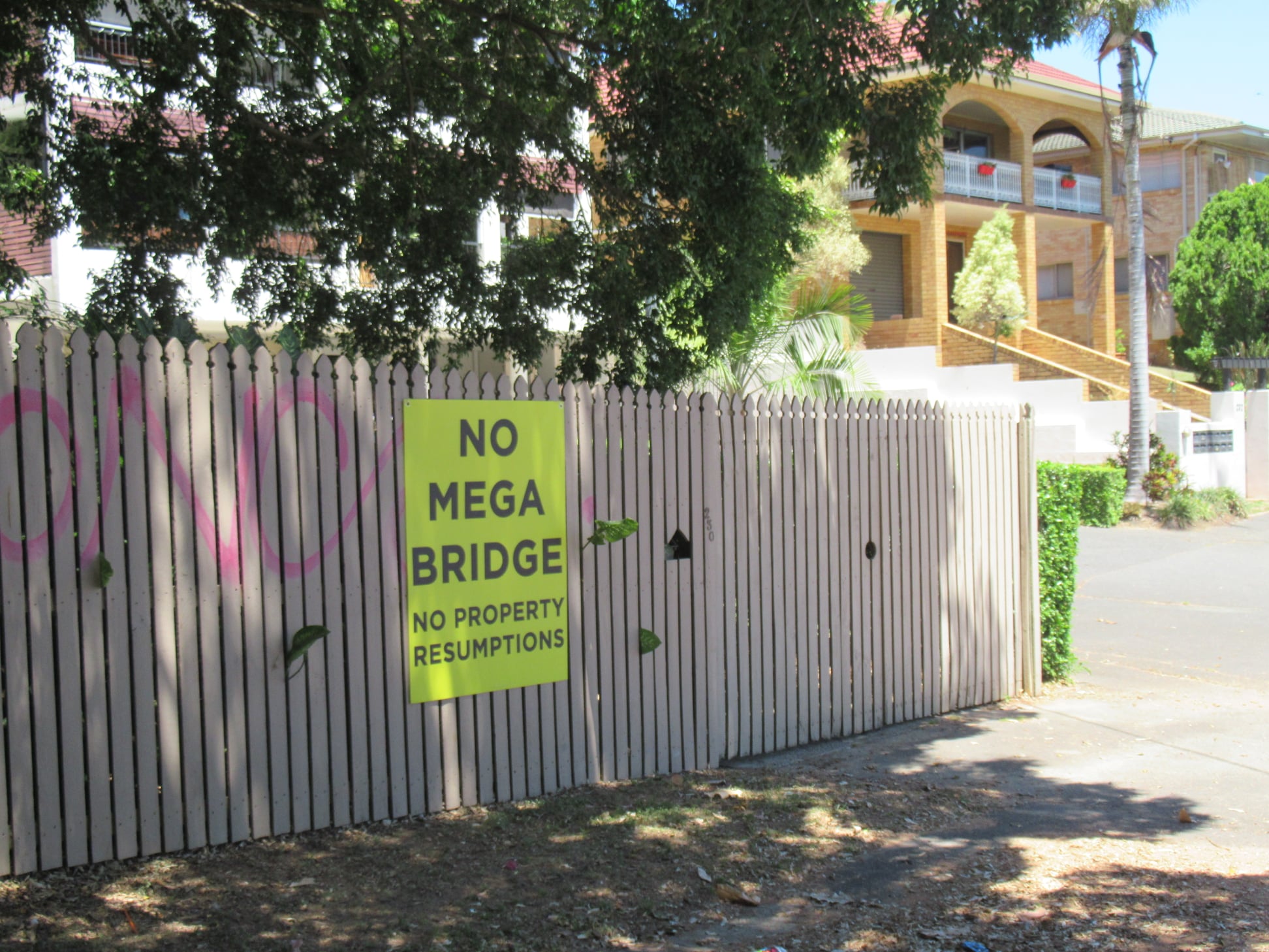
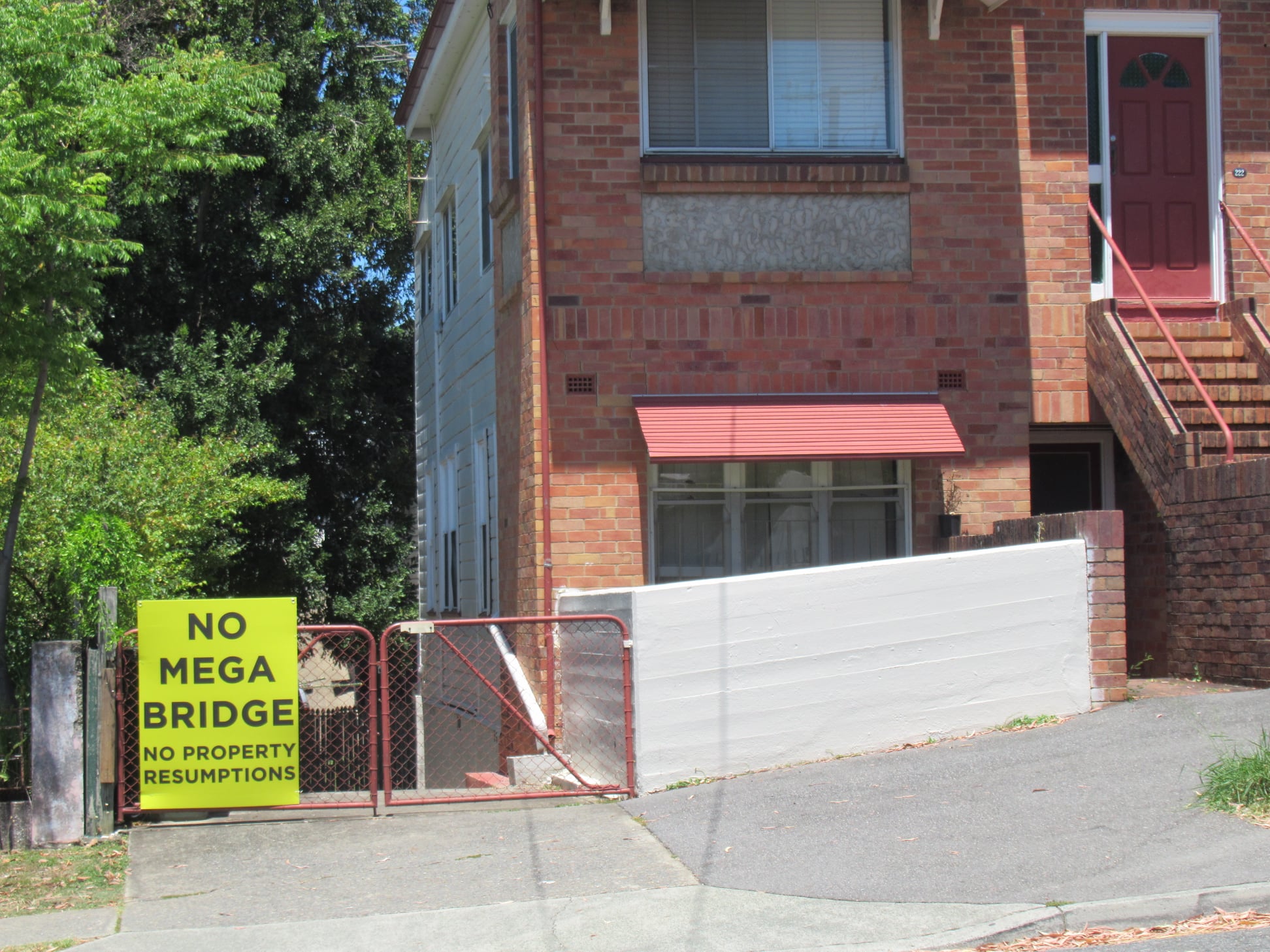
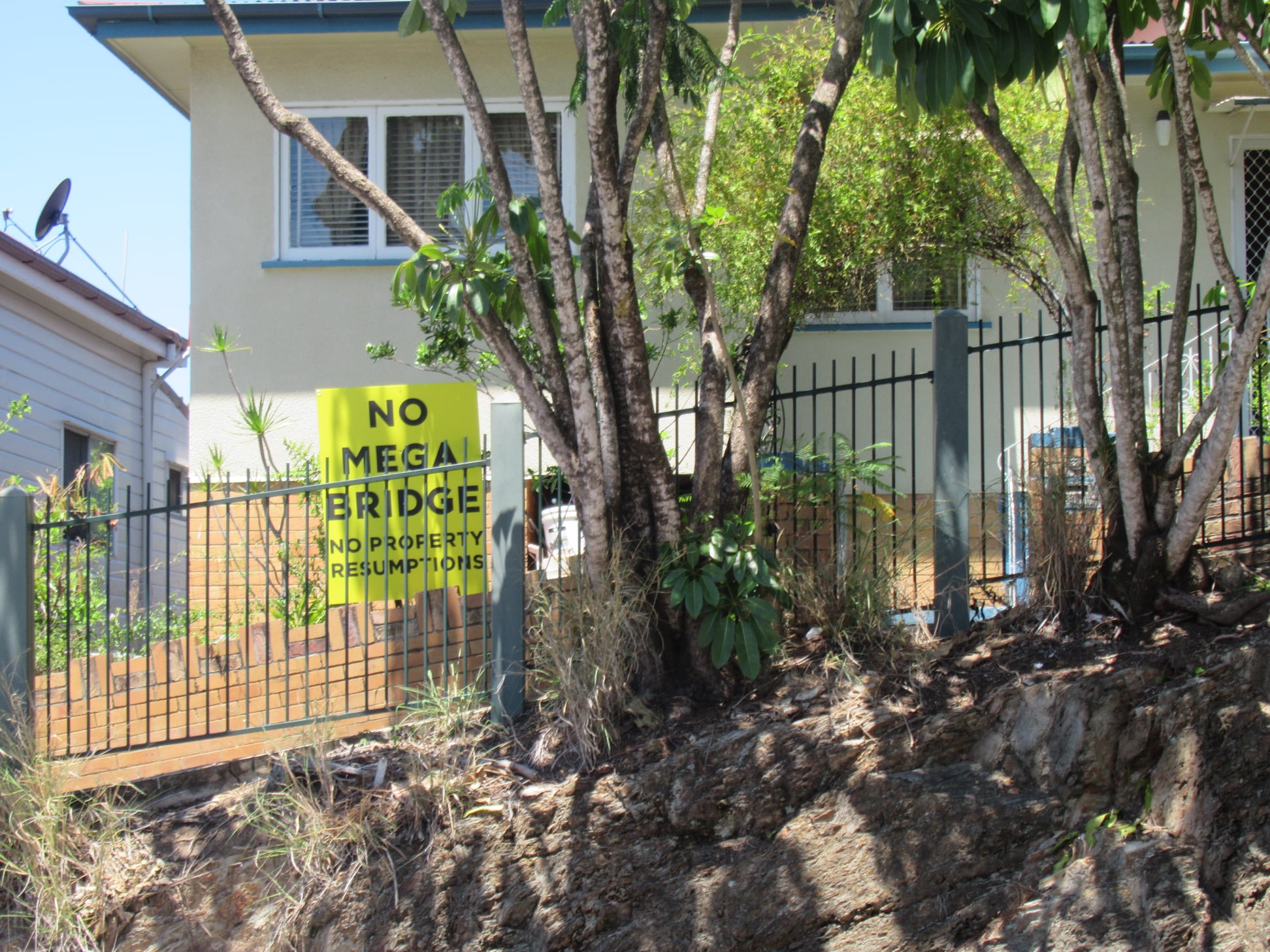
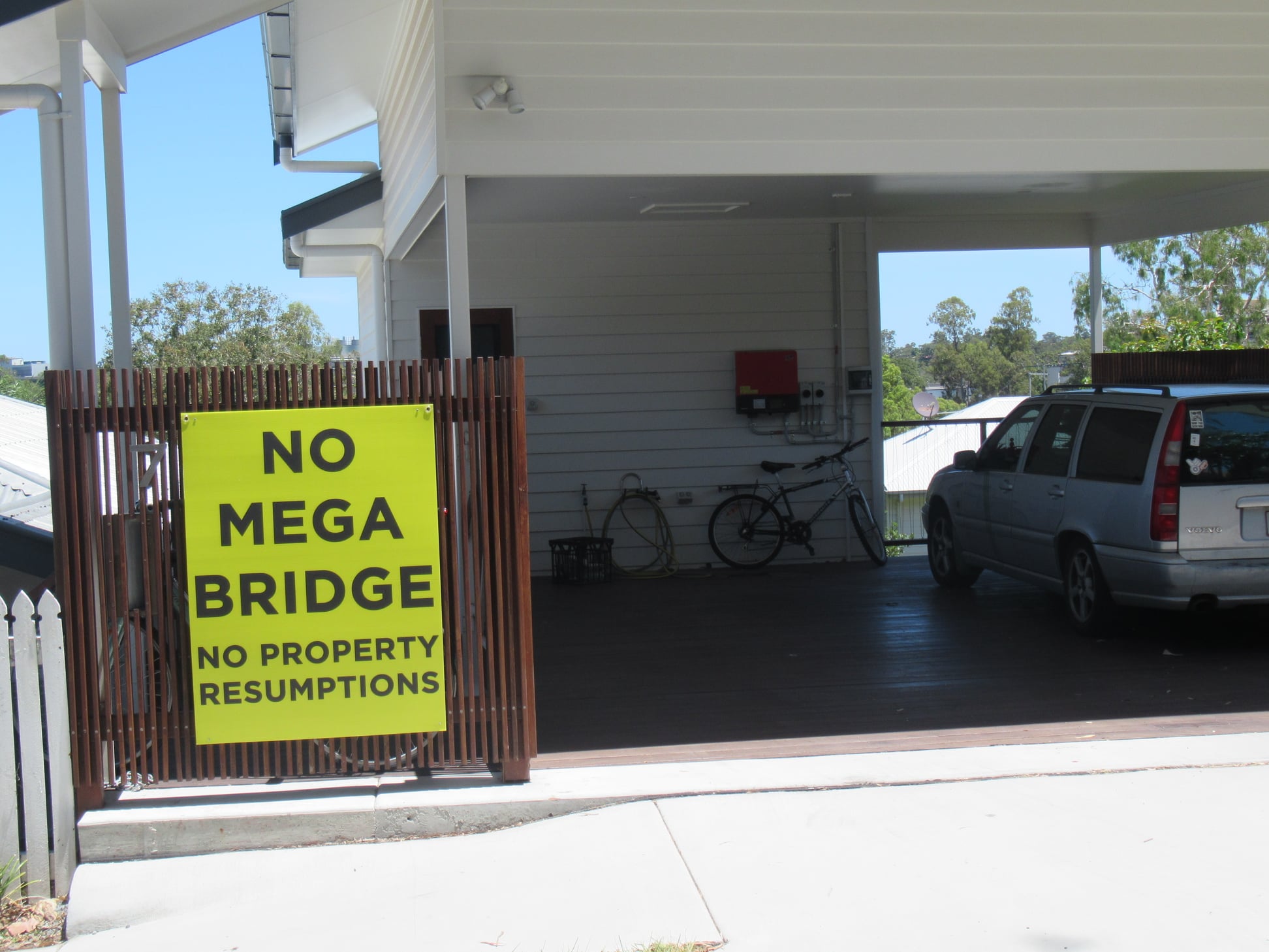


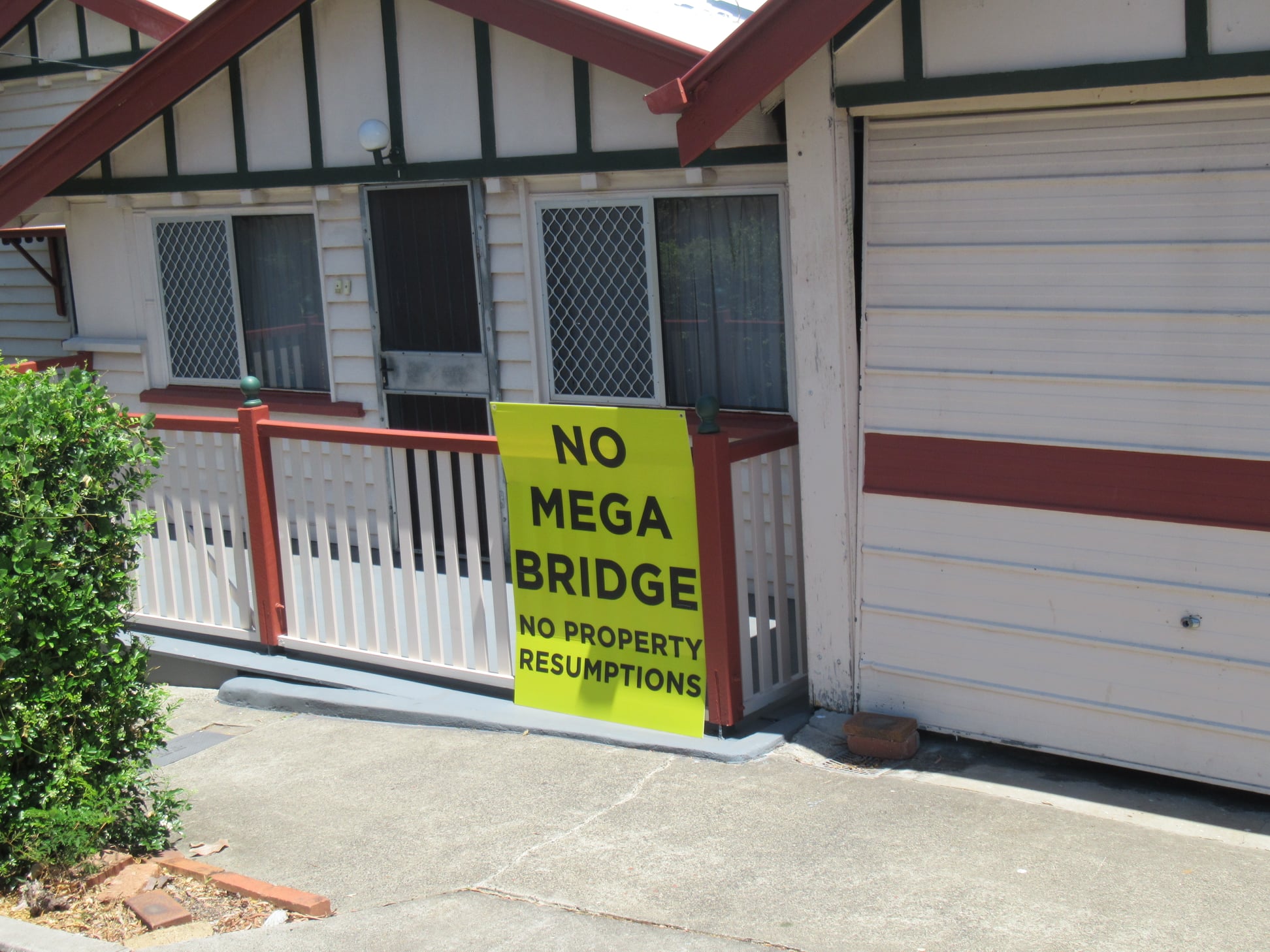
Describing a walking and cycling connection as a “Mega Bridge” seems rather an exaggeration, but it’s not hard to understand the opposition to land resumptions and the effect this bridge would have on the character of this pocket of West End where residents have valued being tucked away over the hill and away from any major traffic routes.
We’ve witnessed the hurt inflicted on the community in East Brisbane where a whole row of homes were compulsorily resumed to widen Lytton Rd. We would not support that here without a clear demonstration of wider benefits.
Since option C is not a good cycling connection – with the access streets being steep and/or narrow – its main value would seem to be for walking trips. The main beneficiaries could then be expected to be the people living close by – but they very clearly don’t want this bridge!
Option B
So, that brings us to Option B. Is this something of a compromise solution?
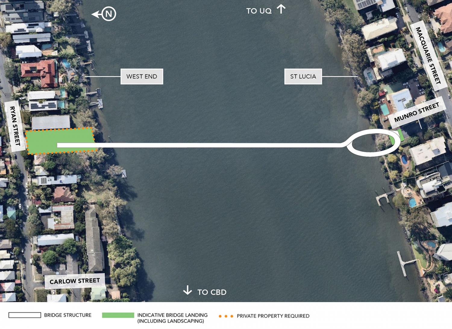
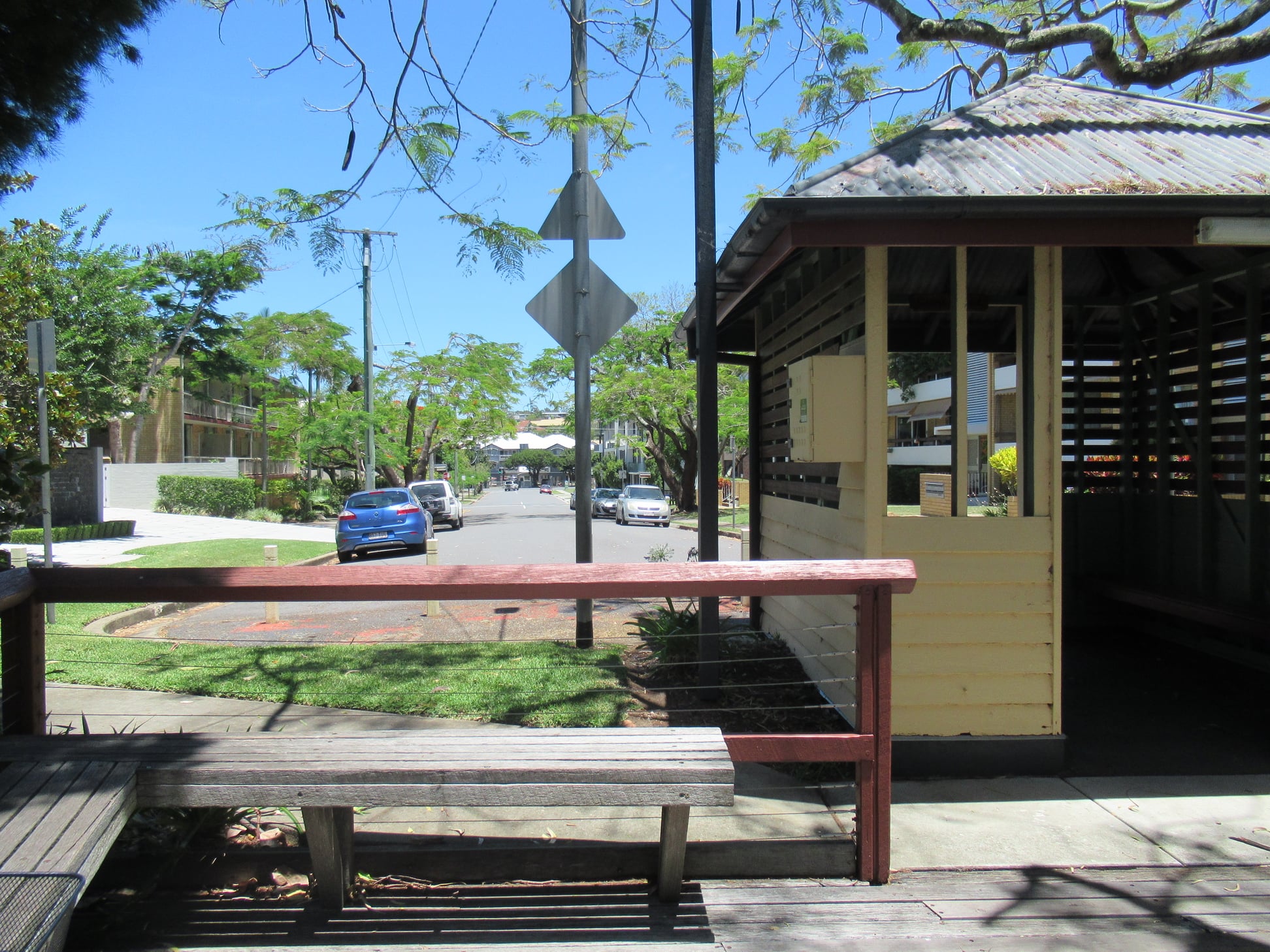
On the St Lucia side, the landing at Munro St would appear to be similar to a landing at Laurence St. It doesn’t have the advantage of linking two parks, but it would provide a good, flat cycling route to the University of Queensland via Macquarie St like the other two options.
On the West End side, the proposed landing is a privately owned block of land on Ryan St. That land is currently empty, so a resumption would presumably be a matter of a commercial transaction, rather than taking someone’s home.
Ryan St provides a reasonably flat cycling connection to Hoogley St, but it’s typically lines with parked cars, and only has narrow footpaths. It would not readily support a frequent bus service, so accessing public transport would involve a substantial walk to an existing stop.
Conclusion
If you’re read this far, you’ve probably gathered that our preference is for Option A, with Option B a poor second. We don’t support option C.
However we would like to see a review of the landing options around Guyatt Park. We think there are alternatives to address legitimate community concerns with this landing. We will be disappointed if a bridge at this location is dismissed based on impacts that could be easily mitigated or avoided.
Further consultation sessions
We encourage our readers to attend one of the upcoming consultation sessions to raise these and other issues:
| Wednesday 2 December 2020 | 4-7pm | Kurilpa Hall, 174 Boundary Street, West End |
| Saturday 5 December 2020 | 6am-2pm | Davies Park Markets, Montague Road and Jane Street, West End |
| Wednesday 9 December 2020 | 4-7pm | St Lucia Bowls Club, 9 Carr Street, St Lucia |
| Thursday 10 December 2020 | 4-7pm | South Brisbane Sailing Club, 68 Hill End Terrace, West End |
| Saturday 12 December 2020 | 9am-12 noon | Toowong Rowing Club, 37 Keith Street, St Lucia |

[…] we’ve noted in our review of the options for a bridge between West End and St Lucia, we think the maximum value for cycling will be achieved if these two bridges are delivered in […]
LikeLike