This week 9 News ran a story about a food delivery rider taking wrong turn into the Airport Link tunnel at Bowen Hills, and how the Transurban operators averted this potential disaster, and quickly allowed motorists to carry on through (because of course nothing is more more important).

The episode was blamed on the rider stuffing up with their GPS
“Transurban urges all cyclist to plan there route before riding and to always make sure you check your GPS settings. It’s very easy for someone to forget their GPS to cycle mode.”
Transurban
But let’s take a closer look.
First, if you ignored your navigation app, and simply followed the signs:
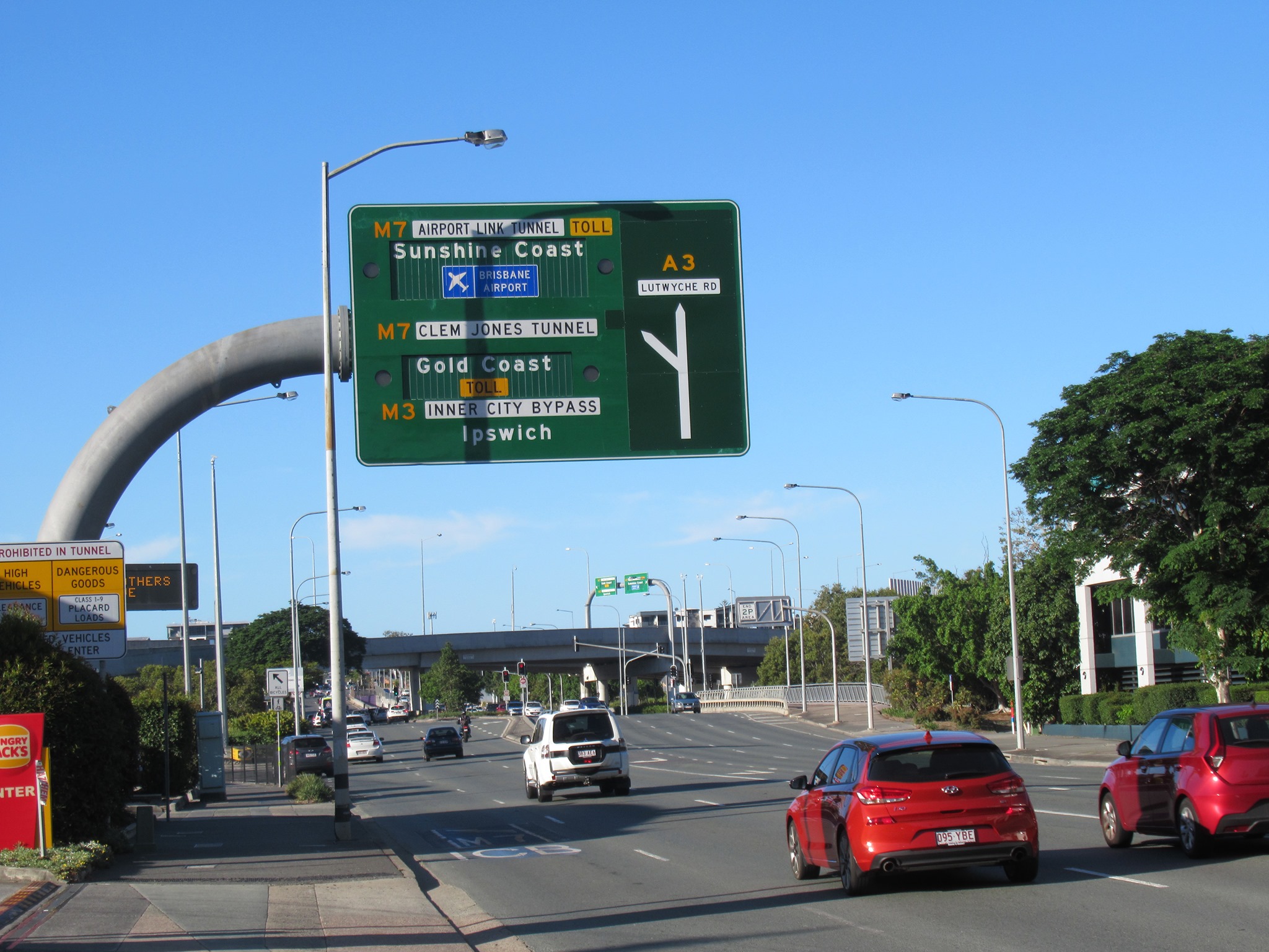
If you were coming from Bowen Bridge Rd and heading for a destination straight ahead on Lutwyche Rd, you might notice the large overhead sign pointing to Lutwyche Rd straight ahead and assume that was the way to go.
A little further along past the petrol station and Hungry Jacks driveways, you might then notice a smaller sign saying that all bikes must go left. You may very well have missed the small ramp just before that sign by which a cyclist could leave the main carriageway and enter the shared path. It’s not marked on the ground, and is not highly visible. It comes just after the little garden bed you can see in the image above. Navigating in a stressful environment, with fast-moving traffic bearing down on you, it would be very easy to miss that little ramp, and miss your last chance to get off the road.


From the road, that sign insisting all bikes must go left appears to direct you to take the lane to the left… towards the Airport Link tunnel.
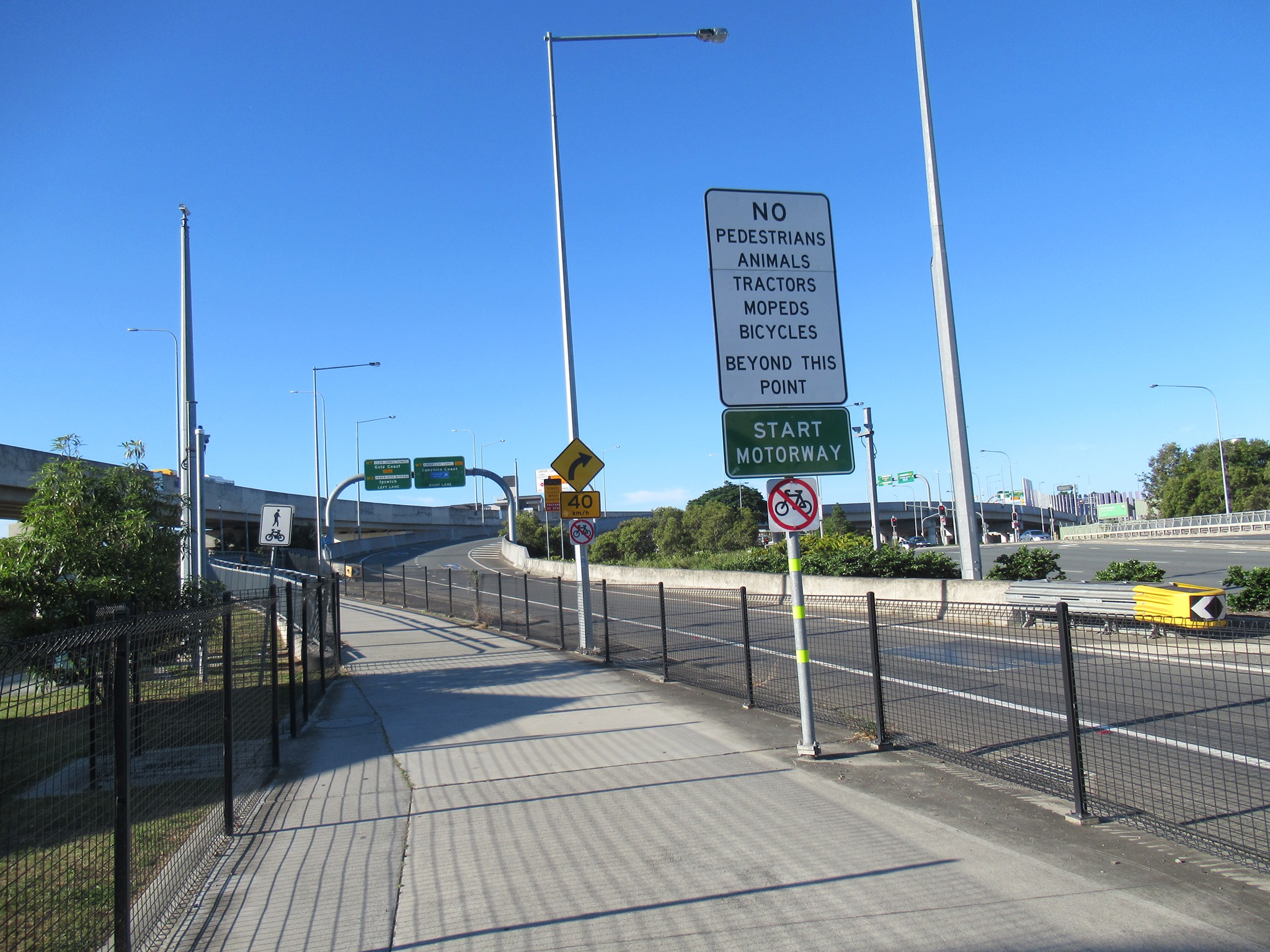
A little further along, there are two signs saying no bicycles. But by then there’s no getting off the road – there is a fence between you and the path. (Note that the “no bikes” signs can also be read by path users, just to add to the confusion).
So perhaps you can see how a delivery rider unfamiliar with the area might think “oh no, I shouldn’t have taken that left turn” and cross to the other side of the lane (like this rider did) before realising it’s too late to turn back.
Before the Airport Link tunnel was built, you used to be able to ride straight ahead on Bowen Bridge Rd / Lutwyche Rd. There was even a footpath.
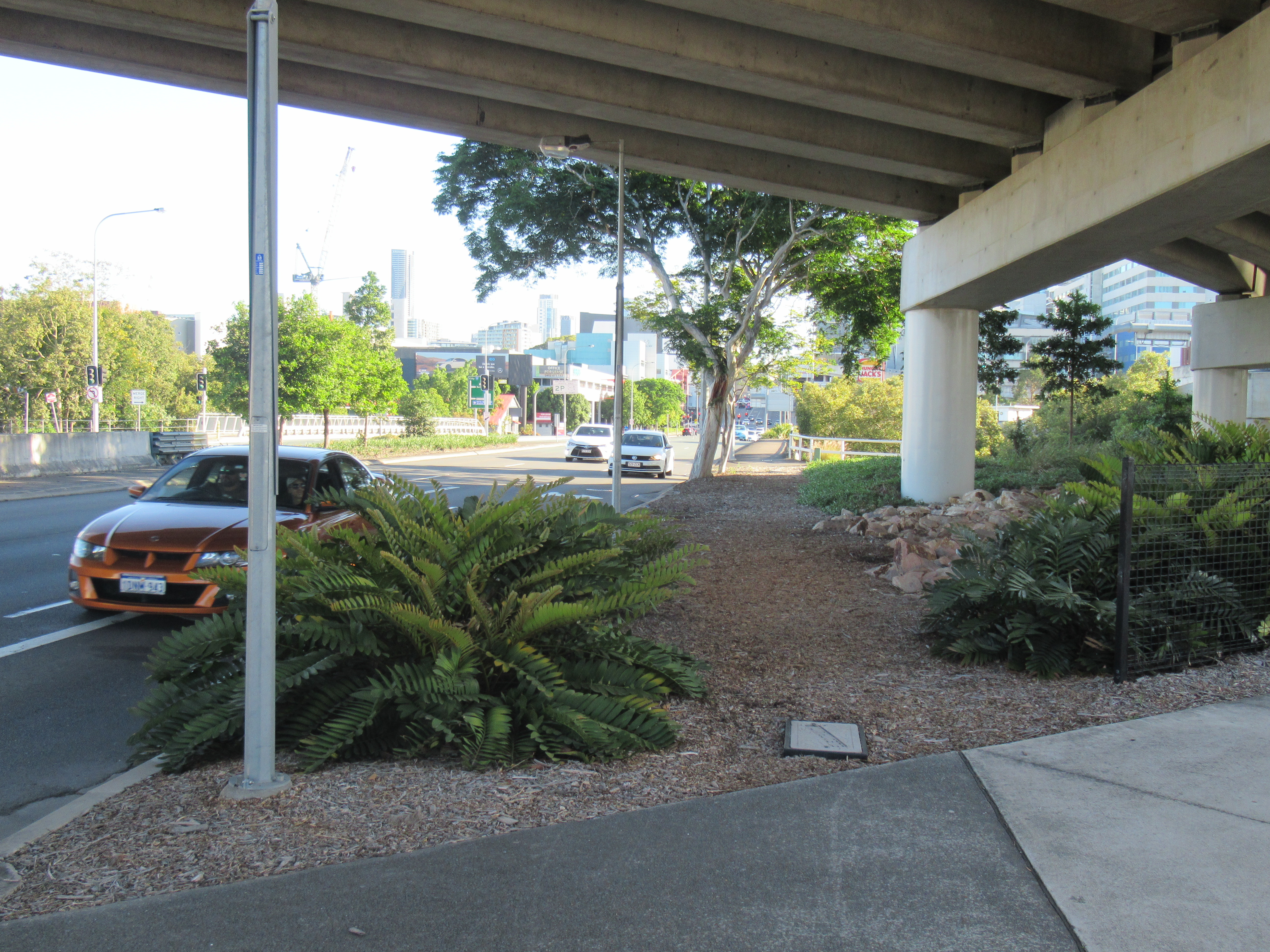

But now, you’re supposed to know that the unsigned shared path that leads off to the left just after the service station driveway and Hungry Jacks drive thru takes you around to reconnect back on to Lutwyche Rd at Northey St. How? It could go anywhere – or nowhere, as is the case far too often with shared paths in Brisbane.
Directional signs for drivers are big and before you need to turn, and drivers still regularly stuff up. Signs for cyclists – if they’re there at all – are in small font, and often right on or after where you need to turn.
In fact, if you’ve cycled much in south east Queensland, you’ve probably had the experience of lifting your bike over a barrier and climbing after it when you’re found yourself somewhere quite frightening. (This author certainly has!)
So, perhaps you should use a navigation app like Google. Except Google doesn’t seem to know of the shared path either – it would have directed the rider straight ahead!!
It is more than 8 years since Airport Link opened, but the path is still not recognised in Google Maps. That’s despite numerous requests from cycling groups to the mapping giant.
So, our suggestions for Transurban, TMR, and Brisbane City Council are: rather than tut-tutting about wayward delivery cyclists, and making patronising comments about how they should learn to use GPS (but also know when to ignore it), they should:
- Work to ensure up to date and accurate information on bikeways is provided to mapping companies like Google, and follow up until it is included.
- Provide directional signage that works in real-time for riders, so they have time to see and follow directions.
- Work to reduce visual clutter such as inappropriate “Cyclists Must Dismount” signs and footpath advertising so that road users can focus on the signs they need to navigate and stay safe.
At this particular location:
- Clearly mark the off-ramp for cyclists from Bowen Bridge Rd to the shared path.
- Provide an “emergency exit” so that any cyclist who does take a wrong turn towards the tunnel can exit to the shared path as soon as they realise their mistake. This could, for example, be a one-way gate. (There’s an example on the M1 at Tweed Heads where cyclists must exit to Barneys Point Road)
Related Story
Earlier the week, Transurban posted a similar story on their Facebook page mocking a delivery rider who ended up on the main carriageway on the Gateway Bridge.
Want to cycle over the Gateway Bridge? Make sure you use the dedicated pedestrian/cycle path.
It has no cars, is much safer and the views are just as good.
Transurban
We can guarantee that rider didn’t cycle over the Gateway for the views. It would undoubtedly have been quite a frightening experience.
But again, approaching the Gateway Bridge from Lytton Rd, and knowing that it is possible to cycle across the bridge, it is not at all obvious to someone unfamiliar with the area how to reach the start of the bikeway. And once you’re taken a wrong turn down onto an entrance ramp, escape is pretty much impossible.
A wider problem
Brisbane urban affairs reporter Lucy Stone writes in The Guardian this week about the tragedy of delivery scooter riders who have been killed on the job. Bicycle riders face similar dangers and issues.
Nick McIntosh, assistant national secretary of the Transport Workers Union points out that these people are meant to the heroes of the pandemic.
We think it’s time to stop mocking and patronising delivery riders—who are working under uncertain conditions in a tough environment—and start getting serious about making cycling safer and more convenient for everyone.
